Holzerhof (Overath)
|
Holzerhof
City of Overath
Coordinates: 50 ° 56 ′ 22 ″ N , 7 ° 12 ′ 41 ″ E
|
||
|---|---|---|
| Height : | 119 m above sea level NN | |
|
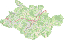
Location of Holzerhof in Overath |
||
|
The Holzerhof was located in this area.
|
||
Holzerhof , also called wood until the end of the 19th century , was a district of Untereschbach in the town of Overath in the Rheinisch-Bergisches Kreis in North Rhine-Westphalia , Germany . The place fell into desolation in the first half of the 20th century .
Location and description
The small district of Holzerhof was west of Overath near the Sülz , below the Hoffnungsthaler Strasse (Landesstrasse 284) and near today's city limits to Bergisch Gladbach . The area is now part of a golf course. Nearby places are Unterauel and Daubenbüchel .
history
The Topographia Ducatus Montani by Erich Philipp Ploennies , Blatt Amt Porz , shows that the residential area had a courtyard as early as 1715, which is labeled as Holts . Carl Friedrich von Wiebeking names the court on his charter of the Duchy of Berg in 1789 as Holtz .
The place is recorded on the topographical survey of the Rhineland from 1817 as wood . The Prussian first recording from 1845 shows the residential area unlabeled. In the Prussian new recording from 1892, the place is recorded on the measuring table as Holzerhof .
In 1822 twelve people lived in the village, which was categorized as a farm and designated wood , which after the collapse of the Napoleonic administration and its replacement belonged to the mayor's office of Bensberg in the Mülheim am Rhein district . For the year 1830 15 inhabitants are given for the place designated as wood . In 1845, according to the overview of the government district of Cöln, categorized as a farm and designated wood , had three residential buildings with 13 inhabitants, all of which were Catholic. The local and Gutbezirksstatistik the Rhine Province leads timber 1871 with two houses and 15 residents. In the municipality lexicon for the Rhineland province from 1888, three houses with 25 inhabitants are given for wood . In 1895 the place had a house with eight residents. In 1905 two houses and ten residents are given.
In the 1930s / 40s, the settlement had to give way to the growing dumps and processing plants of the Lüderich mine and the place fell into desolation.
On the basis of Section 10 of the Cologne Act , several Bensberg outlying areas were transferred to the Overath community in 1975, including the area around Untereschbach with Holzerhof.
Today the desert lies on the grounds of the golf course of the Lüderich Golf Club, which was created on large areas of the former Lüderich mine.
Individual evidence
- ↑ Alexander A. Mützell: New topographical-statistical-geographical dictionary of the Prussian state . tape 2 . Karl August Künnel, Halle 1821.
- ↑ Friedrich von Restorff : Topographical-statistical description of the Royal Prussian Rhine Province , Nicolai, Berlin and Stettin 1830
- ↑ Overview of the components and list of all the localities and individually named properties of the government district of Cologne: by districts, mayor's offices and parishes, with information on the number of people and the residential buildings, as well as the Confessions, Jurisdictions, Military and former state conditions. / ed. from the Royal Government of Cologne [Cologne], [1845]
- ^ The communities and manor districts of the Rhine Province and their population. Edited and compiled by the Royal Statistical Bureau from the original materials of the general census of December 1, 1871. In: Königliches Statistisches Bureau (Hrsg.): The communities and manor districts of the Prussian state and their population. tape XI , 1874, ZDB -ID 1467523-7 ( digitized ).
- ^ Community encyclopedia for the province of Rhineland. Based on materials from the census of December 1, 1885 and other official sources, edited by the Royal Statistical Bureau. In: Royal Statistical Bureau (Hrsg.): Community encyclopedia for the Kingdom of Prussia. tape XII , 1888, ZDB -ID 1046036-6 ( digitized version ).
- ^ Community encyclopedia for the province of Rhineland. Based on materials from the census of December 1, 1895 and other official sources, edited by the Royal Statistical Bureau. In: Royal Statistical Bureau (Hrsg.): Community encyclopedia for the Kingdom of Prussia. tape XII , 1897, ZDB -ID 1046036-6 .
- ^ Community encyclopedia for the Rhine Province. Based on the materials from the census of December 1, 1905 and other official sources, edited by the Royal Prussian State Statistical Office. In: Königliches Prussisches Statistisches Landesamt (Hrsg.): Community encyclopedia for the Kingdom of Prussia. Booklet XII, 1909, ZDB -ID 1046036-6 .
- ^ The Cologne Act in full. Retrieved June 7, 2016 .


