
Le Planois
| Le Planois | ||
|---|---|---|
|
||
| region | Bourgogne-Franche-Comté | |
| Department | Saône-et-Loire | |
| Arrondissement | Louhans | |
| Canton | Pierre-de-Bresse | |
| Community association | Bresse Revermont 71 | |
| Coordinates | 46 ° 47 ' N , 5 ° 20' E | |
| height | 181-208 m | |
| surface | 5.20 km 2 | |
| Residents | 93 (January 1, 2017) | |
| Population density | 18 inhabitants / km 2 | |
| Post Code | 71330 | |
| INSEE code | 71352 | |

Le Planois is a commune in the Saône-et-Loire in the region of Bourgogne Franche-Comté . It belongs to the Arrondissement of Louhans and the canton of Pierre-de-Bresse . The place has 93 inhabitants (as of January 1, 2017). The inhabitants are Planoisiens , resp. Planoisiennes .
geography
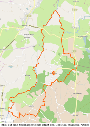

The municipality is located in the Bresse countryside , in the northern third of the Louhans arrondissement and borders the Jura department in the northeast . The entire western border is formed by the Brenne , from the east la Darge von Chapelle-Voland flows into the Brenne in the north . The valley of the Brenne is characteristic for the community, with floods many areas are regularly flooded and serve as retention areas. The department road D23 only touches the outermost municipality in the east, without opening up the place. The community has only a few wooded areas, east of the village there is a larger forest area, otherwise the area has a number of poplar plantations . The inhabited areas are limited to three main areas, the Bourg is located on a slight hill above the Brenne. The following hamlets and meadows belong to the municipality: Deffait, Haut-du-Planois, Sancenne .
climate
The climate in Le Planois is warm and temperate. There is significant rainfall throughout the year, even the driest month still has high rainfall. The effective climate classification according to Köppen and Geiger is Cfb . The annual average temperature is 10.9 ° C. Spread over a year, the rainfall adds up to 838 mm.
| Le Planois | ||||||||||||||||||||||||||||||||||||||||||||||||
|---|---|---|---|---|---|---|---|---|---|---|---|---|---|---|---|---|---|---|---|---|---|---|---|---|---|---|---|---|---|---|---|---|---|---|---|---|---|---|---|---|---|---|---|---|---|---|---|---|
| Climate diagram | ||||||||||||||||||||||||||||||||||||||||||||||||
| ||||||||||||||||||||||||||||||||||||||||||||||||
Toponymy
The first mention of the village goes back to 1374, Plainnay is mentioned… en la perroiche de la Chapelle Volant , in 1476 Le Planoy is mentioned. Ernest Nègre attributes the place name to the plane trees . More likely, however, is the derivation of plaine , the plain, as a description of the terrain along the Brenne .
history
In 1374 Le Planois belonged to the municipality of Chapelle-Voland and only became an independent municipality with the French Revolution . Up until the 17th century, Visargent Castle (municipality of Bosjean ) was a protective castle for the Planoisiens , where the jurisdiction was also located. The building for the mairie and school dates from 1902 and is the only stone building, the other houses are Bresse houses . In the north of the main settlement there is an old distillery . In 1988 there were still 15 farms.
population
| year | 1793 | 1800 | 1806 | 1821 | 1831 | 1841 | 1851 | 1861 | 1872 | 1881 | 1891 | 1901 | 1911 | 1921 | 1931 | 1946 | 1962 | 1975 | 1982 | 1990 | 1999 | 2006 | 2011 | |||||||||||||||||||||||||||||||||||||||||||||||||||||||||||||||||||||||||||||||||||||||||||||||||||||||||||||||||||||||||||||||||||||||||||||||||||||||||||||||||||||||||||||||||||||||||||||||||||||||||||||||||||||||||||||||||||||||||||||||||||||||||||||||||||||||||||||||||||||||||||||||||||||||||||||||||||||||||||||||||||||||||||||||||||||||||||||||||||||||||||||||||||||||||||||||||||||||||||||||||||||||||||||||||||||||||||||||||||||||||||||||||||||||||||||||||||||||||||||
|---|---|---|---|---|---|---|---|---|---|---|---|---|---|---|---|---|---|---|---|---|---|---|---|---|---|---|---|---|---|---|---|---|---|---|---|---|---|---|---|---|---|---|---|---|---|---|---|---|---|---|---|---|---|---|---|---|---|---|---|---|---|---|---|---|---|---|---|---|---|---|---|---|---|---|---|---|---|---|---|---|---|---|---|---|---|---|---|---|---|---|---|---|---|---|---|---|---|---|---|---|---|---|---|---|---|---|---|---|---|---|---|---|---|---|---|---|---|---|---|---|---|---|---|---|---|---|---|---|---|---|---|---|---|---|---|---|---|---|---|---|---|---|---|---|---|---|---|---|---|---|---|---|---|---|---|---|---|---|---|---|---|---|---|---|---|---|---|---|---|---|---|---|---|---|---|---|---|---|---|---|---|---|---|---|---|---|---|---|---|---|---|---|---|---|---|---|---|---|---|---|---|---|---|---|---|---|---|---|---|---|---|---|---|---|---|---|---|---|---|---|---|---|---|---|---|---|---|---|---|---|---|---|---|---|---|---|---|---|---|---|---|---|---|---|---|---|---|---|---|---|---|---|---|---|---|---|---|---|---|---|---|---|---|---|---|---|---|---|---|---|---|---|---|---|---|---|---|---|---|---|---|---|---|---|---|---|---|---|---|---|---|---|---|---|---|---|---|---|---|---|---|---|---|---|---|---|---|---|---|---|---|---|---|---|---|---|---|---|---|---|---|---|---|---|---|---|---|---|---|---|---|---|---|---|---|---|---|---|---|---|---|---|---|---|---|---|---|---|---|---|---|---|---|---|---|---|---|---|---|---|---|---|---|---|---|---|---|---|---|---|---|---|---|---|---|---|---|---|---|---|---|---|---|---|---|---|---|---|---|---|---|---|---|---|---|---|---|---|---|---|---|---|---|---|---|---|---|---|---|---|---|---|---|---|---|---|---|---|---|---|---|---|---|---|---|---|---|---|---|---|---|---|---|---|---|---|---|---|---|---|---|---|---|---|---|---|---|---|---|---|---|---|---|---|---|---|---|---|---|---|---|---|---|---|---|---|---|---|---|---|---|---|---|---|---|---|---|---|---|---|---|---|---|---|---|---|---|---|---|---|---|---|---|---|---|---|---|---|---|---|
| Residents | 273 | 297 | 318 | 270 | 273 | 271 | 288 | 266 | 289 | 288 | 267 | 276 | 298 | 256 | 265 | 192 | 130 | 116 | 106 | 93 | 74 | 93 | 102 | |||||||||||||||||||||||||||||||||||||||||||||||||||||||||||||||||||||||||||||||||||||||||||||||||||||||||||||||||||||||||||||||||||||||||||||||||||||||||||||||||||||||||||||||||||||||||||||||||||||||||||||||||||||||||||||||||||||||||||||||||||||||||||||||||||||||||||||||||||||||||||||||||||||||||||||||||||||||||||||||||||||||||||||||||||||||||||||||||||||||||||||||||||||||||||||||||||||||||||||||||||||||||||||||||||||||||||||||||||||||||||||||||||||||||||||||||||||||||||||
| From 1962 official figures excluding residents with a second residence | ||||||||||||||||||||||||||||||||||||||||||||||||||||||||||||||||||||||||||||||||||||||||||||||||||||||||||||||||||||||||||||||||||||||||||||||||||||||||||||||||||||||||||||||||||||||||||||||||||||||||||||||||||||||||||||||||||||||||||||||||||||||||||||||||||||||||||||||||||||||||||||||||||||||||||||||||||||||||||||||||||||||||||||||||||||||||||||||||||||||||||||||||||||||||||||||||||||||||||||||||||||||||||||||||||||||||||||||||||||||||||||||||||||||||||||||||||||||||||||||||||||||||||||||||||||

Economy and Infrastructure
In the village there is still a mairie , five farms, one building and one forestry. As AOC products are in Le Planois Volaille de Bresse and de Dinde Bresse admitted.
Educational institutions
Le Planois does not have its own school facilities. The children are educated in schools in the surrounding communities.
literature
- Claude Courtépée (1721–1781): Description historique et topographique du Duché de Bourgogne . tape 5 . Chez Causse, Dijon 1780 (French, Google Books ).
- Lucien Guillemaut (1842-1917): Histoire de la Bresse Louhannaise. Vol. 1, Louhans 1897.
- Lucien Guillemaut (1842–1917): Armoiries et familles nobles de la Bresse louhannaise: armoiries ouvrières, armoiries particulières et de familles . Vve L. Romand, Louhans 1909 (French, gallica ).
Web links
- Le Planois. on INSEE. Institut national de la statistique et des études économiques , accessed on January 18, 2015 (French).
- Le Planois. in the register of communes in France. Retrieved January 18, 2015 (French).
- Le Planois. in the Base Mérimée . Ministère de la Culture, accessed January 18, 2015 (French).
- Le Planois. in Archives départementales. Saône-et-Loire department, accessed on January 21, 2016 (French).
Individual evidence
- ↑ Le Planois. on habitants.fr. Retrieved December 31, 2015 (French).
- ↑ La Brenne , length 53.8 km, tributary to Bras la Seillette Aval, source at 46 ° 47 ′ 46 ″ N , 5 ° 40 ′ 6.6 ″ E in Miéry at approx. 437 m, mouth at 46 ° 44 ′ 12.8 ″ N , 5 ° 17 ′ 27.2 ″ E in Sens-sur-Seille at approx. 181 m, La Brenne on sandre.eaufrance.fr
- ↑ La Darge , length 10.2 km, tributary to the Brenne , source at 46 ° 50 ′ 36.2 ″ N , 5 ° 24 ′ 41.8 ″ E in Mouthier-en-Bresse at approx. 209 m, mouth at 46 ° 48 ′ 46.4 ″ N , 5 ° 19 ′ 42.6 ″ E in Le Planois at approx. 184 m, La Darge on sandre.eaufrance.fr
- ↑ Departementsstrasse D23. on routes.wikia.com. Retrieved April 11, 2015 (French).
- ↑ Le Planois. (PDF) in the Dictionnaire Topographique de Saône-et-Loire. Comité des Travaux Historiques et Scientifiques, accessed on May 3, 2015 (French, search term: Ctrl+ FPlanois).
- ^ Ernest Nègre : Toponymie générale de la France . tape 1 . Librairie Droz, 1990, p. 708 ( Google Books, 339 ).
- ↑ Population statistics on cassini.ehess.fr. Retrieved April 30, 2015 (French).
- ^ Chicken de Bresse. to INAO, L'Institut national de l'origine et de la qualité. Retrieved June 26, 2015 (French).
- ↑ Dinde de Bresse. to INAO, L'Institut national de l'origine et de la qualité. Retrieved June 26, 2015 (French).