Saint-Pierre-d'Aurillac
| Saint-Pierre-d'Aurillac | ||
|---|---|---|
|
|
||
| region | Nouvelle-Aquitaine | |
| Department | Gironde | |
| Arrondissement | Langon | |
| Canton | L'Entre-deux-Mers | |
| Community association | Réolais en Sud Gironde | |
| Coordinates | 44 ° 34 ′ N , 0 ° 11 ′ W | |
| height | 0-115 m | |
| surface | 6.52 km 2 | |
| Residents | 1,321 (January 1, 2017) | |
| Population density | 203 inhabitants / km 2 | |
| Post Code | 33490 | |
| INSEE code | 33463 | |
| Website | http://st-pierre-daurillac.fr/ | |
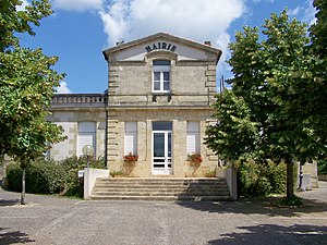
 Saint-Pierre-d'Aurillac town hall |
||
Saint-Pierre-d'Aurillac is a commune with 1,321 inhabitants (as of January 1 2017) in the Gironde department in the region Nouvelle-Aquitaine . It belongs to the arrondissement of Langon and the canton of L'Entre-deux-Mers (until 2015: canton of Saint-Macaire ).
geography
Saint-Pierre-d'Aurillac is located in the southwest of France . The Garonne limits the municipality to the south. North of the municipality is Saint-André-du-Bois , east Saint-Martin-de-Sescas , southeast Castets et Castillon , southwest Saint-Pardon-de-Conques and west Le Pian-sur-Garonne .
Population development
| year | 1962 | 1968 | 1975 | 1982 | 1990 | 1999 | 2008 | 2013 |
| Residents | 892 | 908 | 1.008 | 1,227 | 1,249 | 1,088 | 1,308 | 1,320 |
| Source: Cassini and INSEE | ||||||||
Attractions
- Saint-Pierre church
Community partnerships
Partnerships have been in place with the French communities of Morfontaine and Thil in the Meurthe-et-Moselle department since 1972 and the Palestinian community of Al-Qarara .
literature
- Le Patrimoine des Communes de la Gironde. Flohic Éditions, Volume 2, Paris 2001, ISBN 2-84234-125-2 , p. 1335.
Individual evidence
Commons : Saint-Pierre-d'Aurillac - Collection of images, videos and audio files

