Portets
| Portets | ||
|---|---|---|

|
|
|
| region | Nouvelle-Aquitaine | |
| Department | Gironde | |
| Arrondissement | Langon | |
| Canton | Les Landes des Graves | |
| Community association | Convergence Garonne | |
| Coordinates | 44 ° 42 ′ N , 0 ° 25 ′ W | |
| height | 2-37 m | |
| surface | 15.49 km 2 | |
| Residents | 2,702 (January 1, 2017) | |
| Population density | 174 inhabitants / km 2 | |
| Post Code | 33640 | |
| INSEE code | 33334 | |
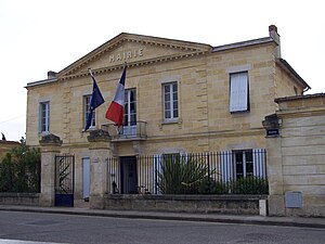
 Mairie Portets |
||
Portets is a French commune with 2,702 inhabitants (at January 1, 2017) in the Gironde department in the region Nouvelle-Aquitaine .
geography
The municipality of Portets is to the left of the Garonne , 22 kilometers southeast of Bordeaux and seven kilometers northwest of Podensac . The local thoroughfare is the department road D1113. Eight kilometers from Portets there is a connection to the A62 autoroute .
Population development
| year | 1962 | 1968 | 1975 | 1982 | 1990 | 1999 | 2007 | 2017 |
|---|---|---|---|---|---|---|---|---|
| Residents | 1685 | 1889 | 1997 | 2030 | 2008 | 2001 | 2195 | 2702 |
Attractions
- Saint-Vincent church from 1861 with sculpture Madonna and Child from the 15th century ( Monument historique )
- Château de Mongenan, a castle from the 18th century with the associated garden, since 2003 as a monument historique out
- Château de Portets, a 16th century castle, now the seat of a winery
Personalities
- Claude Antoine de Valdec de Lessart , super minister under Louis XVI. in the years 1790–1792
literature
- Le Patrimoine des Communes de la Gironde. Flohic Éditions, Volume 2, Paris 2001, ISBN 2-84234-125-2 , pp. 1136-1140.
Web links
Commons : Portets - collection of images, videos and audio files
- Community presentation (French)

