Sainte-Austreberthe (Seine-Maritime)
| Sainte-Austreberthe | ||
|---|---|---|

|
|
|
| region | Normandy | |
| Department | Seine-Maritime | |
| Arrondissement | Rouen | |
| Canton | Notre-Dame-de-Bondeville | |
| Community association | Caux-Austreberthe | |
| Coordinates | 49 ° 36 ' N , 0 ° 54' E | |
| height | 85-154 m | |
| surface | 6.13 km 2 | |
| Residents | 612 (January 1, 2017) | |
| Population density | 100 inhabitants / km 2 | |
| Post Code | 76570 | |
| INSEE code | 76566 | |
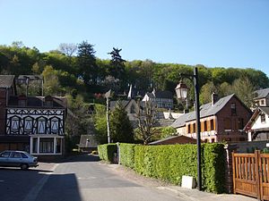
 Center of Sainte-Austreberthe |
||
Sainte-Austreberthe is a French city with a population of 612 (as at 1st January 2017) in the department of Seine-Maritime in the region Normandy (before 2016: Haute-Normandie ). The municipality belongs to the Arrondissement of Rouen and the canton of Notre-Dame-de-Bondeville (until 2015: canton Pavilly ).
geography
Sainte-Austreberthe is located about 19 kilometers north-northwest of Rouen in the Pays de Caux . The river Austreberthe has its source here . Sainte-Austreberthe is surrounded by the neighboring communities of Émanville in the north, Hugleville-en-Caux in the north and northeast, Butot in the east and northeast, Sierville in the east, Goupillières in the south and southeast, Pavilly in the south and Limésy in the west.
history
The place is connected to the story of Saint Austreberta because of the chapel at the source of the Austreberthe river .
Population development
| 1962 | 1968 | 1975 | 1982 | 1990 | 1999 | 2006 | 2013 |
|---|---|---|---|---|---|---|---|
| 342 | 416 | 545 | 453 | 521 | 583 | 586 | 615 |
| Source: Cassini and INSEE | |||||||
Attractions
- Sainte-Austreberthe church from the 11th century
- Sainte-Austreberthe source chapel, historic pilgrimage site
