Moosseedorf
| Moosseedorf | |
|---|---|
| State : |
|
| Canton : |
|
| Administrative district : | Bern-Mittelland |
| BFS no. : | 0544 |
| Postal code : | 3302 |
| Coordinates : | 603 293 / 207385 |
| Height : | 532 m above sea level M. |
| Height range : | 520–799 m above sea level M. |
| Area : | 6.38 km² |
| Residents: | 4111 (December 31, 2018) |
| Population density : | 557 inhabitants per km² |
| Mayor : | Peter Bill ( SVP ) |
| Website: | www.moosseedorf.ch |
|
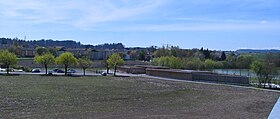
Moosseedorf, lido and Moossee |
|
| Location of the municipality | |
Moosseedorf is a municipality in the Bern-Mittelland administrative district in the canton of Bern in Switzerland .
geography
Moosseedorf lies at 532 m above sea level. M. , 8 km north-northeast of the canton capital Bern (linear distance). The village extends slightly elevated south of Moss Lake , at the southeast end of the Moss Lake Valley and at the northern foot of Molassehöhen of Bantigers , in the Swiss Plateau .
The area of the 6.3 km² municipal area covers a section of the central Bernese plateau. The northern border runs in a straight line along the canalized Urtenen and through the Moossee. From here, the municipality extends southward over the flat, around 500 m wide valley low to the heights of Moosseedorf and into the extensive Wiliwald (up to 600 m above sea level ) on the watershed between the Aare and the Urtenen. To the southeast, the community ban extends into the hollow of Im Sand and over the steep, densely forested northern slope of the gray wood to the ridge of this ridge, on which at 800 m above sea level. M. the highest point of Moosseedorf is reached. In 1997, 20% of the municipal area was in settlements, 36% in forests and woodlands, 42% in agriculture and a little less than 2% was unproductive land.
Moosseedorf includes the Sand district ( 536 m above sea level ) in a hollow at the northern foot of the gray wood, east of the motorway, and the Tannacheren settlement ( 578 m above sea level ) in a cleared island between the Wiliwald and the gray wood. Neighboring communities of Moosseedorf are Urtenen-Schönbühl , Bolligen , Münchenbuchsee and Wiggiswil .
population
With 4,321 inhabitants (as of April 5, 2018), Moosseedorf is one of the medium-sized communities in the canton of Bern. 89.8% of the residents speak German and 4.5% speak Serbian (as of 2018). The population of Moosseedorf was 584 in 1850 and 573 in 1900. In the course of the 20th century, the population increased slowly but steadily to 833 people by 1960. In the following three decades, the population grew rapidly, with the number of inhabitants quadrupling. Since 1990 (3494 inhabitants) only minor population fluctuations have been registered. The residential and commercial area of Moosseedorf has now merged seamlessly with that of Urtenen-Schönbühl.
politics
The voting shares of the parties on the occasion of the 2015 National Council elections were: SVP 35.4%, SP 22.4%, BDP 14.5%, FDP 9.2%, glp 5.9%, GPS 3.6%, EPP 3.6 %, CVP 2.5%, EDU 1.4%.
economy
Up until the second half of the 20th century, Moosseedorf was predominantly an agricultural village. Today the community offers around 3800 jobs. With 1% of the workforce who are still employed in the primary sector, agriculture (predominantly arable farming , dairy farming and forestry ) only has a marginal role in the employment structure of the population. Around 21% of the workforce is employed in the industrial sector, while the service sector accounts for 78% of the workforce (as of 2001).
Moosseedorf has thus become an agglomeration municipality of Bern, which, thanks to the excellent traffic situation, has been chosen to be the location of several large shopping centers ( Shoppyland ). Extensive commercial and industrial zones have emerged since the early 1970s in the area of the Schönbühl motorway exit and on the western edge of the village. Information technology, construction, metal construction and mechanical workshops are represented in Moosseedorf today.
New residential quarters have been developing since the 1960s on the slopes south of the old village center and in the sand. Although Moosseedorf has a clear inbound commuter surplus, many workers are also commuters who work in the city and agglomeration of Bern .
traffic
The community is excellently developed in terms of traffic, but is cut into different parts by the numerous main traffic routes. The old village center is on main road 12 from Bern to Solothurn or on main road 1 to Burgdorf . The closest connection to the A1 (Bern-Zurich) and A6 (Bern-Biel) motorways is less than 1 km from the town center. The Schönbühl junction is located in the municipal area, where the A6 meets the A1. On April 10, 1910, the Zollikofen – Solothurn section was inaugurated with a train station in Moosseedorf, which is now operated by the Regionalverkehr Bern – Solothurn (RBS) company. The trains run every 15 minutes to Bern, which is reached after a journey time of 12 minutes. Since 2005 the RBS has joined the Bern S-Bahn . The old route of the main line from Bern to Olten also runs through the village, but has no stop here.
history
The municipality of Moosseedorf can look back on a very long tradition of settlement. The earliest evidence of human presence was found on the Moosbühl from the late Paleolithic (around 10,000 to 8,000 BC). At the outflow of Urtenen from the Moossee a long time was during the Neolithic used stilt houses . Various grave mounds from the Hallstatt period were also excavated in the sand .
The place was first mentioned in a document in 1242 under the name Sedorf . Later, the names Seedorf (1384) and Mossedorf (1389) appeared. The place name originally meant village by the lake .
In the Middle Ages , Moosseedorf was the ancestral seat of the Knights of Seedorf. Through a barter trade, the village with castle and lake came to the Johanniterkommende in Münchenbuchsee in 1256. Since 1406, sovereignty over the area near Bern was incumbent. After the Commandery was secularized in 1528, Moosseedorf was assigned to the Landvogtei Münchenbuchsee in the Zollikofen Regional Court .
Against the French troops marched in in 1798, the Battle of the Grauholz took place on March 5, 1798 at the foot of the Grauholz , which led to the final fall of old Bern. After the collapse of the Ancien Régime , the village belonged to the Zollikofen district during the Helvetic Republic and from 1803 to the Fraubrunnen Oberamt, which received the status of an official district with the new cantonal constitution of 1831.

Attractions
The reformed village church with the oldest evidence from 1242, in today's late Gothic appearance, has a nave with masonry from the Romanesque period. The Grauholzdenkmal has been a reminder of the retreat of the Bernese since 1886 .
literature
- Andrea Zellweger: Swiss Art Guide GSK, Volume 768: Church Moosseedorf , Bern 2005, ISBN 3-85782-768-8
Web links
- Official website of the municipality of Moosseedorf
- Felix Müller and Anne-Marie Dubler : Moosseedorf. In: Historical Lexicon of Switzerland .
Individual evidence
- ↑ Permanent resident population from STAT-TAB of the BfS , municipalities see also regional portraits 2020 on bfs.admin.ch, accessed on May 29, 2020
- ↑ Elections 2015: Results of the Moosseedorf municipality. Canton of Bern, accessed on March 21, 2016


