Laymont
|
Laymont Laimont |
||
|---|---|---|
|
|
||
| region | Occitania | |
| Department | Gers | |
| Arrondissement | Also | |
| Canton | Val de Save | |
| Community association | Le Savès | |
| Coordinates | 43 ° 25 ′ N , 0 ° 59 ′ E | |
| height | 190-315 m | |
| surface | 11.05 km 2 | |
| Residents | 210 (January 1, 2017) | |
| Population density | 19 inhabitants / km 2 | |
| Post Code | 32220 | |
| INSEE code | 32206 | |
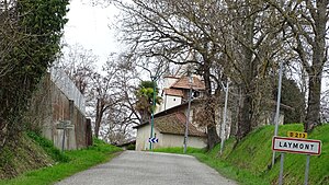
 Entrance to Laymont |
||
Laymont ( Gascon : Laimont ) is a French municipality with 210 inhabitants (at January 1, 2017) in the department of Gers in the region Occitania (before 2016 Midi-Pyrenees ). It belongs to the canton of Val de Save (until 2015 Lombez ) and the arrondissement Auch . The inhabitants are called Laymontois .
location
Laymont is about 39 kilometers southwest of Toulouse . Laymont is surrounded by the neighboring communities of Montégut-Savès in the north and north-west, Saint-Loube in the north, Forgues in the north-east, Monès in the east, Le Pin-Murelet in the south and south-east, Montpézat in the south and Saint-Lizier-du-Planté in the west .
Population development
| year | 1962 | 1968 | 1975 | 1982 | 1990 | 1999 | 2006 | 2011 | 2016 |
|---|---|---|---|---|---|---|---|---|---|
| Residents | 263 | 254 | 218 | 210 | 199 | 216 | 206 | 200 | 209 |
| Sources: Cassini and INSEE | |||||||||
Attractions
- Saint Martin Church
Web links
Commons : Laymont - collection of images, videos and audio files
