
Saint Martin (Palatinate)
| coat of arms | Germany map | |
|---|---|---|

|
Coordinates: 49 ° 18 ' N , 8 ° 6' E |
|
| Basic data | ||
| State : | Rhineland-Palatinate | |
| County : | Southern Wine Route | |
| Association municipality : | May Chamber | |
| Height : | 225 m above sea level NHN | |
| Area : | 11.2 km 2 | |
| Residents: | 1691 (Dec. 31, 2019) | |
| Population density : | 151 inhabitants per km 2 | |
| Postal code : | 67487 | |
| Area code : | 06323 | |
| License plate : | SOUTH | |
| Community key : | 07 3 37 070 | |
| Association administration address: | Immengartenstrasse 24 67487 Maikammer |
|
| Website : | ||
| Local Mayor : | Timo Glaser ( CDU ) | |
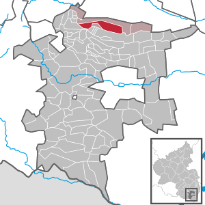
| Location of the local community Sankt Martin in the district of Südliche Weinstrasse | ||
  |
||

.jpg)
Sankt Martin is a municipality in the Südliche Weinstrasse district in Rhineland-Palatinate . It belongs to the Maikammer community , within which it is the smallest local community with 1700 inhabitants. Viticulture is an important economic factor in the municipality.
geography
Geographical location
Sankt Martin is located in the north-northwest of the southern wine route district. Nestled in an elongated valley fold, the so-called Sankt Martiner Tal , the village leans against the eastern slope of the Haardt . The Rhine plain extends to the east . Neighboring communities are - in clockwise direction - Maikammer , Edenkoben , Kirrweiler (Pfalz) (exclave), Gommersheim (exclave), Edenkoben (exclave) and Kirrweiler (exclave).
Surveys
In the north, Sankt Martin is bordered by the highest elevation in the Palatinate Forest , the 673 m high Kalmit , which is already in the district of Maikammer. To the south of the village rises the 635.3 m high high mountain , which is the fourth largest mountain in the range. Other elevations on the municipality are the southern flank of the Schafkopf ( 617 m ), the southern flank of the Stotz ( 603 m ), the Hüttenberg ( 591 m ), the southwest flank of the Breitenberg ( 545 m ), the Kleyenkopf ( 459 m ) and the Heidelberg ( 338 m ).
Waters
The Kropsbach , which flows in a west-east direction and which represents the central body of water of the local community, has its source in the district of Sankt Martin . For the first few kilometers it flows through the forest, where it first takes up the Hüttenbach from the left and is then dammed up to the sand meadow pond; then it runs through the settlement area of the local community. The Wetzbrunnen and the Wolsel spring also pour in the parish of the municipality in the Palatinate Forest , the flowing stream of which flows into the Kropsbach from the left. Shortly before reaching the settlement area, the Kropsbach joins the Frauenbach from the right . From the left he also takes up the cross moat . The north-flowing Kleyenbach rises in the far west of the district and drains beyond the municipal boundary via the Argenbach and the Speyerbach .
history


The area has been populated since Roman times. However, the first written mention of the place was not made until 1149. However, it is assumed that a village has existed here since the seventh century. Until the end of the 18th century, Sankt Martin belonged to the Speyer Monastery ; there the place was subordinate to the Oberamt Kirrweiler .
From 1798 to 1814, when the Palatinate was part of the French Republic (until 1804) and then part of the Napoleonic Empire , Sankt Martin was incorporated into the canton of Edenkoben in the department of the Lower Rhine and had its own Mairie . In 1815 the community had a total of 1,400 inhabitants. In the same year, Austria was struck. Just one year later, the place, like the entire Palatinate, changed to the Kingdom of Bavaria . From 1818 to 1862, Sankt Martin belonged to the Landau Landau inspectorate ; from this the district office of Landau emerged.
From 1939 the place was part of the district of the Palatinate . After the Second World War , Sankt Martin became part of the then newly formed state of Rhineland-Palatinate within the French occupation zone . During the first Rhineland-Palatinate administrative reform changed the place on 7 June 1969 in the newly created district Landau-Bad Bergzabern, in 1978 in South County Wine Trail is renamed . In 1972, Sankt Martin was assigned to the Maikammer Association, which was also newly formed . Due to the dissolution of the latter, Sankt Martin was initially part of the community of Edenkoben from July 2014 , before the Maikammer counterpart was restored a year later by judgment of the Constitutional Court .
population
Population development
In 1928, Sankt Martin had 1940 residents who lived in 379 residential buildings.
Religions


In the first half of the 20th century, the Catholics owned a local parish, while the Protestants belonged to that of Maikammer. On October 31, 2014, 66.87 percent of the population were Catholic and 16.398 percent Protestant. The rest belonged to another religion or were non-denominational.
St. Martin of Tours is also the patron of the Roman Catholic parish church of St. Martin . In addition to a late Gothic reticulated vault in the choir , the church, which is considered a typical example of medieval architecture, also contains other objects of Gothic architectural style, such as the tomb of Johann XXII. Chamberlain of Worms († 1531) and his wife Katharina von Cronberg . Both have a UNESCO plaque. A pilgrimage to the church takes place annually on November 12th.
There is also a Lourdes grotto on site .
politics
Municipal council
The local council in Sankt Martin consists of 16 council members, who were elected in the local elections on May 26, 2019 in a personalized proportional representation, and the honorary local mayor as chairman.
The distribution of seats in the municipal council:
| choice | SPD | CDU | FWG | total |
|---|---|---|---|---|
| 2019 | 5 | 9 | 2 | 16 seats |
| 2014 | 5 | 8th | 3 | 16 seats |
| 2009 | 6th | 8th | 2 | 16 seats |
| 2004 | 6th | 9 | 1 | 16 seats |
- FWG = Free Voting Group Sankt Martin e. V.
mayor
The current local mayor is Timo Glaser (CDU), who has been in office since 2014. In the direct election on May 26, 2019, he was confirmed in his office for another five years with a share of the vote of 75.16%. His predecessor was Manfred Lameli from the SPD. Michael Rößler is the first alderman to assist the mayor, as is the alderman Frank Moll.
coat of arms
The Ministry of the Interior of Rhineland-Palatinate approved the municipality of Sankt Martin, Landau district, in accordance with § 5 of the municipal code, dated April 30, 1952, to use its own coat of arms.
|
|
Blazon : "In blue under a golden pointed shield head, a gold-nimbed, gold-clad and armed saint in natural colors with a golden, red-tied helmet on a silver, red-bridled, striding horse, dividing his red equestrian cloak with a silver, gold-stapled sword, above in the first and third The tip is accompanied by a silver lily , in the center of the base of the shield is a silver label with a black horseshoe inside. "
It was approved by the Mainz Ministry of the Interior in 1952 and goes back to a seal from the 18th century showing a horseshoe. To distinguish itself from the multitude of other horseshoe communities, St. Martin was added in 1952. |
Culture and sights
Cultural monuments
,_Maikammerer_Str.JPG)
The medieval town center and the Kropsburg are designated as monument zones. The latter rises south of the village on a hill in front of the Hochberg and was once the seat of the highest barons of the empire, the Knights of Dalberg .
There are also several dozen individual buildings that are listed , including the Old Castle , the Catholic Church of St. Martin and the local Gasthaus Zur Krone .
nature

The nature reserves Haardtrand - Am Wingertsberg and Haardtrand - Im Dörnel are also located within the municipality . With the sea of rocks on the Hüttenberg, which is partly already on the district of Maikamnmer, a sweet chestnut and the Dichterhain rock formation in the so-called Swallow Rock, there are a total of three natural monuments on site . The poet's grove was created in 1929 by the local tourist office and shows reliefs by Fritz Claus , August Heinrich and Lina Sommer .
There is a so-called Bible garden on site . The Ritterstein 243 is also located at the Wetzbrunnen . The St. Martin's fig also comes from the community .
Regular events
- Martin's Day, Martini, which takes place on November 11th, is celebrated as a local holiday in Sankt Martin. Various customs such as Martinsfeuer, lantern parade [ lantern parade] and Martinsspiel by the amateur play group make the festival a highlight of the year and attract numerous guests to the historic center of 'Made', as the wine village is called in the Palatinate dialect (derived from 'Martenheim, Marten') .
- On the first weekend in August - the first Sunday in August is decisive - the traditional Weinkerwe, also known as the parish fair, takes place from Friday to Tuesday. Numerous bars, kerwebuden, rides and local restaurants invite you to linger and celebrate in St. Martin's romantic alleyways.
- On the so-called Kerwe Friday the Kerwe opening takes place in the early evening and later the excavation of the Kerwe takes place
- The Kerwemontag includes the traditional Kerw hike to the “Maademer Kerwetälchen”; the latter are four beeches in the Kleyental
- In the afternoon the Kerwedienstaga winegrowers carry a Flurbegang by which Kerwe funeral, which the club Club St. Martin will be held in the evening followed
Economy and Infrastructure
.JPG)
economy
Sankt Martin lives mainly from the wine that is grown on around 200 hectares in the two individual layers Baron and Kirchberg - both part of the large Schloss Ludwigshöhe site . The place is part of the Palatinate wine-growing region . Associated with this, the volume of tourism is also an important economic factor. The landscape-defining local mountain above the village was transversely terraced in 2012 and mostly newly planted with vines. This location, visible from afar, is popularly known as “St. Martiner Wingertsberg ”.
In the course of the Haingeraide , Sankt Martin was involved in the so-called fifth Haingeraiden , which was dissolved in the early modern period and which was partially subordinated to the community.
traffic
The Totenkopfstraße , which leads west into the hills of the Palatinate Forest, starts in Sankt Martin in the east; it is identical to the state road 514 ; the latter also connects the place with the city of Edenkoben. District road 32 branches off from here and connects to Maikammer. The Kreisstraße 30 coming from Edenkoben connects the Kropsburg to the road network.
Sankt Martin is connected to the local transport network via the bus lines 500 and 501 of the Rhein-Neckar transport association, both of which lead to Landau and Neustadt an der Weinstrasse. The closest train station is Maikammer-Kirrweiler on the Palatinate Maximiliansbahn .
tourism

In the middle of the Palatinate Forest, on the parish of the local community, is the Haus an den Fichten, operated by the Palatinate Forest Association . The German Wine Route and the Palatinate Keschdeweg also run through the village . The Pfälzer Weinsteig, a so-called Prädikatswanderweg , leads through the forest marking . In addition, St. Martin is the southern terminus of a hiking trail, the white-green with a bar is highlighted and the Wasener cross in Stumpfwaldbahn starts. In addition, one that is marked with a red bar and that runs from Bad Dürkheim to Siebeldingen and one that is marked with a red point and leads from Hertlingshausen to Bobenthal run through the community.
Personalities
Honorary citizen
- Cäcilie Ziegler (* 1921; † before 2010), appointed in 1999
- Armin Kiefer (* 1940), appointed 2020
- Karl Hartkorn (* 1939), appointed 2020
Sons and daughters of the church
- Aloys Weisenburger (1815–1887), Catholic priest; Preacher, writer and publicist. Because of the many years of publishing his house calendar, he is also known as the “Palatinate Calendar Man”.
- Franz Ritter von Will (1830–1912), Bavarian major general , since 1871 knight of the Military Max Joseph Order
- Georg Christmann (1874–1947), crop scientist
- Nikolaus Moll (1879–1948), Catholic priest, prelate and youth educator
- Franz Schweizer (1886–1969), magician
People who worked on site
- Jakob Baumann (1862–1922), chaplain on site from 1887 to 1889
- Johann XXII. Chamberlain of Worms († 1531), Lord of the Kropsburg and in Sankt Martin, whose splendid tomb has been preserved in the local Martinskirche.
- Joachim Günther (1720–1789) designed a local high altar that no longer exists
- August Heinrich (1881–1965), there is a memorial with his relief on site
- Cäcilia Hormuth, Palatinate Wine Queen 1948/49
- Adolph Hund von Saulheim (~ 1595–1668), cathedral dean, builder of the Old Palace
- Johann Christoph Hund von Saulheim († 1624), senior bailiff of the Speyer prince-bishop of Marientraut ; The old castle in St. Martin was built as a noble residence
- Jakob von Landshut (around 1450–1509) designed the local Catholic church
- Martin Walzer (1883–1958), priest, at times chaplain on site
- Gabriele Weingartner (* 1948), journalist and author, lived on site until November 2008
literature
- Günter Schäfer: Saint Martin. From 1530 and local family book 671 to 1925. G. Schäfer, Sankt Martin 2010.
Web links
- Virtual local history museum Sankt Martin / Pfalz
- Catholic parish of St. Martin in St. Martin
- Literature about Sankt Martin in the Rhineland-Palatinate State Bibliography
Individual evidence
- ↑ State Statistical Office of Rhineland-Palatinate - population status 2019, districts, communities, association communities ( help on this ).
- ↑ a b daten.digitale-sammlungen.de: List of localities for the Free State of Bavaria . Retrieved July 1, 2016 .
- ↑ Municipal statistics . In: KommWis. October 31, 2014, accessed November 30, 2014 .
- ^ The Regional Returning Officer Rhineland-Palatinate: Local elections 2019, city and municipal council elections .
- ↑ The Regional Returning Officer Rhineland-Palatinate: direct elections 2019. see Verbandsgemeinde Maikammer, third line of results. Retrieved April 11, 2020 .
- ↑ Sankt Martin: Contact details. Sankt Martin parish, accessed on April 11, 2020 .
- ^ Karl Heinz Debus: The great book of arms of the Palatinate . Neustadt an der Weinstrasse 1988, ISBN 3-9801574-2-3 .
- ↑ Description on the original coat of arms, which is owned by the local community.
- ↑ General Directorate for Cultural Heritage Rhineland-Palatinate (ed.): Informational directory of cultural monuments - Southern Wine Route district. Mainz 2020, p. 85 ff. (PDF; 10 MB).
- ↑ A worthy home for the museum. Retrieved July 1, 2018 .
- ^ GenWiki, OFB St. Martin.

Cities: Annweiler am Trifels | Bad Bergzabern | Edenkoben
Municipalities: Albersweiler | Altdorf (Palatinate) | Barbelroth | Cheapheim-Ingenheim | Birkenhördt | Birkweiler | Böbingen (Palatinate) | Böchingen | Böllenborn | Bornheim (Palatinate) | Burrweiler | Dernbach (Palatinate) | Dierbach | Dörrenbach | Edesheim | Eschbach (Palatinate) | Essingen (Palatinate) | Eusserthal | Flemlingen | Frankweiler | Freimersheim (Palatinate) | Gleisweiler | Gleiszellen-Gleishorbach | Goecklingen | Gommersheim | Gossersweiler-Stein | Großfischlingen | Hainfeld (Palatinate) | Hergersweiler | Herxheim near Landau / Pfalz | Herxheimweyher | Heuchelheim Blades | Hochstadt (Palatinate) | Ilbesheim near Landau in the Palatinate | Vaccinees | Insheim | Kapellen-Drusweiler | Kapsweyer | Kirrweiler (Palatinate) | Small fish | Klingenmünster | Knöringen | Leinsweiler | May Chamber | Münchweiler am Klingbach | Niederhorbach | Niederotterbach | Oberhausen (near Bad Bergzabern) | Oberotterbach | Oberschlettenbach | Offenbach an der Queich | Pleisweiler-Oberhofen | Ramberg (Palatinate) | Ranschbach | Rhodt under Rietburg | Rinnthal | Rohrbach (Palatinate) | Roschbach | Saint Martin (Palatinate) | Schweigen-Rechtenbach | Schweighofen | Siebeldingen | Silz | Steinfeld (Palatinate) | Venningen | Völkersweiler | Vorderweidenthal | Waldhambach | Waldrohrbach | Walsheim | Wernersberg | Weyher in the Palatinate