List of streets and squares in Berlin's Hansaviertel

The list of streets and squares in Berlin-Hansaviertel describes the street system in the Berlin district of Hansaviertel with the corresponding historical references. At the same time, this compilation is part of the lists of all Berlin streets and places .
overview
Location
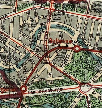
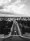
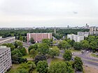
The Hansaviertel was built in the 1870s and 1880s on an arch of the Spree as a bourgeois residential area with closed perimeter block development, primarily with villas and better townhouses. Some of the streets were given names related to northern Germany, while other streets were named after composers and poets. The Hansa district belonged to 1920 to the Tiergarten district, then in the formation of Greater Berlin to Tiergarten district . During the Second World War , the Hansaviertel was one of the most severely damaged districts in Berlin. The part of the Hansaviertel to the south of the tram viaduct was rebuilt as part of the 1957 Interbau International Building Exhibition , partially abandoning the old street grid in the classic modern style. Many of these buildings are listed. With the district reform in 2001, the Hansaviertel became a separate official district in Berlin's Mitte district . The district is the smallest in terms of area and one of the most densely populated among the Berlin districts.
The Hansaviertel has 5,926 inhabitants (as of December 30, 2019) and includes the postcode areas 10555 and 10557.
Road system
The Berlin street list names 16 streets in the district with a total length of 5.4 kilometers. From these two streets run over the district boundary. Due to the location of the district in the middle of Berlin and the Spreebogen, there are no federal highways through the district, but 1,300 meters of the main streets in the Berlin road network belong to the superordinate system: Altonaer , Bachstraße and Lessingstraße . The Bartningallee and Klopstockstraße be considered in addition roads (feeder) of ( Category IV included in the directory). The banks of the Spree can usually be reached on sidewalks. The Schleswiger Ufer and Holsteiner Ufer are included in the official list as " STRA ", 30 & meters from the latter as "FUWE" (footpath). The English Garden is also included as an object on the street list in the RBS “PARK” class and as a pedestrian area after Okstra. Along the Spree there are sections of two main green paths : Spreeweg and Tiergartenring .
Overview of streets and squares
The following table gives an overview of the streets and squares in the district as well as some related information.
- Name / location : current name of the street or square. Via the link Location , the street or the square can be displayed on various map services. The geoposition indicates the approximate center of the street length.
- Traffic routes not listed in the official street directory are marked with * .
- Former or no longer valid street names are in italics . A separate list may be available for important former streets or historical street names.
-
Length / dimensions in meters:
The length information contained in the overview are rounded overview values that were determined in Google Earth using the local scale. They are used for comparison purposes and, if official values are known, are exchanged and marked separately.
For squares, the dimensions are given in the form a × b for rectangular systems and for (approximately) triangular systems as a × b × c with a as the longest side.
If the street continues into neighboring districts, the addition ' in the district ' indicates how long the street section within the district of this article is. - Name origin : origin or reference of the name.
- Notes : further information on adjacent monuments or institutions, the history of the street and historical names.
- Image : Photo of the street or an adjacent object.
| Name / location | Length / dimensions (in meters) |
Origin of name | Date of designation | Remarks | image |
|---|---|---|---|---|---|
|
Altonaer Strasse
( Location ) |
470 (in the district) |
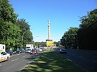
Altona , until 1937 a town in the Prussian province of Schleswig-Holstein , since then part of Hamburg | 1879 | In the northwest, the road ends at about the Spree to Moabit leading Hansabrücke . In the southeast the road leads to the Tiergarten district and ends there at the Großer Stern . |
|
|
Bachstrasse
( Location ) |
650 | Johann Sebastian Bach (1685–1750), composer | 1889 | The street runs from the Straße des 17. Juni to Altonaer Straße parallel to the viaduct arches of the Stadtbahn . At the southern end of the street is the Tiergarten station of the Stadtbahn. |

|
| Bartningallee
( Location ) |
570 | Otto Bartning (1883–1959), architect involved in the reconstruction of the Hansaviertel | 1960 | In the northeast, the road ends at about the Spree to Moabit leading Moab bridge . The Bellevue station of the Berlin Stadtbahn is located on Bartningallee . |

|
|
Claudiusstrasse
( Location ) |
240 | Matthias Claudius (1740–1815), poet and journalist | 1879 | House No. 5 by Conrad Hölzel, built in 1893, is a listed building monument. |

|
| Cuxhavener Strasse
( Location ) |
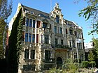
90 | Cuxhaven , until 1937 part of Hamburg port city on the North Sea , today the district town of the Cuxhaven district in Lower Saxony | 1879 | The part of the street south of the tram viaduct was built over when the Hansaviertel was rebuilt in the 1950s. This is where the embassy of Honduras is located . |
|
|
Flensburger Strasse
( Location ) |
390 | Flensburg , independent city in Schleswig-Holstein | 1879 | On the street is an ensemble of buildings typical of the prewar Hansaviertel , numbers 5, 7, 9, 11 and 13. |

|
| Flotowstrasse
( Location ) |
190 | Friedrich von Flotow (1812–1883), composer | 1904 | Like other streets in the Hansaviertel, the street laid out as street 5a of Dept. V / 2 of the development plan received the name of a well-known composer. It leads from the Bachstraße to the Schleswiger Ufer. |

|
|
Händelallee
( Location ) |
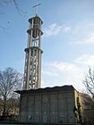
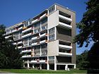
600 | Georg Friedrich Handel (1685–1759), German- English composer | May 3, 1935 | The Handelallee originally ran in an east-west direction from Klopstockstrasse via Lessingstrasse to Altonaer Strasse. It was called Händelstrasse from 1879 to 1935 . Through the redesign of the Hansaviertel in the course of Interbau 1957, various streets were changed. In 1956, the eastern section of Händelallee was drawn in and a new horseshoe-shaped route led it back to Klopstockstraße. With effect from March 28, 1958, this new section of street was given the name Handelallee. The new Kaiser-Friedrich-Gedächtniskirche is located in the street . The apartment block No. 1–9 was designed by Walter Gropius . | |
|
Hansaplatz
( Location ) |
200 × 200 | after the Hanseatic League , a medieval association of towns and merchants | May 23, 1879 | Hansaplatz is on both sides of Altonaer Straße and Klopstockstraße / Bartningallee. Here are hansaplatz that St. Ansgar Church of Willy Kreuer and the Grips Theater . In the southern segment between Altonaer Straße and Klopstockstraße is the Hansabücherei designed by Werner Düttmann . |

|
| Hanseatenweg
( Location ) |
260 | Hanseat , name for the citizens of the German Hanseatic cities | March 28, 1958 | The building of the former West Berlin Academy of the Arts by Werner Düttmann is on the street . |

|
| Holstein shore
( Location ) |
580 | Holstein , duchy until 1864, after 1867 part of the Prussian province of Schleswig-Holstein , since 1946 part of the state of Schleswig-Holstein | May 23, 1879 | The street runs along the south bank of the Spree . The building ensemble No. 14 to 24 is a listed architectural monument. |

|
|
Joseph-Haydn-Strasse
( Location ) |
100 | Joseph Haydn (1732–1809), Austrian composer | Jan. 9, 1901 | It connects Bachstrasse with Klopstockstrasse. In 1957 the part of the street between Klopstockstrasse and Strasse des 17. Juni was withdrawn. |

|
|
Klopstockstrasse
( Location ) |
560 | Friedrich Gottlieb Klopstock (1724–1803), poet | May 23, 1879 | The Road No. 2, Div. V / 2 of the development plan was created by the Berlin-Hamburg real estate company in 1878 to the Schöneberg meadows. It is one of the oldest streets in the Hansaviertel. Due to the redesign of the Hansaviertel, this section was partially withdrawn in 1957 and was given the name Brückenallee (today Bartningallee) on March 28, 1958. The Imperial Health Department , which was destroyed in the Second World War , was located on Klopstockstrasse . As a path, the road also runs parallel to the actual road. | |
|
Lessingstrasse
( Location ) |
410 | Gotthold Ephraim Lessing (1729–1781), poet | May 23, 1879 | In the northeast, the road ends at about the Spree to Moabit leading Lessing Bridge . Nelly Sachs , who later won the Nobel Prize for Literature, lived in Lessingstrasse 33 until 1940 ( Berlin memorial plaque on house no. 33). |

|
|
Schleswiger Ufer
( Location ) |
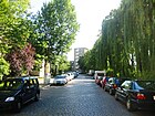
230 | Schleswig , until 1864 duchy under Danish sovereignty, after 1867 part of the Prussian province of Schleswig-Holstein , since 1946 part of the state of Schleswig-Holstein | May 23, 1879 | The previous name was Street 4b . It runs along the south bank of the Spree . At the height of Siegmunds Hof, the Wüllenwebersteig leads to the Hansa-Ufer over the Spree. |
|
| Siegmund's court
( Location ) |
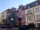
260 | Johann Gottfried Siegmund (1792–1865), Berlin banker and merchant | 1862 | Siegmund had the street laid out as a private road on his property. The public dedication took place on January 23, 1888. At the northern end of the street, the Wullenwebersteg footbridge leads over the Spree to Moabit . This is where Ben Wagin opened his Gallery S on May 3, 1962 at the Siegmunds Hof dormitory. |
|
|
June 17th Street
( Location ) |
100 (in the district) |
after the uprising of June 17, 1953 | Jul 13, 1953 | Only plot No. 100 of Straße des 17. Juni with the Berlin Pavilion, which is now used as a fast-food restaurant, is located in the Hansaviertel. Except for this property, the street runs in the districts of Charlottenburg and Tiergarten . |

|
See also
- List of cultural monuments in Berlin-Hansaviertel
- List of stumbling blocks in Berlin's Hansaviertel
- List of cinemas in Berlin-Hansaviertel
literature
- Walter Kaupert (Ed.): Kaupert's street guide through Berlin 2010 . Kaupert Media, Berlin 2009, ISBN 3-941108-01-8 .
Web links
- Map of Berlin 1: 5000 with district boundaries. Senate Department for Urban Development Berlin, 2009, accessed on March 22, 2010 .
- Street directory Hansaviertel. kaupert media gmbh, accessed on October 30, 2010 .
- Berlin-Brandenburg Statistics Office: List of streets and squares in the Mitte district (as of February 2015); pdf
Individual evidence
- ↑ National map series sheet 4234 from 1932 to 1990 ( Memento of the original from November 16, 2016 in the Internet Archive ) Info: The archive link was inserted automatically and has not yet been checked. Please check the original and archive link according to the instructions and then remove this notice.
- ↑ Apartment building Claudiusstrasse 5
- ↑ Tenement group Flensburger Strasse 5/13
- ^ Kauperts: Händelallee
- ↑ Academy of Arts
- ↑ Holsteiner Ufer ensemble
- ^ Kauperts: Klopstockstrasse
