
Ireland: Difference between revisions
Guliolopez (talk | contribs) m →History: Fix link |
|||
| Line 64: | Line 64: | ||
About 400 species of birds have been recorded in Ireland. Many of these species are migratory. There are arctic birds, which come in the winter, and birds such as the [[Barn Swallow|swallow]], which come from [[Africa]] in the summer to breed. Ireland has a rich marine [[avifauna]], with many large [[seabird]] colonies dotted around its coastline such as those on the [[Saltee Islands]], [[Skellig Michael]] and the [[Copeland Islands]]. Also of note are [[Golden Eagle|golden eagles]], recently reintroduced after decades of extinction. |
About 400 species of birds have been recorded in Ireland. Many of these species are migratory. There are arctic birds, which come in the winter, and birds such as the [[Barn Swallow|swallow]], which come from [[Africa]] in the summer to breed. Ireland has a rich marine [[avifauna]], with many large [[seabird]] colonies dotted around its coastline such as those on the [[Saltee Islands]], [[Skellig Michael]] and the [[Copeland Islands]]. Also of note are [[Golden Eagle|golden eagles]], recently reintroduced after decades of extinction. |
||
There are no snakes |
There are no snakes or reptiles native to Ireland. There are three amphibians, the [[Common Frog|common frog]], the [[Smooth Newt|smooth newt]] and the [[Natterjack Toad|natterjack toad]], of which only the frog is native. Certain marine turtle species appear regularly off the south west coast but do not come ashore.[http://www.turtle.ie/story.htm] |
||
Irish Wildlife Manuals is a series of contract reports relating to the conservation management of habitats and species in Ireland. The volumes are published on an irregular basis by Ireland's National Parks and Wildlife Service.<ref>[http://www.npws.ie/en/PublicationsLiterature/IrishWildlifeManuals Irish Wildlife Manuals] www.npws.ie</ref> |
Irish Wildlife Manuals is a series of contract reports relating to the conservation management of habitats and species in Ireland. The volumes are published on an irregular basis by Ireland's National Parks and Wildlife Service.<ref>[http://www.npws.ie/en/PublicationsLiterature/IrishWildlifeManuals Irish Wildlife Manuals] www.npws.ie</ref> |
||
Revision as of 21:01, 11 April 2007


Ireland (Irish: Éire; Ulster Scots: Airlann) is the third largest island in Europe .[1] It lies to the northwest of Continental Europe with the island of Great Britain lying to the east. Politically it is divided into the Republic of Ireland, a sovereign state occupying five-sixths of the island, and Northern Ireland, a part of the United Kingdom, occupying the northeastern sixth of the island.[2] The name 'Ireland' derives from the name Ériu (in modern Irish, Éire) with the addition of the Germanic word 'land'.
The population of the island is slightly under six million (2006), with 4,239,848 in the Republic of Ireland[3] (1.7 million in Greater Dublin[4]) and about 1.7 million in Northern Ireland[5] (0.6 million in Greater Belfast).[6]
Political geography

The island of Ireland has two distinct jurisdictions:
- Ireland (legally described[7] as the Republic of Ireland ), a sovereign state, covers five sixths of the island. Its capital is Dublin.
- Northern Ireland, part of the United Kingdom of Great Britain and Northern Ireland, covers the remaining sixth. Its capital is Belfast.
For the political history of the island, see History of Ireland.
Traditionally, Ireland is subdivided into four provinces: Connacht, Leinster, Munster and Ulster and, since the 19th Century, 32 counties. Twenty six of the counties are in the Republic of Ireland, and the remaining six (all in Ulster) are in Northern Ireland. Since 1974, the counties in Northern Ireland only have ceremonial status, being replaced by District Councils. Across Ireland, the 32 traditional counties are still used in sports and in some other cultural areas and retain a strong sense of local identity.
All-island institutions
In a number of areas the island operates officially as a single entity - for example, in Gaelic games, rugby and certain other sports, but notably not association football. The major religious bodies, the Roman Catholic Church, the Methodist Church in Ireland, the Church of Ireland and the Presbyterian Church in Ireland, are organised on an all-island basis. Some trade unions are also organised on an all-island basis and associated with the Irish Congress of Trades Unions (ICTU) in Dublin, while others in Northern Ireland are affiliated with the Trades Union Congress (TUC) in the United Kingdom, and some affiliate to both — although such unions may organise in both parts of the island as well as in Britain. The Union of Students in Ireland operates in both jurisdictions, but organises jointly in Northern Ireland with the National Union of Students (the United Kingdom's student body), under the name NUS-USI.
The island also has a shared culture in many other ways. Traditional Irish music, for example, is, broadly speaking, the same on both sides of the border. Irish and Scottish traditional music have many similarities.
Physical geography

A ring of coastal mountains surrounds low central plains. The highest peak is Carrauntuohill (Irish: Corrán Tuathail) in County Kerry, which is 1,041 m (3,414 feet).[8] The island is bisected by the River Shannon, at 386 km (240 miles) the longest river in Ireland.[9] The island's lush vegetation, a product of its mild climate and frequent but soft rainfall, earns it the sobriquet "Emerald Isle". The island's area is 84,412 km²[10] (32,591 square miles).
Ireland's least arable land lies in the south-western and western counties. These areas are largely mountainous and rocky, with beautiful green vistas.
Climate
Overall, Ireland has a mild, but changeable, climate all year. The island experiences few weather extremes. The warmest recorded air temperature was 33.3°C (91.94°F) at Kilkenny Castle, County Kilkenny on 26 June 1887. The coldest air temperature was -19.1°C (-2.38°F) at Markree Castle, County Sligo on 16 January 1881.[11] The climate is typically insular, and as a result of the moderating moist winds which ordinarily prevail from the Atlantic, it is of a temperate nature, avoiding the extremes in temperature of many other global areas sharing similar latitudes.
Precipitation falls throughout the year, but is light overall, particularly in the east. The west, however, tends to be wetter on average and prone to the full force of Atlantic storms, more especially in the late autumn and winter months, which occasionally bring destructive winds and high rainfall totals to these areas, as well as snow and hail. The regions of North Galway and East Mayo have the highest incidents of recorded lightning annually (5 to 10 days per year)[12]. Though not noted for its snowfall, the four provinces of Ireland experience some snowfall each winter, though its intensity varies with Munster in the south recording the least snow with Ulster in the north more prone to snow. Some areas along the south and southwest coasts haven't had any lying snow for the past 16 years, with February 1991 being the last such event.[citation needed]
There are noticeable differences in temperature between coastal and inland areas. Inland areas are warmer in summer, and colder in winter - there are usually around 40 days of below freezing temperatures (0°C) at inland weather stations, but only 10 days at coastal stations. The temperature difference can be seen in very short distances, for example the average daily maximum temperature in July in Omagh is 23°C (73.4°F), while it is only 18°C (64.4°F) in Derry, just 54.1 kilometres (33.6 miles) away. The average daily minimum temperatures in January in these locations also differ, with only -3°C in Omagh and 0°C in Derry. Ireland is sometimes affected by heat waves, most recently 1995, 2003 and 2006.
Average temperatures in the island vary from -4°C (min) to 11°C (max) in January, and 9°C (min) to 23°C (max) in July.
One of the coldest nights for the past few years was recorded on Monday, 5 February 2007 when air temperatures in the capital Dublin dipped to -5ºC (23ºF) with parts of Ulster recording lows of -9ºC (15.8ºF).
Geology
Geologically, the island consists of a number of provinces - in the far west around Galway and Donegal is a medium to high grade metamorphic and igneous complex of Caledonide (Scottish Highland) affinity. Across southeast Ulster and extending southwest to Longford and south to Navan is a province of Ordovician and Silurian rocks with more affinities with the Southern Uplands province of Scotland. Further south, there is an area along the Wexford coast of granite intrusives into more Ordovician and Silurian rocks with a more Welsh affinity.

In the southwest, around Bantry Bay and the mountains of Macgillicuddy's Reeks, is an area of substantially deformed but only lightly metamorphosed Devonian-aged rocks with a more Cornish affinity.
This partial ring of "hard rock" geology is covered by a blanket of Carboniferous limestones over the centre of the country, giving rise to the comparatively fertile and famously "lush" landscape of the country. The west coast district of the Burren around Lisdoonvarna has well developed karst features. Elsewhere, significant stratiform lead-zinc mineralisation is found in the limestones (around Silvermines and Tynagh).
Hydrocarbon exploration is continuing. The first major find was the Kinsale Head gas field off Cork/Cobh by Marathon Oil in the mid-1970s. More recently, in 1999, Enterprise Oil announced the discovery of the Corrib Gas Field. This has increased activity off the west coast in parallel with the "West of Shetland" step-out development from the North Sea hydrocarbon province. Exploration continues, with a frontier well planned north of Donegal for August 2006 and continuing drilling of prospects in the Irish Sea and St Georges Channel.
Flora and fauna
Ireland has fewer animal and plant species than either Britain or mainland Europe because it became an island shortly after the end of the last Ice Age, about 8,000 years ago. Many different habitat types are found in Ireland, including farmland, open woodland, temperate forests, conifer plantations, peat bogs, and various coastal habitats.
Fauna

Only 31 mammal species are native to Ireland, again because it was isolated from Europe by rising sea levels after the Ice Age. Some species, such as the red fox, hedgehog, stoat, and badger are very common, whereas others, like the Irish hare, red deer and pine marten are less common and generally seen only in certain national parks and nature reserves around the island. Some introduced species have become thoroughly naturalised, e.g. rabbits and the brown rat. See List of Irish mammals.
About 400 species of birds have been recorded in Ireland. Many of these species are migratory. There are arctic birds, which come in the winter, and birds such as the swallow, which come from Africa in the summer to breed. Ireland has a rich marine avifauna, with many large seabird colonies dotted around its coastline such as those on the Saltee Islands, Skellig Michael and the Copeland Islands. Also of note are golden eagles, recently reintroduced after decades of extinction.
There are no snakes or reptiles native to Ireland. There are three amphibians, the common frog, the smooth newt and the natterjack toad, of which only the frog is native. Certain marine turtle species appear regularly off the south west coast but do not come ashore.[1]
Irish Wildlife Manuals is a series of contract reports relating to the conservation management of habitats and species in Ireland. The volumes are published on an irregular basis by Ireland's National Parks and Wildlife Service.[13]
Ireland has also been invaded by other animals from abroad such as Calyptraea chinensis a Gastropod. It was first recorded in Clew Bay in 1963. During 1980 - 81 a total of 121 dredge hauls were carried out in Inishlyre Harbour and hundreds of the gastropods were found. The first records of the species in Irish waters may have been in the 19th Century. This point is discussed in some detail by Minchin et al.[14]
Flora
- See also Category:Flora of Ireland.
Ireland is home to hundreds of plant species, some of them unique to the island, others have been introduced, either artificially or otherwise.
History
| History of Ireland |
|---|
 |
|
|

Ireland was mostly ice-covered and joined by land to Britain and continental Europe during the last ice age. It has been inhabited for about 9,000 years. Mesolithic stone age inhabitants arrived some time after 8000 BC. Agriculture arrived with the Neolithic circa 4000 to 4500 BC. Sheep, goats, cattle and cereals were imported from southwest continental Europe. At the Céide Fields in County Mayo, an extensive Neolithic field system - arguably the oldest in the world - has been preserved beneath a blanket of peat. Consisting of small fields separated from one another by dry-stone walls, the Céide Fields were farmed for several centuries between 3500 and 3000 BC. Wheat and barley were the principal crops cultivated. The Bronze Age, which began around 2500 BC, saw the production of elaborate gold and bronze ornaments and weapons. The Iron Age in Ireland was supposedly associated with people known as Celts. They are traditionally thought to have colonised Ireland in a series of waves between the 8th and 1st centuries BC, with the Gael, the last wave of Celts, conquering the island and dividing it into five or more kingdoms. Many scholars, however, now favour a view that emphasises cultural diffusion from overseas over significant colonisation.[2] [3] [4] The Romans referred to Ireland as Hibernia[15] and/or Scotia[16]. Ptolemy in AD 100 records Ireland's geography and tribes.[17] Native accounts are confined to Irish poetry, myth, and archaeology. The exact relationship between Rome and the tribes of Hibernia is unclear; the only references are a few Roman writings.
According to early medieval chronicles, in 431, Bishop Palladius arrived in Ireland on a mission from Pope Celestine to minister to the Irish "already believing in Christ." The same chronicles record that Saint Patrick, Ireland's patron saint, arrived in 432. There is continued debate over the missions of Palladius and Patrick, but the general consensus is that they both existed and that 7th century annalists may have mis-attributed some of their activities to each other. Palladius most likely went to Leinster, while Patrick is believed to have gone to Ulster, where he probably spent time in captivity as a young man.
The druid tradition collapsed in the face of the spread of the new religion. Irish Christian scholars excelled in the study of Latin and Greek learning and Christian theology in the monasteries that flourished, preserving Latin and Greek learning during the Early Middle Ages. The arts of manuscript illumination, metalworking, and sculpture flourished and produced such treasures as the Book of Kells, ornate jewellery, and the many carved stone crosses that dot the island. From the 9th century, waves of Viking raiders plundered monasteries and towns, adding to a pattern of endemic raiding and warfare. Eventually Vikings settled in Ireland, and established many towns, including the modern day cities of Dublin, Cork, Limerick and Waterford.
In 1171, King Henry II of England invaded Ireland, using the 1155 Bull Laudabiliter issued to him by then English Pope Adrian IV to claim sovereignty over the island, and forced the Cambro-Norman warlords and some of the Gaelic Irish kings to accept him as their overlord. From the 13th century, English law began to be introduced. By the late thirteenth century the Norman-Irish had established the feudal system throughout most of lowland Ireland. Their settlement was characterised by the establishment of baronies, manors, towns and large land-owning monastic communities. The towns of Dublin, Cork, Wexford, Waterford, Limerick, Galway, New Ross, Kilkenny, Carlingford, Drogheda, Sligo, Athenry, Arklow, Buttevant, Carlow, Carrick-on-Suir, Cashel, Clonmel, Dundalk, Enniscorthy, Kildare, Kinsale, Mullingar, Naas, Navan, Nenagh, Thurles, Wicklow, Trim and Youghal were all under Norman-Irish control. In the fourteenth century the English settlement went into a period of decline and large areas, for example Sligo, were re-occupied by Gaelic septs. From the late fifteenth century English rule was once again expanded, first through the efforts of the Earls of Kildare and Ormond then through the activities of the Tudor State under Henry VIII and Mary and Elizabeth. This resulted in the complete conquest of Ireland by 1603 and the final collapse of the Gaelic social and political superstructure at the end of the 17th century, as a result of English and Scottish Protestant colonisation in the Plantations of Ireland, and the disastrous Wars of the Three Kingdoms and the Williamite War in Ireland. After the Irish Rebellion of 1641, Irish Catholics were barred from voting or attending the Irish Parliament. The new English Protestant ruling class was known as the Protestant Ascendancy. Towards the end of the 18th century the entirely Protestant Irish Parliament attained a greater degree of independence from the British Parliament than it had previously held. Under the Penal Laws no Irish Catholic could sit in the Parliament of Ireland, even though some 90% of Ireland's population was native Irish Catholic when the first of these bans was introduced in 1691. This ban was followed by others in 1703 and 1709 as part of a comprehensive system disadvantaging the Catholic community, and to a lesser extent Protestant dissenters.[18] In 1798, many members of this dissenter tradition made common cause with Catholics in a rebellion inspired and led by the Society of United Irishmen. It was staged with the aim of creating a fully independent Ireland as a state with a republican constitution. Despite assistance from France the Irish Rebellion of 1798 was put down by British forces.
In 1800, the British and subsequently the unrepresentative Irish Parliament passed the Act of Union which, in 1801, merged the Kingdom of Ireland and the Kingdom of Great Britain to create the United Kingdom of Great Britain and Ireland. The passage of the Act in the Irish Parliament was achieved with substantial majorities, achieved in part according to contemporary documents through bribery, namely the awarding of peerages and honours to critics to get their votes.[19] Thus, Ireland became part of an extended United Kingdom, ruled directly by the UK Parliament in London. The 19th century saw the Great Famine of the 1840s, during which one million Irish people died and over a million emigrated. Mass emigration became entrenched as a result of the famine and the population continued to decline until late in the 20th century. The pre-famine peak was over 8 million recorded in the 1841 census. The population has never returned to this level.
The 19th and early 20th century saw the rise of Irish Nationalism especially among the Catholic population. Daniel O'Connell led a successful non-violent campaign for Catholic Emancipation. A subsequent campaign for Repeal of the Act of Union failed. Later in the century Charles Stewart Parnell and others campaigned for self government within the Union or "Home Rule". A resurgence of militant separatism came to a head with the Easter Rising of 1916, and the subsequent Irish War of Independence. In 1921, a treaty was concluded between the British Government and the leaders of the Irish Republic. The Treaty recognised the two-state solution created in the Government of Ireland Act 1920. Northern Ireland was presumed to form a home rule state within the new Irish Free State unless it opted out. Northern Ireland had a majority Protestant population which feared becoming a minority in a majority Catholic state. Not unexpectedly it opted out of the new state and chose instead to remain part of the United Kingdom. A Boundary Commission was set up to decide on the boundaries between the two Irish states, though it was subsequently abandoned after it recommended only minor adjustments to the border. Disagreements over some provisions of the treaty led to a split in the Nationalist movement and subsequently to the Civil War. The civil war ended in 1923 with the defeat of the Anti-treaty forces.
History since partition
Irish Independence: The Irish Free State, Éire, Ireland
The Anglo-Irish Treaty was narrowly ratified by the Dáil in December 1921 but was rejected by a large minority, resulting in the Irish Civil War which lasted until 1923. In 1922, in the middle of this civil war, the Irish Free State came into being. For its first years the new state was governed by the victors of the Civil War. However, in the 1930s Fianna Fáil, the party of the opponents of the treaty, were elected into government. The party introduced a new constitution in 1937 which renamed the state "Éire or in the English language, Ireland" (article 4 of the Constitution).
The state was neutral during World War II which was known internally as The Emergency, but offered some assistance to the Allies, especially in Northern Ireland. However it is estimated[20] that around 50,000 volunteers from Éire/Ireland fought in the British armed forces during the second World War. In 1949, the Irish state declared itself to be a republic and that henceforth it should be described additionally as the Republic of Ireland. The Republic was plagued by poverty and emigration until the mid-1970s. The 1990s saw the beginning of unprecedented economic success, in a phenomenon known as the "Celtic Tiger". By the early 2000s it had become one of the richest countries (in terms of GDP per capita) in the European Union, moving from being a net recipient of the budget to becoming a net contributor during the next Budget round (2007-13), and from a country of net emigration to one of net immigration. In October 2006, there were talks between Ireland and the U.S. to negotiate a new immigration policy between the two countries, in response to the growth of the Irish economy and desire of many U.S. citizens who sought to move to Ireland for work.[21]
Northern Ireland
Northern Ireland was created as an administrative division of the United Kingdom by the Government of Ireland Act 1920. From 1921 until 1972, Northern Ireland was granted limited self-government within the United Kingdom, with its own parliament and prime minister.
In the first half of the 20th Century, Northern Ireland was largely spared the strife of the Civil War in the south, but there were sporadic episodes of inter-communal violence between Catholics and Protestants during the decades that followed partition. Although the Irish Free State was neutral during World War II, Northern Ireland as part of the United Kingdom was not, and became deeply involved in the British war effort (albeit without military conscription as it was introduced in Great Britain). Belfast suffered a bombing raid from the German Luftwaffe in 1941 causing one of the greatest losses of life in a single incident of the Battle of Britain.
In elections to the 1921-1972 regional government, the Protestant and Catholic communities in Northern Ireland each voted almost entirely along sectarian lines, meaning that the government of Northern Ireland (elected by "first past the post" from 1929) was always controlled by the Ulster Unionist Party. Over time, the minority Catholic community felt increasingly alienated by the regional government in Northern Ireland, with further disaffection fuelled by incidents such as gerrymandering of the local council in Londonderry in 1967, and the discrimination of Catholics in housing and employment[22].
In the 1960s Nationalist grievances at unionist discrimination within the state eventually led to large civil rights protests, which the government suppressed heavy-handedly, most notably on "Bloody Sunday". It was during this period of civil unrest that the paramilitary Provisional IRA, who favoured the creation of a united Ireland, began its campaign against what it called the "British occupation of the six counties". Other groups, legal and illegal on the unionist side, and illegal on the nationalist side, began to participate in the violence and the period known as the "Troubles" began, resulting in approximately 3000 deaths over the subsequent three decades. Owing to the civil unrest as "The Troubles" erupted, the British government suspended home rule in 1972 and imposed direct rule from Westminster.
Attempts were made to end "The Troubles", such as the Sunningdale Agreement of 1974 and Anglo-Irish Agreement of 1985, but ultimately were failures mainly due to the continuing level of violence. More recently in 1998, following a Provisional IRA cease fire and multi-party talks, the Good Friday Agreement was concluded and ratified by referendum in both Northern Ireland and the Republic of Ireland. This agreement attempts to restore self-government to Northern Ireland on the basis of power sharing between the two communities. Violence has greatly decreased since the signing of the accord. The power-sharing assembly has only operated for brief periods and is currently suspended.
In 2001 the police force in Northern Ireland, the Royal Ulster Constabulary, was replaced by the Police Service of Northern Ireland.
On 28 July 2005, the Provisional IRA announced the end of its armed campaign and on 25 September 2005 international weapons inspectors supervised what they currently regard as the full decommissioning of the Provisional IRA's weapons.[23]
Sport
Gaelic football, hurling are the most popular sports in Ireland.[24] Hurling and Gaelic football, along with Camogie, Ladies' Gaelic football, handball and rounders, make up the national sports of Ireland, collectively known as Gaelic Games. All Gaelic games are governed by the Gaelic Athletic Association (GAA), with the exception of Ladies' Gaelic Football, which is governed by a separate organisation. The GAA is organised on an all-Ireland basis with all 32 counties competing; traditionally, counties first compete within their province, in the provincial championships, and the winners then compete in the All-Ireland senior hurling or football championships. The headquarters of the GAA (and the main stadium) is located at the 82,500[25] capacity Croke Park in north Dublin. Major GAA games are played there, including the semi-finals and finals of the All-Ireland championships. During the redevelopment of the Lansdowne Road stadium, International Rugby is being played there, with huge success. All GAA players, even at the highest level, are amateurs and receive no wages.
The Irish rugby team includes players from north and south, and the Irish Rugby Football Union governs the sport on both sides of the border. Consequently in international rugby, the Ireland team represents the whole island. The same is true of cricket, golf, tennis and hockey. The Irish rugby team have played in every Rugby World Cup, making the quarter-finals at four of them. Ireland also hosted games during the 1991 Rugby World Cup (including a quarter and semi-final) and the 1999 Rugby World Cup (including a quarter-final). There are also four professional provincial sides that contest the Celtic League and European Heineken Cup. Irish rugby has become increasingly competitive at both the international and provincial levels since the sport went professional in 1994. During that time, Ulster (1999) and Munster (2006) have both won the European Cup.
The Irish Football Association (IFA) was originally the governing body for football (soccer) throughout the island. Football has been played in Ireland since the 1860s (Cliftonville F.C. Belfast being the oldest club on the island), but remained a minority sport outside of Ulster until the 1880s. However, some clubs based outside Belfast felt that the IFA largely favoured Ulster-based, Protestant clubs in such matters as selection for the national team. Following an incident in which, despite an earlier promise, the IFA moved an Irish Cup final replay from Dublin to Belfast, the clubs based in the Free State set up a new Football Association of the Irish Free State (FAIFS) - now known as the Football Association of Ireland (FAI) - in 1921.
Despite the new organisation being initially blacklisted by the Home Nations' football associations, the Association was recognised by FIFA in 1923 and organised its first international fixture in 1926 (against Italy in Turin). However, both the IFA and FAI continued to select their teams from the whole of Ireland, with some players earning international caps for matches with both teams. Both also referred to their respective teams as "Ireland". It was not until 1950 that FIFA directed the Associations to only select players from within their respective territories, and in 1953 FIFA further clarified that the FAI's team was to be known only as "Republic of Ireland", and the IFA's team only as "Northern Ireland" (with certain exceptions).
Northern Ireland qualified for the FIFA World Cup finals in 1958 (where they made it to the quarter-finals), 1982 and 1986. The Republic of Ireland made it to the World Cup in 1990 (where they made it to the quarter-finals), 1994 and 2002. The IFA still retains All-Ireland cups and trophies at its Belfast HQ.
Greyhound racing and horse racing are both popular in Ireland: greyhound stadiums are well attended and there are frequent horse race meetings. The Republic is noted for the breeding and training of race horses and is also a large exporter of racing dogs. The horse racing sector is largely concentrated in the central east of the Republic.
Boxing is also an all-island sport governed by the Irish Amateur Boxing Association.
The west-coast of Ireland, and Donegal Bay in particular has some superb surfing beaches; being fully exposed to the fury of the Atlantic Ocean, beaches such as Rossnowlagh and Bundoran catch any swell going. Surfing in Donegal Bay is big business, as it attracts surfers from all over Western Europe aiming to catch Europe's largest waves. Since Donegal Bay is shaped like a funnel (like the Bristol Channel), the West/South-West winds coming off the Atlantic get funnelled and trapped into a generally short area, therefore increasing the speed and size of the incoming rollers, and creating, especially in winter, some truly fantastic surf. Donegal Bay also boasts good facilities and excellent water quality. In recent years, Bundoran has hosted European championship surfing. The south-west of Ireland, such as the Dingle Peninsula also boasts excellent surf beaches, although Donegal Bay is usually first choice for Ireland's surfing community.
With thousands of lakes, over 14,000km of fish bearing rivers, and over 3,700km of coastline, Ireland is a popular angling destination in Europe. The temperate Irish climate is suited to sport angling, with moderate summers, mild winters and adequate rainfall throughout the year. While salmon and trout fishing remain popular with anglers, salmon fishing in particular received a boost in 2006 with the closing of the salmon driftnet fishery. Coarse fishing (for bream, roach, rudd and hybrids) continues to increase its profile. Sea angling is developed with many beaches mapped and signposted. In recent times the range of sea angling species has increased; most notably blue fin tuna, golden grey mullet and gilthead bream are now regularly caught from Irish shores. [26]
Golf is a popular sport in Ireland and golf tourism is a major industry. The 2006 Ryder Cup was held at The K Club in County Kildare.[27]
In 2007, the Irish National Cricket team were among the Associate nations which qualified for the 2007 Cricket World Cup. The Irish team proceeded to defeat (and knock out) Pakistan and place second in their pool, earning a place in the Super 8 section of the competition.
- See also: List of Irish sports people
Places of interest
Some interesting places on the island of Ireland include the following:
- Achill Island, Co. Mayo
- The Aran Islands, Co. Galway
- Blarney Castle, Co. Cork
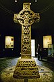
- The Book of Kells, Trinity College Dublin
- Bunratty Castle, Co. Clare
- The Burren, Co. Clare
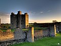
- Cahir Castle nearby Cahir, Co. Tipperary
- Céide Fields, Co. Mayo
- Clonmacnoise Co. Offaly
- Croagh Patrick, Co. Mayo
- Cliffs of Moher, Co. Clare
- Walled City of Derry
- Dublin Zoo, Dublin
- Emain Macha (also known as Navan Fort), Co. Armagh
- Fore Abbey Co. Westmeath
- The Giant's Causeway, Co. Antrim
- Glendalough, Co. Wicklow
- The Glens of Antrim, Co. Antrim
- Hill of Tara, Co. Meath
- The Botanic Gardens, Dublin
- The Japanese Gardens, Co. Kildare
- Jerpoint Abbey, Co.Kilkenny
- Knock Shrine, Co. Mayo
- Lake County Westmeath
- The Mourne Mountains, Co. Down
- Mount Errigal, Co. Donegal
- Newgrange, Co. Meath
- Rathlin Island, Co. Antrim
- The Rock of Cashel, Co. Tipperary
- Slieve League cliffs, Co.Donegal
- Trim Castle, Co. Meath
- Trinity College, Dublin
- Tory Island, Co. Donegal
- The Wicklow Way, Co. Wicklow
Gallery of images
-
 The Aran Islands, Co. Galway
 -
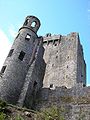 Blarney Castle, Co. Cork
 -
 A Dolmen in The Burren, Co. Clare
 -
 Cahir Castle nearby Cahir, Co. Tipperary
 -
 Clonmacnoise Co. Offaly
 -
 Cliffs of Moher, Co. Clare
 -
-
 The Ha'penny Bridge, Dublin
 -
 The town of the tribes, Galway City
 -
 The Giant's Causeway, Co. Antrim
 -
 Glendalough, Co. Wicklow
 -
 The Mourne Mountains, Co. Down
 -
 Rathlin Island, Co. Antrim
 -
 The Rock of Cashel, Co. Tipperary
 -
 Christ's Saddle, Skellig Michael, Co. Kerry
 -
 Slieve League cliffs, Co.Donegal
 -
 Trim Castle, Co. Meath
 -
 Trinity College, Dublin
 -
 Tory Island, Co. Donegal
 -
 The Wicklow Way, Co. Wicklow


Culture
Template:IrishNobel Template:IrishArts
Literature and the arts
For an island of relatively small population, Ireland has made a disproportionately large contribution to world literature in all its branches, mainly in English. Poetry in Irish represents the oldest vernacular poetry in Europe with the earliest examples dating from the 6th century; Jonathan Swift, still often called the foremost satirist in the English language, was wildly popular in his day (Gulliver's Travels, A Modest Proposal etc.) and remains so in modern times amongst both children and adults. In more recent times, Ireland has produced four winners of the Nobel Prize for Literature: George Bernard Shaw, William Butler Yeats, Samuel Beckett and Seamus Heaney. Although not a Nobel Prize winner, James Joyce is widely considered one of the most, if not the most, significant writers of the 20th century. His 1922 novel Ulysses is cited as the greatest English-language novel of the 20th century and his life is celebrated annually on June 16 in Dublin as the Bloomsday celebrations.[28]
The early history of Irish visual art is generally considered to begin with early carvings found at sites such as Newgrange and is traced through Bronze age artifacts, particularly ornamental gold objects, and the religious carvings and illuminated manuscripts of the mediæval period. During the course of the 19th and 20th centuries, a strong indigenous tradition of painting emerged, including such figures as John Butler Yeats, William Orpen, Jack Yeats and Louis le Brocquy.
Music and dance
The Irish tradition of folk music and dance is also widely known. In the middle years of the 20th century, as Irish society was attempting to modernise, traditional music tended to fall out of favour, especially in urban areas. During the 1960s, and inspired by the American folk music movement, there was a revival of interest in the Irish tradition. This revival was led by such groups as The Dubliners, The Chieftains, the Clancy Brothers, Sweeney's Men, and individuals like Seán Ó Riada. Irish and Scottish traditional music are similar.
Before too long, groups and musicians including Horslips, Van Morrison, and even Thin Lizzy were incorporating elements of traditional music into a rock idiom to form a unique new sound. During the 1970s and 1980s, the distinction between traditional and rock musicians became blurred, with many individuals regularly crossing over between these styles of playing as a matter of course. This trend can be seen more recently in the work of artists like U2, Enya, Moya Brennan, The Saw Doctors, Damien Rice, The Corrs, Sinéad O'Connor, Clannad, The Cranberries, Rory Gallagher, Westlife, B*witched, BoyZone, Gilbert O'Sullivan, Black 47, Wolfe Tones, Ash and The Pogues.
Of note also is a growing genre of Irish music fused with heavy Heavy Metal called Celtic Metal / Celtic Battle Metal (also sometimes called Folk Metal). Geasa, Primordial, Waylander, and Cruachan are examples of bands who perform this style of music.
Irish music has shown an immense inflation of popularity with many attempting to return to their roots. Some contemporary music groups stick closer to a "traditional" sound, including Altan, Gaelic Storm, Lúnasa, and Solas. Others incorporate multiple cultures in a fusion of style, such as Afro Celt Sound System.
The Republic has done well in the Eurovision Song Contest, being the most successful country in the competition, with seven wins.[29]
Demographics

Ireland has been inhabited for at least 9,000 years, although little is known about the paleolithic or neolithic inhabitants of the island. Early historical and genealogical records note the existence of dozens of different peoples (Cruithne, Attacotti, Conmaicne, Eóganachta, Érainn, Soghain, to name but a few).
Over the last 1,000 years, there have been influences by the Vikings, who founded several ports, including Dublin, and Normans, with some admixture to the gene pool.
Ireland's largest religious group is the Roman Catholic Church (about 70% for the entire island, and over 90% for the Republic), and most of the rest of the population adhere to one of the various Protestant denominations. The largest is the Anglican Church of Ireland. The Irish Muslim community is growing, mostly through increased immigration (see Islam in Ireland). The island also has a small Jewish community (See History of the Jews in Ireland), although this has declined somewhat in recent years. Since joining the EU in 2004, Polish people have been the largest source of immigrants (over 180,000) from Central Europe, followed by other migrants from Lithuania, the Czech Republic and Latvia.
It is Ireland's high standard of living, high wage economy and EU membership that attract many migrants from the newest of the European Union countries: Ireland has had a significant number of Romanian immigrants since the 1990s. In recent years, mainland Chinese have been migrating to Ireland in significant numbers. Nigerians, along with people from other African countries have accounted for a large proportion of the non-European Union migrants to Ireland. After Dublin (1,661,185 in Greater Dublin), Ireland's largest cities are Belfast (579,276 in Greater Belfast), Cork (380,000 in Metropolitan Cork), Derry (94,329 in Derry Urban Area), Limerick (93,321 incl. suburbs), Galway (71,983), Lisburn (71,465), Waterford (45,775 excluding near suburbs), Newry (27,433), Kilkenny (23,967 incl. suburbs) and Armagh (14,590).
Transport
Air
The four most important international airports in Ireland are Dublin Airport, Belfast International Airport (Aldergrove), Cork International Airport and Shannon Airport. All provide extensive services to Great Britain and continental Europe, while Belfast, Dublin and Shannon also offer a range of transatlantic services. Shannon was once an important stopover on the trans-Atlantic route for refuelling operations and, with Dublin, is still one of the Republic's two designated transatlantic gateway airports.
There are several smaller regional airports: George Best Belfast City Airport, Derry Airport, Galway Airport, Kerry Airport (Farranfore), Ireland West Airport (Knock), Sligo Airport, Waterford Airport, and Donegal Airport (Carrickfinn). Scheduled services from these regional points are mostly limited to Ireland and Great Britain.
Rail

The rail network in Ireland was developed by various private companies, some of which received (British) Government funding in the late 19th century. The network reached its greatest extent by 1920. The broad gauge of 5 foot 3 inches (1,600 mm) was eventually settled upon throughout the island, although there were narrow gauge (3 ft / 91.4 cm) railways also.
Long distance passenger trains in the Republic are managed by Iarnród Éireann (Irish Rail) and connect most major towns and cities across the country. In Dublin, two local rail networks provide transportation in the city and its immediate vicinity. The Dublin Area Rapid Transit (DART, pictured right) links the city centre with surrounding suburbs. Additionally, a new light rail system named Luas, opened in 2004, transports passengers within city limits. Several more Luas lines are planned as well as an eventual upgrade to metro. The scheme is being run by Connex under franchise from the RPA. Under the Irish government's Transport 21 plan, reopening the Navan-Clonsilla rail link, the Cork Midleton rail link and the Western Rail Corridor are amongst plans for Ireland's railways.
In Northern Ireland, all rail services are provided by Northern Ireland Railways, part of Translink. Services in Northern Ireland are sparse in comparison to the rest of the UK. A large railway network was severely curtailed in the 1950s and 1960s (in particular by the Ulster Transport Authority). The current situation includes suburban services to Larne, Newry and Bangor, as well as services to Derry. There is also a branch from Coleraine to Portrush.
Ireland also has one of the largest freight railways in Europe, operated by Bord na Móna. This company has a narrow gauge railway of 1,200 miles (1,930 km).
Roads

Motorists must drive on the left in Ireland, as in Great Britain, Australia, New Zealand, India, Hong Kong and Japan. Unfortunately, tourists driving on the wrong side of the road cause serious accidents every year.[30] The island of Ireland has an extensive road network, with a (limited) motorway network fanning out from Belfast and Dublin. Historically, land owners developed most roads and later Turnpike Trusts collected tolls so that as early as 1800 Ireland had a 10,000 mile (16,100 km) road network.[31]
The year 1815 marked the inauguration of the first horsecar service from Clonmel to Thurles and Limerick. Now, the main bus companies are Bus Éireann in the Republic and Ulsterbus, a division of Translink, in Northern Ireland, both of which offer extensive passenger service in all parts of the island. Dublin Bus specifically serves the greater Dublin area, and a further division of Translink called Metro, operates services within the greater Belfast area. Translink also operate Ulsterbus Foyle in the Derry Urban Area.
Energy network
For much of their existence electricity networks in the Republic of Ireland and Northern Ireland were entirely separate. Both networks were designed and constructed independently, but are now connected with three interlinks and also connected by Northern Ireland Electricity (NIE) through Great Britain to mainland Europe. The Electricity Supply Board (ESB) in the Republic drove a rural electrification programme in the 1940s until the 1970s.
The natural gas network is also now all-island, with a connection from Antrim to Scotland. Most of Ireland's gas comes from the Kinsale field. The Corrib Gas Field in Mayo has yet to come online, and is facing some localised opposition over the controversial decision to refine the gas onshore.

Ireland, north and south has faced difficulties in providing continuous power at peak load. The situation in Northern Ireland is complicated by the issue of private companies not supplying NIE with enough power, while in the Republic, the ESB has failed to modernise its power stations. In the latter case, availability of power plants has averaged 66% recently, one of the worst such figures in Western Europe.
There have been recent efforts in Ireland to use renewable energy such as wind energy with large wind farms being constructed in coastal counties such as Donegal, Mayo and Antrim. Recently what will be the world's largest offshore wind farm is being developed at Arklow Bank off the coast of Wicklow. It is estimated to generate 10% of Ireland's energy needs when it is complete. These constructions have in some cases been delayed by opposition from locals, most recently on Achill Island, some of whom consider the wind turbines to be unsightly. Another issue in the Republic of Ireland is the failure of the aging network to cope with the varying availability of power from such installations. Turlough Hill is the only energy storage mechanism in Ireland.[32]
Economy
In the 1920s and early 1930s, the Republic of Ireland pursued a low-tax, low-spending policy under the government of W.T. Cosgrave and Cumann na nGaedheal, focused mainly on agriculture, livestock farming being of primary importance. The only notable expense the government went to during this time was for the rural electrification scheme, which saw £5,000,000 being spent (a colossal sum of money) constructing the Ardnacrusha hydroelectric power station on the river Shannon. During this period, 97% of trade was done with Britain.

In 1932, Eamonn De Valera's Fianna Fáil party defeated Cosgrave's party with a solid majority. De Valera focused on agriculture again. Fianna Fáil abandoned free trade and put up protective tariffs on almost all industries, spurring a long economic war with the United Kingdom, who taxed imports from Ireland in retaliation. The economic war resulted in widespread hardship for Irish farming. It ended in 1938, when control of several naval ports in the country was transferred to the free state, an important factor in Ireland's neutrality during World War II.[citation needed].
Fianna Fáil remained in power until 1948, when the first coalition government ousted them from power. To the present day, the two largest parties, Fianna Fáil and Fine Gael, have dominated the scene, Fine Gael traditionally being pro-business, low tax and low spending, although with Fianna Fáil's alliance with the Progressive Democrats, it has modified its standpoint to be more pro-business.
Northern Ireland experienced a boom during World War II and received British support thereafter. In comparison, the Republic did not experience a WWII boom and its situation declined relative to Northern Ireland. Overall, until the early 1960s, population and economic decline plagued Ireland. In the early 1960s, Sean Lemass became Taioseach and embarked on a programme of economic reform. For the first time in Ireland, second level education was made free and compulsory. The Republic abandoned protectionism and applied to join the European Economic Community, along with Britain, gaining entry in 1973.
Though the 1960s and early 1970s saw a boom and, for the first time since 1842, a rise in population, the late 1970s and the 1980s saw a long recession. There was mass unemployment, with many people with tertiary education working minimum wage jobs or being out of work. Emigration returned to 50,000 per year.
This situation changed dramatically in the early 1990s as the result of a second, more prodigious, economic boom, known as "The Celtic Tiger" (as in "tiger economy"). In July of 2006, a survey undertaken by Bank of Ireland Private Banking showed that, of the top 8 leading OECD nations, the Republic of Ireland was ranked the second wealthiest per capita, behind Japan and ahead of the UK (which includes Northern Ireland), US, Italy, France, Germany and Spain, showing an average wealth per head of nearly €150,000 (~ $190,000)[citation needed].
See also
Notes
- ^ Great Britain being the largest and Iceland being the second largest.
- ^ "Population growth rate highest in EU" in RTÉ Business (19 July 2006) accessed 6 February 2007
- ^ "Census 2006 Preliminary Report" www.cso.ie
- ^ "Population of the Greater Dublin Area to reach 2 million by 2021" www.cso.ie
- ^ Home Population and Components of Change, 2004 estimates Demography and Methodology Branch, NISRA - Excel file
- ^ "Background Information on Northern Ireland Society: Population and Vital Statistics" from CAIN Web Service. Combined population of Belfast, Castlereagh, Carrickfergus and Lisburn. Accessed 6 February 2007
- ^ Article 2, The Republic of Ireland Act, 1948, Government of Ireland
- ^ CIA World Factbook
- ^ River Shannon - Shannon Development Website www.shannonregiontourism.ie
- ^ Land and People www.irlgov.ie
- ^ Website of Met Éireann - Temperature in Ireland www.met.ie
- ^ Website of Met Éireann - Rainfall in Ireland www.met.ie
- ^ Irish Wildlife Manuals www.npws.ie
- ^ Minchin, D., McGrath, D. and Duggan, C.B. 1987. Calyptraea chinensis (Mollusca, Gastropoda) on the west coast of Ireland: a case of accidental introduction? J.Conch., Lond. 32(5): 297 - 302
- ^ Romans and Ireland www.irishclans.com
- ^ http://www.bartleby.com/65/sc/Scotia.html The Columbia Encyclopedia, Sixth Edition. 2001-05
- ^ The Geography of Ptolemy www.roman-Britain.org
- ^ Laws in Ireland for the Suppression of Popery at University of Minnesota Law School
- ^ Alan J. Ward, The Irish Constitutional Tradition p.28.
- ^ BBC History of Northern Ireland
- ^ Ireland considering immigration deal with U.S., Reuters, October 25, 2006
- ^ Professor John H. Whyte paper on discrimination in Northern Ireland
- ^ http://cain.ulst.ac.uk/events/peace/decommission/iicd190106.pdf
- ^ Irish Government Website Culture and Sport Information http://www.irlgov.ie
- ^ "CROKE PARK REDEVELOPMENT". Retrieved 2007-01-12.
- ^ Fishing in Ireland- Central Fisheries Board www.cfb.ie
- ^ 2006 Ryder Cup Official Site http://www.pga.com
- ^ The James Joyce Centre - Bloomsday in Dublin www.jamesjoyce.ie
- ^ Ireland in shock Eurovision exit BBC Online, 19 May, 2005
- ^ U.S. Department of State, Consular Information Sheet Ireland, TRAFFIC SAFETY AND ROAD CONDITIONS travel.state.gov
- ^ THE HISTORY OF TRANSPORT IN IRELAND PART 1 www.cie.ie
- ^ Options For Future Renewable Energy Policy, Targets And Programmes Issued By Department Of Communications, Marine And Natural Resources www.hibernianwindpower.ie (27 February 2004)
References
- Fairley, J.S. 1975. An Irish Beast Book. A Natural History of Ireland's Furred Wildlife. Blackstaff Press, Belfast. ISBN 85640 090 4
- Hardy, F.G. & Guiry, M.D. 2006. A Check-list and Atlas of the Seaweeds of Britain and Ireland. Revised Edition pp. x + 435. London: British Phycological Society. Available from Koeltz Books, Germany. ISBN 3-906166-35-X
- Knowles, M.C. 1929. The Lichens of Ireland. Proceedings of the Royal Irish Academy. Vol. 38 :179 - 434.
- Morton, O. 1994. Marine Algae of Northern Ireland. Ulster Museum. ISBN 0 900761 28 8
- Morton, O. 2003. The marine algae macroalgae of County Donegal, Ireland. Bull. Ir. biogeog. Soc. 27:3 - 164.
- Seaward, M.R.D. 1984. Census Catalogue of Irish Lichens. Glasra 8: 1 - 32.
External links
- Wikitravel guide to the Republic of Ireland
- Wikitravel guide to Northern Ireland
- History of Ireland: Primary Documents
- Encyclopaedia Britannica's Ireland country page
- Map of Ireland
- Public domain photos of Ireland
- Ireland Facts Photo and information gallery from AOL Research & Learn
