Bedford, Virginia
| Bedford | ||
|---|---|---|
| Nickname : Bedrock | ||
 Bedford County Courthouse in Bedford |
||
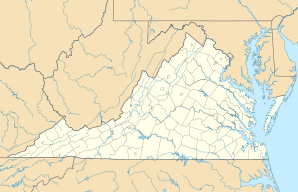
| Location in Virginia | ||
|
|
||
| Basic data | ||
| Foundation : | 1782 | |
| State : | United States | |
| State : | Virginia | |
| Coordinates : | 37 ° 20 ′ N , 79 ° 31 ′ W | |
| Time zone : | Eastern ( UTC − 5 / −4 ) | |
| Residents : | 6,222 (as of 2010) | |
| Population density : | 349.6 inhabitants per km 2 | |
| Area : | 17.9 km 2 (approx. 7 mi 2 ) of which 17.8 km 2 (approx. 7 mi 2 ) is land |
|
| Height : | 306 m | |
| Postal code : | 24523 | |
| Area code : | +1 540 | |
| FIPS : | 51-05544 | |
| GNIS ID : | 1498450 | |
| Website : | www.bedfordva.gov | |
| Mayor : | Skip Tharp | |
Bedford is an independent city in the US state Virginia with 6222 inhabitants (2010). It is the seat of the county seat of Bedford County .
history
The population of Bedford in 1944 was about 3,200. 19 soldiers died on D-Day , 3 more soldiers died in the following days in combat in Normandy . When it landed in Normandy, Bedford suffered the highest casualties in terms of population of any American community. That is why the National D-Day Memorial was inaugurated on June 6, 2001 in Bedford in the presence of the then US President George W. Bush .
geography
The urban area covers an area of 17.9 km², of which 17.8 km² is land and 0.1 km² is water. The center is at an altitude of 306 m.
Attractions
Web links
Commons : Bedford (Virginia) - Collection of images, videos, and audio files
- Official website of the City of Bedford ( English )
- National D-Day Memorial (English)
Individual evidence
- ↑ Ronald D. Gerste, Washington: Proud and melancholy looks at the C-47. In: nzz.ch. June 5, 2014, accessed October 14, 2018 .
- ↑ Newspaper article about the death of the last survivor of the "Bedford Boys" (English)
