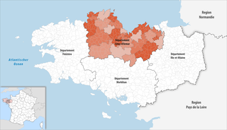
Côtes-d'Armor department
| Cotes-d'Armor | |
|---|---|
| region | Brittany |
| prefecture | Saint-Brieuc |
| Sub-prefecture (s) |
Dinan Guingamp Lannion |
| Residents | 598,814 (Jan. 1, 2017) |
| Population density | 87 inhabitants per km² |
| surface | 6,878.32 km² |
| Arrondissements | 4th |
| Community associations | 11 |
| Cantons | 27 |
| Communities | 348 |
|
President of the Department Council |
Claudy Lebreton ( PS ) |
| ISO-3166-2 code | FR-22 |
 Location of the department of Côtes-d'Armor in the region of Brittany |
|
The Département Côtes d'Armor [ kot.daʁ.mɔʁ ] ( Breton Aodoù an Arvor ) is the French department with the order number 22. It is located in the northwest of the country in the region of Brittany and is named after the Celtic name Armor (“Land by the sea ") named.
geography
Côtes d'Armor borders on the Finistère department to the west, the Morbihan department to the south and the Ille-et-Vilaine department to the east .
The 250 km long coastline of the department consists of cliff sections that alternate with numerous sandy beaches and bays. The Côte de Granit Rose between the Pointe de l'Arcouest and Trébeurden with its bright pink, sometimes bizarre shaped granite rocks is particularly well known . The Bréhat Islands are in front of the Pointe de l'Arcouest . The highest cliffs in Brittany can be found at the Pointe de Plouha .
The region is shaped by the sea, which, with the exception of spring, shows its calm side in many places. This depends on the protection of the mainland from the strong west currents. With a strong tidal range of 5 to 11 meters, depending on the tide, you can find a wide or - sometimes at high tide - no sandy beach. In less exposed sections, the water usually rolls onto the beach with a slight swell.
coat of arms
Description : Divided into blue and ermine by two gussets .
history
The department was formed on March 4, 1790 from part of the province of Brittany. Until 1990, the department was called Côtes-du-Nord (Breton Aodoù to Hanternoz ).
population
language
In the west of the department, the Breton language is still very present, in the remaining parts of the French or Gallo dominates .
Cities
The most populous municipalities in the Côtes-d'Armor department are:
| city | Population (2017) |
Arrondissement |
|---|---|---|
| Saint-Brieuc | 44,372 | Saint-Brieuc |
| Lannion | 19,880 | Lannion |
| Lamballe armor | 16,578 | Saint-Brieuc |
| Dinan | 14,166 | Dinan |
| Plérin | 14,062 | Saint-Brieuc |
| Ploufragan | 11,546 | Saint-Brieuc |
| Loudéac | 9,571 | Saint-Brieuc |
| Trégueux | 8,432 | Saint-Brieuc |
| Perros-Guirec | 7.139 | Lannion |
| Paimpol | 7.172 | Saint-Brieuc |
Other important places are Guingamp , Plouha and Tréguier .
Attractions
- Allée couverte du Chêne hat
- Allée couverte Coët-Correc
- Allée couverte by Corn-er-Houët
- Allée couverte de la Couette
- Allée couverte du Grand Argantel
- Allée couverte by Grimolet
- Crec'h Quillé
- Champ des Roches
- Le Guildo stones
Administrative division
The Département Côtes-d'Armor is divided into 4 arrondissements , 27 cantons and 348 communes :
| Arrondissement | Cantons | Communities | Residents January 1, 2017 |
Area km² |
Density of population / km² |
Code INSEE |
|---|---|---|---|---|---|---|
| Dinan | 6th | 67 | 102,890 | 998.64 | 103 | 221 |
| Guingamp | 7th | 111 | 125,332 | 2,287.26 | 55 | 222 |
| Lannion | 5 | 57 | 99,607 | 896.47 | 111 | 223 |
| Saint-Brieuc | 15th | 113 | 270.985 | 2,695.95 | 101 | 224 |
| Côtes-d'Armor department | 27 | 348 | 598.814 | 6,878.32 | 87 | 22nd |
See also:
- List of communes in the Côtes-d'Armor department
- List of cantons in the Côtes-d'Armor department
- List of associations of municipalities in the Côtes-d'Armor department
climate
|
Average monthly temperatures and rainfall for Île de Bréhat at an altitude of 40 meters
Source: Jean-Noël Darde: Plages et côtes de France. Éditions Balland, Paris 1991
|
|||||||||||||||||||||||||||||||||||||||||||||||||||||||||||||||||||||||||||||||||||||||||||||||||||||||||||||||||||||||||||||||||||||||||||||||||||||||||||||||||||||||||||||||||||||||||||||||||||||||||||||||||||||||||||||||||
Days per year with
- Rainfalls over 1 mm: 128
- Frost: 5
- Snow: 5
- Thunderstorm: 7
- Hail: 5
(Status 2011)
Web links
- Département Côtes-d'Armor (French)
- Prefecture of the Côtes-d'Armor (French)
Individual evidence
- ↑ Le président du Conseil général ( Memento of March 6, 2015 in the Internet Archive ) on cotesdarmor.fr, accessed on July 6, 2012
Coordinates: 48 ° 22 ′ N , 2 ° 50 ′ W


