
Lübs (Western Pomerania)
| coat of arms | Germany map | |
|---|---|---|

|
Coordinates: 53 ° 44 ' N , 13 ° 53' E |
|
| Basic data | ||
| State : | Mecklenburg-Western Pomerania | |
| County : | Vorpommern-Greifswald | |
| Office : | At the Szczecin Lagoon | |
| Height : | 12 m above sea level NHN | |
| Area : | 30.2 km 2 | |
| Residents: | 337 (Dec. 31, 2019) | |
| Population density : | 11 inhabitants per km 2 | |
| Postal code : | 17379 | |
| Primaries : | 039771, 039777 | |
| License plate : | VG, ANK, GW, PW, SBG, UEM, WLG | |
| Community key : | 13 0 75 084 | |
| Office administration address: | Stettiner Strasse 1 17367 Eggesin |
|
| Website : | ||
| Mayor : | Rainer Jaeschke | |
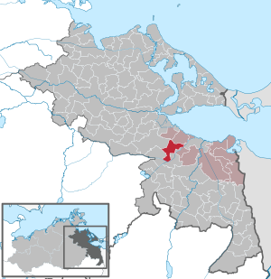
| Location of the municipality of Lübs in the Vorpommern-Greifswald district | ||
 _in_SVO.svg) |
||

Lübs is a German municipality in the Vorpommern-Greifswald district in eastern Mecklenburg-Western Pomerania . The community is administered by the Am Stettiner Haff office based in Eggesin .
geography
The municipality of Lübs is located on the western edge of the Ueckermünder Heide , only a few km from the Stettiner Haff . The terrain is largely flat, the Friedländer Große Wiese extends southwest of the community , and an approx. 20 km² forest area to the north ( Anklamer Stadtforst ).
Lübs is surrounded by the neighboring communities Leopoldshagen in the north, Mönkebude in the northeast, Ueckermünde in the east, Meiersberg in the southeast, Ferdinandshof in the south, Altwigshagen in the southwest and Ducherow in the northwest.
Districts
- Annenhof
- Heinrichshof
- Luebs
- Millnitz
history
- Luebs
The name Lübs comes from the Slavic word for linden tree = Lipa . The Slavs were followed by settlers from areas to the west in the course of Germany's eastward expansion.
The village or the lands and the forest was after the Thirty Years War and u. a. owned by von Borken and von Borcke for a long time until the expropriation in 1945 .
In addition to traditional agriculture, trade was also represented in the village, and there were still various crafts.
The almost 500 year old Lübser church was rebuilt in 1897 (as a brick building ).
On January 1, 1998 Lübs moved from the Ostvorpommern district to the Uecker-Randow district. Both districts went up on September 4, 2011 in the newly founded district of Vorpommern-Greifswald .
The community of Lübs today attracts mainly young families thanks to its favorable conditions and the quiet residential area in nature. Tourism is slowly playing a bigger role, which is mainly due to the proximity to the lagoon.
politics
Coat of arms, flag, official seal
The municipality has no officially approved national emblem, neither a coat of arms nor a flag . The official seal is the small state seal with the coat of arms of the region of Western Pomerania . It shows an upright griffin with a raised tail and the inscription "GEMEINDE LÜBS * LANDKREIS VORPOMMERN-GREIFSWALD".
Attractions

- Village church Lübs
- Several forest houses
- Tower Hill Lübs
- Grain mill with demonstration workshop
→ See also: List of architectural monuments in Lübs (Western Pomerania)
Transport links
Lübs is about 3 km from the B 109 ( Prenzlau - Anklam ). The nearest train stations are in Ducherow and Ferdinandshof on the Angermünde – Stralsund railway line and in Ueckermünde on the Jatznick – Ueckermünde railway line .
Web links
Individual evidence
- ↑ Statistisches Amt MV - population status of the districts, offices and municipalities 2019 (XLS file) (official population figures in the update of the 2011 census) ( help ).
- ↑ Main Statute, Section 1, Paragraph 2 (PDF).
Ahlbeck | Old Tellin | Altwarp | Altwigshagen | Anklam | Bandelin | Bargischow | Behrenhoff | Bentzin | Benz | Mountain wood | Blankensee | Blesewitz | Boldekow | Boock | Brietzig | Brünzow | Bugewitz | Buggenhagen | Butzow | Daberkow | Dargelin | Dargen | Dersekow | Ducherow | Eggesin | Fahrwalde | Ferdinandshof | Garz | Glazov | Görmin | Grambin | Grambov | Greifswald | Gribow | Gross Kiesow | Groß Luckow | Great Polzin | Gützkow | Hammer ad Uecker | Hanshagen | Heinrichswalde | Heringsdorf | Hinrichshagen | Hintersee | Iven | Jarmen | Jatznick | Comb teeth | Karlsburg | Karlshagen | Katzow | Kemnitz | Klein Bünzow | Koblentz | Korswandt | Koserow | Krackow | Krien | Kröslin | Kruckow | Krugsdorf | Krummin | Krusenfelde | Lassan | Leopoldshagen | Levenhagen | Liepgarten | Löcknitz | Loddin | Loissin | Loitz | Lubmin | Luebs | Luckow | Luetow | Medow | Meiersberg | Mellenthin | Mesekenhagen | Mölschow | Mönkebude | Murchin | Nadrensee | Neetzow-Liepen | New Boltenhagen | New Kosenow | Neuenkirchen | Neuenkirchen | Low | Papendorf | Pasewalk | Peenemünde | Penkun | Plow | Polzow | Postlow | Pudagla | Ramin | Rankwitz | Rollwitz | Rossin | Rossow | Rothemühl | Rothenklempenow | Rubenov | Rubkov | Sarnow | Sassen-Trantow | Sauzin | Schmatzin | Schönwalde | Spantekow | Stumble on the Peene | Stolpe on Usedom | Strasburg (Uckermark) | Torgelow | Trassenheide | Tutow | Ückeritz | Ueckermünde | Usedom | Square | Vogelsang-Warsin | Völschow | Wackerow | Weitenhagen | Wilhelmsburg | Wolgast | Wrangelsburg | Wusterhusen | Zemitz | Zempin | Zerrenthin | Ziethen | Zinnowitz | Zirchow | Züssow