Pillerhöhe
| Pillerhöhe | |||
|---|---|---|---|
|
View from the Pillerhöhe to Fliess and the Lechtal Alps |
|||
| Compass direction | west | Northeast | |
| Pass height | 1559 m above sea level A. | ||
| state | Tyrol | ||
| Valley locations | Flow | If it | |
| expansion | Pass road | ||
| Mountains | Kaunergrat , Ötztal Alps | ||
| profile | |||
| Denzel scale | SG 2-3 | SG 3 | |
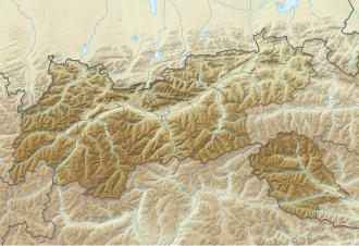
| Map (Tyrol) | |||
|
|
|||
| Coordinates | 47 ° 7 '5 " N , 10 ° 40' 0" E | ||
The Pillerhöhe (also Piller saddle or Pillersattel ) is 1559 m above sea level. A. high Tyrolean Alpine pass that connects the Oberinntal with the Pitztal . It is named after the Pillertal , which rises from the northeast and whose valley head forms the Pillerhöhe. Three narrow, paved roads lead to the Pillerhöhe: Piller Straße L 17 runs from Fließ (west) in the Oberinntal or from Wenns (northeast) in the Pitztal ; from Kaunerberg (south) in the front Kaunertal the Gacher-Blick-Straße L 63 leads to the top of the pass.
history
The valley of today's Pillerhöhe was the continuation of the Upper Inn Valley more than 100,000 years ago. Despite the steep ascent from the Oberinntal, the Piller Saddle was a much-used shortcut from the Engadin via the anterior Pitztal to Imst .
From 1992 to 1996, on behalf of the University of Innsbruck, a Hallstatt cult complex was found and examined on the Pillerhöhe . The center is a 2.30 x 3.00 m stone altar that was used for burnt offerings. Its surroundings are paved with stone slabs and there is also a two meter high dump of burned bone fragments.
Starting in the 15th century BC BC - in the Middle Bronze Age - until the end of the Hallstatt Age , plants and animals were sacrificed here, after that there were only material sacrifices instead of the burnt offerings (jewelry, agricultural implements, weapons and miniature shields made of sheet bronze ), from around 100 BC. BC Coin offerings (around 900 pieces). Depending on the style, one can distinguish between Alpine and Venetian , as well as Celtic offerings. The Celtic include fibulae , broken swords and the remains of an iron helmet. About two kilometers away, a depot with fragments of various bronze objects was discovered in 2001, which was dated to the end of the Middle Bronze Age.
Location and surroundings
The "Gache Blick" near the top of the pass offers a wide view of the upper Inn Valley . The area is rich in small raised bogs, a bog nature trail leads through the Pillermoor , which is protected as a natural monument . To the southeast is the Hahnenegger ( 1685 m ) and the Kalkofenegg ( 1721 m ), further north is the Goglesalpe ( 2017 m ).
The eponymous Piller, a district of Fließ , is located about 2.5 km northeast of the top of the pass, at about 1350 m above sea level. There is also the so-called Fuchsmoos, an alpine and meadow landscape with a pond and high moor, where sculptors' symposia were held annually from 1986 to 2007 and a permanent exhibition of the works created there can be seen in the Fuchsmoos sculpture field to this day.
Web links
Individual evidence
- ↑ a b Denzel, Harald; Great Alpine Road Guide; 22nd edition. Denzel-Verlag Innsbruck 2005, ISBN 3-85047-764-9 .
- ↑ Pillerhöhe and the surrounding area on ÖK 50 , www.austrianmap.at , 1: 50,000 (ÖK 50) of the BEV
- ^ Susanne Sievers , Otto Helmut Urban , Peter C. Ramsl: Lexicon for Celtic Archeology. A – K and L – Z. (Communications from the Prehistoric Commission, Volume 73). Publishing house of the Austrian Academy of Sciences , Vienna 2012, ISBN 978-3-7001-6765-5 , p. 554 f.
- ↑ Text on the Symposium Skulpturenfeld Fuchsmoos 1998 , queried December 13, 2016.

