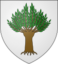
Saulce-sur-Rhône
| Saulce-sur-Rhône | ||
|---|---|---|

|
|
|
| region | Auvergne-Rhône-Alpes | |
| Department | Drôme | |
| Arrondissement | Nyons | |
| Canton | Montélimar-1 | |
| Community association | Montélimar agglomeration | |
| Coordinates | 44 ° 42 ′ N , 4 ° 48 ′ E | |
| height | 76-181 m | |
| surface | 18.43 km 2 | |
| Residents | 1,855 (January 1, 2017) | |
| Population density | 101 inhabitants / km 2 | |
| Post Code | 26270 | |
| INSEE code | 26337 | |
| Website | http://www.saulce.com/ | |
 Town hall (Mairie) of Saulce-sur-Rhône |
||
Saulce-sur-Rhone is a French commune with a population of 1,855 (as at 1st January 2017) in the department of Drôme in the region Auvergne Rhône-Alpes ; it belongs to the arrondissement of Nyons and the canton of Montélimar-1 (until 2015: canton of Loriol-sur-Drôme ).
geography
Saulce-sur-Rhône is located around 16 kilometers north-northeast of Montélimar on the Rhône . Saulce-sur-Rhône is surrounded by the neighboring communities of Loriol-sur-Drôme in the north, Cliousclat in the east and northeast, Mirmande in the east and southeast, Les Tourrettes in the south, Cruas in the southwest and Baix in the west.
The A7 autoroute runs through the municipality .
Population development
| year | 1962 | 1968 | 1975 | 1982 | 1990 | 1999 | 2006 | 2017 |
| Residents | 1660 | 1125 | 1199 | 1210 | 1443 | 1613 | 1641 | 1855 |
| Sources: Cassini and INSEE | ||||||||
Attractions
- Tour-de-Veyre fortified house from the 13th century
- Gavazel fortified house from the 14th century
- Freycinet Castle
- Menuret domain from the 19th century
Web links
Commons : Saulce-sur-Rhône - Collection of images, videos and audio files
