Pont-de-Barret
| Pont-de-Barret | ||
|---|---|---|
|
|
||
| region | Auvergne-Rhône-Alpes | |
| Department | Drôme | |
| Arrondissement | Nyons | |
| Canton | Dieulefit | |
| Community association | Dieulefit-Bourdeaux | |
| Coordinates | 44 ° 36 ' N , 5 ° 1' E | |
| height | 206-623 m | |
| surface | 16.60 km 2 | |
| Residents | 670 (January 1, 2017) | |
| Population density | 40 inhabitants / km 2 | |
| Post Code | 26160 | |
| INSEE code | 26249 | |
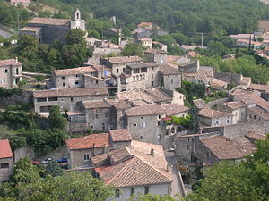
 View of Pont-de-Barret |
||
Pont-de-Barret is a French municipality with 670 inhabitants (at January 1, 2017) in the region of Auvergne Rhône-Alpes in the department of Drôme ; it belongs to the canton of Dieulefit in the arrondissement of Nyons . The inhabitants are called Pontois or Pontoises .
geography
Nestled between the mountains of Sainte Euphémie in the north, Éson in the northeast and Briesse in the east, Pont-de-Barret lies at an average altitude of 415 meters above sea level in the valley of the Roubion and its tributary, the Rimandoule, which flows into it. It is 15 kilometers by car to the northwestern town of Dieulefit and 23 kilometers to Montélimar . Neighboring communities are Soyans , Félines-sur-Rimandoule , Rochebaudin , Eyzahut , Salettes , Charols and Manas .
Population development
| year | 1911 | 1962 | 1975 | 1982 | 1990 | 1999 | 2009 | 2016 |
| Residents | 707 | 414 | 424 | 385 | 453 | 459 | 579 | 671 |
history
The village is of Gallo-Roman origin and used to be called Savenna . In the 9th century, the residents and monks left the plain and settled on the Saint-Rambert hill . In the 11th century, a bridge over the Roubion was built on the rocks called Barres , which allowed a new settlement in the valley - at the Pont de la Barre - to emerge, from which the current place name Pont de Barret became. The heart of the new settlement on the left bank of the Roubion was the Church of Notre-Dame de la Brune . The place became a fortress of the Counts of Valentinois , in the 14th century it was largely destroyed by Raymond de Turenne .
In Pont-de-Barret, the silk spinning trade was established early on , which was operated with the help of hydropower from the beginning of industrialization .
On May 13, 1901 at about eight o'clock in the morning, a magnitude VII earthquake shook the Drôme, the epicenter of which was around Saou , Manas and Pont-de-Barret; chimneys collapsed in the village, houses were damaged, as was the church.
There is a mineral spring in the village , a so-called calcareous carbonic acid.
Attractions
- Château Saint-Ferréol : ruin on a rock massif above the river, it dates from the eleventh century and was part of the old village.
- Church Notre-Dame de la Brune , the oldest parts in the choir should probably originate already from the 9th century. Former convent church of a Benedictine - priory in the dependence from the Abbey Saint-Chaffre-le-Monastier. It is considered to be one of the northernmost buildings of the Provencal Romanesque .
- medieval stone bridge in the village that crosses the Roubion.
- Châteauvieux : Outside the village on the Montagne-de-Sainte-Euphémie, pre-Roman and early Middle Ages ruins of a tower and remains of a castle
Personalities
- Patrick Beaugiraud , oboist , interpreter of baroque music, especially by Georg Friedrich Handel
Individual evidence
- ↑ Canstatt's Annual Report on Advances in Pharmacy and Allied Sciences, Volume 1. Verlag der Stahel'schen Buchh., 1857, p. 99
- ^ Marie Elisabeth Martin Laprade: Paroisses et communes de France: Drôme. Éditions du Center national de la recherche scientifique, 1981.
literature
- Dictionnaire geographique universel contenant la description de tous les lieux du globe intéressans sous le rapport de la geographie physique et politique, de l'histoire, de la statistique, du commerce, de l'industrie, etc. Paris, Imp. Kilian 1831, p 199.
