
Lüttow-Valluhn
| coat of arms | Germany map | |
|---|---|---|

|
Coordinates: 53 ° 32 ' N , 10 ° 51' E |
|
| Basic data | ||
| State : | Mecklenburg-Western Pomerania | |
| County : | Ludwigslust-Parchim | |
| Office : | Zarrentin | |
| Height : | 30 m above sea level NHN | |
| Area : | 24.31 km 2 | |
| Residents: | 884 (Dec. 31, 2019) | |
| Population density : | 36 inhabitants per km 2 | |
| Postal code : | 19246 | |
| Area code : | 038851 | |
| License plate : | LUP, HGN, LBZ, LWL, PCH, STB | |
| Community key : | 13 0 76 092 | |
| Community structure: | 3 districts | |
| Office administration address: | Amtsstr. 4–5, 19246 Zarrentin am Schaalsee |
|
| Website : | ||
| Mayor : | Marko Schilling ( SPD ) | |
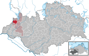
| Location of the municipality of Lüttow-Valluhn in the Ludwigslust-Parchim district | ||
  |
||

Lüttow-Valluhn is a municipality in the Ludwigslust-Parchim district in Mecklenburg-Western Pomerania . It is administered by the Zarrentin Office based in the town of Zarrentin am Schaalsee .
Lüttow-Valluhn is made up of the districts Lüttow, Schadeland and Valluhn.
geography

The community is located in the west of Mecklenburg-Western Pomerania on the border with Schleswig-Holstein and south of the Schaalsee biosphere reserve . The river Boize , the federal highway 24 and the federal highway 195 run through the municipality .
history
fusion

On June 13, 2004, the previous municipalities of Lüttow and Valluhn were merged to form the new municipality of Lüttow-Valluhn.
Lüttow
Lüttow is first mentioned in 1230 as Luttekowe in the Ratzeburg tithe register , when the place still consisted of 14 hooves . In 1496 the village had about 35 inhabitants. The Thirty Years War and a wave of plague in 1676 claimed numerous victims. 1894 is Lüttow of twelve farms, Büdnereien and cottagers land and 246 residents.
Valluhn
The first written mention of Valluhn as Vilun, which comes from Slavic and means something like "sorceress", can be found in 1194 in Isfried's partition agreement . This place also appears in the Ratzeburg tithe register in 1230, when it still consisted of 14 hooves and belonged to the parish of Zarrentin and was ruled by the German colonist Ottbertus. In 1496 Valluhn had 14 families and 68 residents. The Thirty Years' War also claimed numerous victims here. At Valluhn, French fought German-Russian troops in 1813, the French were defeated and retreated towards Hamburg.
Valluhn has always been characterized by agriculture. After 1990, thanks to its location on the autobahn and to Hamburg, the largest newly created industrial area in Mecklenburg-Western Pomerania was established, in which mainly the transport industry settled. In addition, the Edeka Nord meat factory has been located there since 2006 , with an area of 43,000 m², around 400 employees and 350 tons per day, one of the largest meat processing companies in Germany.
politics
As of May 25, 2014, the municipal council has been composed as follows:
| Civic alliance | 4 seats |
| CDU | 3 seats |
| Single applicant Rheinschmitt | 1 seat |
Coat of arms, flag, official seal
The municipality has no officially approved national emblem, neither a coat of arms nor a flag. The official seal is the small state seal with the coat of arms of the state of Mecklenburg. It shows a looking bull's head with torn off neck fur and crown and the inscription "GEMEINDE LÜTTOW-VALLUHN".
Attractions
- Valluhn museum courtyard
Web links
Individual evidence
- ↑ Statistisches Amt MV - population status of the districts, offices and municipalities 2019 (XLS file) (official population figures in the update of the 2011 census) ( help ).
- ↑ § 9 of the main statute (PDF; 41 kB) of the municipality
- ^ StBA: Changes in the municipalities in Germany, see 2004
- ↑ Overall result of the Lüttow-Valluhn municipal council, May 25, 2014
- ↑ Main Statute, Section 1, Paragraph 3

Alt Krenzlin | Old Zachun | Balow | Bandenitz | Banzkow | Barkhagen | Barnin | Belsch | Bengerstorf | Possession | Blankenberg | Blievenstorf | Bobzin | Boizenburg / Elbe | Borkow | Brahlstorf | Brenz | Bresegard at Eldena | Bresegard near Picher | Bruel | Brunow | Bülow | Cambs | Crivitz | Dabel | Dambeck | Demes | Dersenow | Dobbertin | Dobin at the lake | Dömitz | Domsühl | Dumber | Eldena | Friedrichsruhe | Gallin | Gallin Cupcentess | Gammelin | Ganzlin | Gehlsbach | Gneven | Göhlen | Goldberg | Gorlose | Grabow | Granzin | Grebs-Niendorf | Greetings | Greven | Great Godems | Big stuff | Groß Laasch | Hagenow | Hohen Pritz | Holthusen | Hoort | Hülseburg | Parental leave | Karrenzin | Karstädt | Church of Jesar | Klein Rogahn | Tempzin Monastery | Kobrow | Kogel | Circling | Kremmin | Kritzow | Kuhlen-Wendorf | Cow peat | Langen Brütz | Leezen | Lewitzrand | Luebesse | Lueblow | Lübheen | Luebz | Ludwigslust | Lüttow-Valluhn | Malk Göhren | Malliss | Mestlin | Milow | Möllenbeck | Moraas | Muchow | Mustin | New Gülze | New Kaliss | New Poserin | Neustadt-Glewe | Nostorf | Upper Warnow | Pampow | Parchim | Passow | Pätow-Steegen | Picher | Pinnow | Plate | Plau am See | Prislich | Pritzier | Raben Steinfeld | Rastow | Redefin | Rome | Ruhner Mountains | Lap in | Schwanheide | Siggelkow | Spornitz | Sternberg | Stumble | Stralendorf | Straw churches | Sukow | Sülstorf | Techentin | Teldau | Ticino | Toddin | Tramm | Uelitz | Vellahn | Vielank | Warlitz | Warlow | Warsow | Weitendorf | Werder | Wittenburg | Wittendbod | Wittenförden | Witch | Wöbbelin | Zapel | Zarrentin am Schaalsee | Ziegendorf | Zierzow | Zölkow | Zulow