Adair County, Kentucky
![The Adair County Courthouse in Columbia, listed on NRHP No. 74000847 [1]](https://upload.wikimedia.org/wikipedia/commons/thumb/f/f2/Adair_County_Kentucky_courthouse.jpg/298px-Adair_County_Kentucky_courthouse.jpg) The Adair County Courthouse in Columbia, listed on NRHP No. 74000847 |
|
| administration | |
|---|---|
| US state : | Kentucky |
| Administrative headquarters : | Columbia |
| Address of the administrative headquarters: |
County Courthouse Annex 424 Public Square Columbia, KY 42728-1465 |
| Foundation : | December 11, 1801 |
| Made up from: | Green County |
| Area code : | 001 270 |
| Demographics | |
| Residents : | 18,656 (2010) |
| Population density : | 17.7 inhabitants / km 2 |
| geography | |
| Total area : | 1068 km² |
| Water surface : | 14 km² |
| map | |
| Website : www.adaircounty.ky.gov | |
The Adair County is a county in the US -amerikanischen State Kentucky . In 2010 , the county had 18,656 residents and a population density of 17.7 people per square kilometer. The county seat is Columbia , named in memory of Christopher Columbus . The county is part of the dry counties , which means that the sale of alcohol is restricted or prohibited.
geography
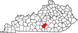
The county is located south of the geographic center of Kentucky and about 25 miles south of Tennessee . It has an area of 1068 square kilometers, of which 14 square kilometers are water.
In the northeast, the county is traversed by the Green River , a left tributary of the Ohio. About half of Green River Lake , a reservoir of the Green River, is in Adair County.
The following neighboring counties border Adair County:
| Green County | Taylor County | Casey County |

|
Russell County | |
| Metcalfe County | Cumberland County |
history
Adair County was formed on December 11, 1801 from former parts of Green County. It was named after John Adair (1757-1840), a former US Senator from Kentucky (1805-1806), commander of the Kentucky troops in the Battle of New Orleans and governor of Kentucky (1820-1824).
| Population development | |||
|---|---|---|---|
| Census | Residents | ± in% | |
| 1810 | 6011 | - | |
| 1820 | 8765 | 45.8% | |
| 1830 | 8217 | -6.3% | |
| 1840 | 8466 | 3% | |
| 1850 | 9898 | 16.9% | |
| 1860 | 9509 | -3.9% | |
| 1870 | 11,065 | 16.4% | |
| 1880 | 13,078 | 18.2% | |
| 1890 | 13,721 | 4.9% | |
| 1900 | 14,888 | 8.5% | |
| 1910 | 16,503 | 10.8% | |
| 1920 | 17,289 | 4.8% | |
| 1930 | 16.401 | -5.1% | |
| 1940 | 18,566 | 13.2% | |
| 1950 | 17.603 | -5.2% | |
| 1960 | 14,699 | -16.5% | |
| 1970 | 13,037 | -11.3% | |
| 1980 | 15,233 | 16.8% | |
| 1990 | 15,360 | 0.8% | |
| 2000 | 17,244 | 12.3% | |
| 2010 | 18,656 | 8.2% | |
| 2012 estimate | 18,675 | 0.1% | |
| 1810–1890 1900–1990 2000 2010–2012 | |||
population
According to the 2010 census , Adair County had 18,656 people in 6,717 households. The population density was 17.7 inhabitants per square kilometer. Statistically, 2.54 people lived in each of the 6717 households.
The racial the population was composed of 94.9 percent white, 2.7 percent African American, 0.2 percent Native American, 0.2 percent Asian and other ethnic groups; 1.1 percent were descended from two or more races. Hispanic or Latino of any race was 1.7 percent of the population.
22.5 percent of the population were under 18 years old, 62.2 percent were between 18 and 64 and 15.3 percent were 65 years or older. 50.6 percent of the population was female.
The median income for a household was 29,200 USD . The per capita income was $ 15,349. 24.0 percent of the population lived below the poverty line.
Places in Adair County
In Adair County is a parish that has the status of a city .
structure
Adair County is divided into 6 Census County Divisions (CCD):
| CCD | Population (2010) | FIPS |
|---|---|---|
| Cane Valley | 1,722 | 21-90552 |
| Casey Creek | 1,727 | 21-90624 |
| Columbia | 8,331 | 21-90784 |
| Glen's fork | 1,403 | 21-91416 |
| Gradyville | 2,457 | 21-91432 |
| White Oak | 3,016 | 21-93680 |
See also
Individual evidence
- ^ Extract from the National Register of Historic Places . Retrieved March 13, 2011
- ↑ GNIS-ID: 516847. Retrieved on February 22, 2011 (English).
- ↑ a b c U.S. Census Bureau, State & County QuickFacts - Adair County, KY Retrieved August 27, 2013
- ^ A b National Association of Counties.Retrieved August 26, 2013
- ^ US Census Bureau _ Census of Population and Housing.Retrieved February 17, 2011
- ↑ Extract from Census.gov.Retrieved February 17, 2011
- ↑ Missouri Census Data Center - Kentucky ( page no longer available , search in web archives ) Info: The link was automatically marked as defective. Please check the link according to the instructions and then remove this notice. Retrieved February 8, 2011
Web links
Coordinates: 37 ° 7 ′ N , 85 ° 17 ′ W

