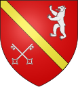
Chazay-d'Azergues
| Chazay-d'Azergues | ||
|---|---|---|

|
|
|
| region | Auvergne-Rhône-Alpes | |
| Department | Rhône | |
| Arrondissement | Villefranche-sur-Saône | |
| Canton | Anse | |
| Community association | Beaujolais Pierres Dorées | |
| Coordinates | 45 ° 52 ' N , 4 ° 43' E | |
| height | 179-311 m | |
| surface | 5.94 km 2 | |
| Residents | 4,130 (January 1, 2017) | |
| Population density | 695 inhabitants / km 2 | |
| Post Code | 69380 | |
| INSEE code | 69052 | |
| Website | www.chazaydazergues.fr | |
 View of the historic - fortified - center of Chazay-d'Azergues |
||
Chazay-d'Azergues is a French municipality with 4130 inhabitants (as of January 1 2017) in the department of Rhône in the region of Auvergne Rhône-Alpes . It belongs to the arrondissement of Villefranche-sur-Saône and is part of the canton of Anse .
geography
Chazay-d'Azergues is located in the Bourgogne wine region on the Azergues River . Chazay-d'Azergues is surrounded by the neighboring communities of Morancé in the north, Les Chères in the northeast, Marcilly-d'Azergues in the east and southeast, Civrieux-d'Azergues in the south, Lozanne in the southwest and Saint-Jean-des-Vignes in the west .
Population development
| year | Residents |
|---|---|
| 1962 | 1,267 |
| 1968 | 1,479 |
| 1975 | 2,054 |
| 1982 | 2.712 |
| 1990 | 3,314 |
| 1999 | 3,903 |
| 2006 | 3,896 |
| 2011 | 3,878 |
Attractions
- Chazay Castle, castle complex from the 15th century, built on the ground of the convent from the 9th century donated for the Abbey of Ainay, monument historique since 1923/1938
Personalities
- Pierre Rebut (1827–1898), cactus gardener in Chazay
Web links
Commons : Chazay-d'Azergues - Collection of images, videos and audio files

