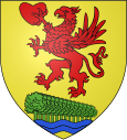
Civrieux-d'Azergues
| Civrieux-d'Azergues | ||
|---|---|---|

|
|
|
| region | Auvergne-Rhône-Alpes | |
| Department | Rhône | |
| Arrondissement | Villefranche-sur-Saône | |
| Canton | Anse | |
| Community association | Beaujolais Pierres Dorées | |
| Coordinates | 45 ° 52 ' N , 4 ° 43' E | |
| height | 189-303 m | |
| surface | 5.02 km 2 | |
| Residents | 1,515 (January 1, 2017) | |
| Population density | 302 inhabitants / km 2 | |
| Post Code | 69380 | |
| INSEE code | 69059 | |
| Website | http://www.civrieuxdazergues.fr/ | |
 Town hall of Civrieux-d'Azergues |
||
Civrieux-d'Azergues is a commune with 1,515 inhabitants (as of January 1 2017) in the department of Rhône in the region of Auvergne Rhône-Alpes . Administratively it belongs to the arrondissement Villefranche-sur-Saône and is part of the canton Anse (until 2015: canton Limonest ). The inhabitants are called Sévériens .
geography
Civrieux-d'Azergues is located on the range of hills of the Mont d'Or , in the wine-growing region of Coteaux du Lyonnais , about 13 kilometers northwest of Lyon . The Azergues limits the municipality to the north. Civrieux-d'Azergues is surrounded by the neighboring communities of Chazay-d'Azergues in the north, Marcilly-d'Azergues in the east, Dommartin in the south and Lozanne in the west.
Population development
| year | 1962 | 1968 | 1975 | 1982 | 1990 | 1999 | 2006 | 2013 |
|---|---|---|---|---|---|---|---|---|
| Residents | 452 | 537 | 768 | 898 | 1,099 | 1,299 | 1,396 | 1,520 |
| Source: Cassini and INSEE | ||||||||
Attractions
- Saint-Cyr et Saint-Blaise church
- Nous Deux garden
- Bridge over the Azergues
Parish partnership
There are partnerships with the Italian municipality of Corciano in the province of Perugia (Umbria) and the German municipality of Pentling in the Upper Palatinate (Bavaria).

