
Frauenstein (Ore Mountains)
| coat of arms | Germany map | |
|---|---|---|

|
Coordinates: 50 ° 48 ' N , 13 ° 32' E |
|
| Basic data | ||
| State : | Saxony | |
| County : | Central Saxony | |
| Height : | 650 m above sea level NHN | |
| Area : | 58.99 km 2 | |
| Residents: | 2772 (Dec. 31, 2019) | |
| Population density : | 47 inhabitants per km 2 | |
| Postal code : | 09623 | |
| Area code : | 037326 | |
| License plate : | FG, BED, DL, FLÖ, HC, MW, RL | |
| Community key : | 14 5 22 170 | |
| City structure: | 4 districts | |
City administration address : |
Market 28 09623 Frauenstein |
|
| Website : | ||
| Mayor : | Reiner Hentschel (EB Hentschel) | |
| Location of the city of Frauenstein in the district of central Saxony | ||
  |
||

Frauenstein is a small town in the south of the Saxon district of Central Saxony .
geography
The town lies in osterzgebirgischen part of the Nature Park Erzgebirge / Vogtland , 20 km southeast of Freiberg and 30 km southwest of Dresden .
history
founding
The starting point for the formation of the settlement was the construction of a castle, which took place around 1200 and rose on a prominent hilltop ( granite porphyry ) above the undulating plateaus of the surrounding area. Shortly after the castle was founded, silver ores were found in the vicinity in Reichenau . As a result, miners and craftsmen settled in the Kuttelbachtal northeast of the castle. However, the settlement was chosen unfavorably, as it was at risk of flooding and away from the castle. The settlement was therefore abandoned after 1470. The new Frauenstein was built according to plan on a plateau in the immediate vicinity of the castle.
Coat of arms and name
The name Frauenstein was first mentioned in a document in 1218. In this a priest named "Heinricus de Vrounsten" (Heinrich von Frauenstein) is mentioned. The presence of a priest indicates an existing settlement (next to the castle). The castle itself was only mentioned in 1272 as "Castrum Vrowenstein" in a fiefdom confirmation. From the city name are u. a. still the spellings “Vrouwenstein” (1321), “Vrowinstein” (1385), “Frauwinstein” (1405), “Frawenstein” (1424) and “ffrauwenstein” (1439) handed down. The name goes back to the Middle High German word Vrowe , which means something like mistress, mistress, woman (of a higher class). The name probably referred to the castle, later it passed to the place. A religious background, as shown in the city arms, is hardly likely and cannot be proven.

Town hall and castle in winter

Frauenstein, town church

Silbermannbrunnen on the market square
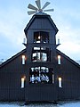
Town pyramid on the edge of the market square in front of the castle entrance

Coat of arms on the town hall


_Marktplatz,_Silbermannbrunnen.JPG)


Development of the castle and chateau


The foundation of Frauenstein Castle was the result of the first phase of colonization in the Ore Mountains . After the silver finds from Freiberg in 1168, the previously uninhabited forest mountains between the Margraviate of Meißen and the Kingdom of Bohemia became the focus of Markmeißn and Bohemian interests. Both sides began with the construction of a number of border protection castles (including Sayda , Purschenstein , Rechenberg , Bärenstein , Lauenstein , Königstein ) to delimit their own sphere of interest.
Frauenstein Castle, built around 1200, was one of these border guard castles. It stood out from most of the other castles, as it also protected and controlled the important trade route (later Alte Freiberg-Teplitzer Poststrasse ) leading from Freiberg over the pass from Klostergrab (Hrob) to Teplice (Teplice) . The castle complex was about halfway between Freiberg and the Bohemian border. The founding was possibly also in connection with the alleged robbery of the silver treasure of Margrave Otto the Rich by Bohemian robbers around 1180 .
The castle, which was in ruins after the city fire in 1728, is now the largest castle ruin in Saxony. From 1585 to 1588 a castle was built next to the castle. The castle (and later the palace) was owned by the Margraves of Meissen and the Electors of Saxony , who gave the complex to vassals as a fief .
In the course of history, the following owners of the castle or palace and rule of Frauenstein appeared (incomplete):
- second half of the 13th century: The family of those von Siden ( Latin : de Serico ) entered a. a. with knights Johannes and Heinrich von Siden as lords of the castle. Johannes von Siden also called himself Johannes de Vrowenstein.
- before 1320–1323 (?): Margrave Friedrich the Freidige enfeoffed the von Ileburgs with the castle. The loan was probably released again in 1323.
- 1329–1426: The castle came into the hereditary fiefdom of the Burgraves of Meißen , who used the castle as ancestral seat from around 1380. The city charter (1411) went back to the function as a princely seat. In 1426 Burgrave Heinrich fell in the battle of Aussig . Since he was childless, the castle and rule came back to the Elector Frederick the Quarrel .
- 1428–1439: In 1428 Heinrich I von Plauen (court judge of Sigismund von Luxemburg ) was enfeoffed with the castle. Heinrich soon got into a feud with Elector Friedrich the Meek , which ended in 1438 with the conquest of the castle and the seizure of the fief.
- 1439–1472: The castle was administered as the center of the electoral office of the same name by various bailiffs , bailiffs and loyal followers of the Marquis of Meissen.
- 1473–1647: The noble family von Schönbergs was enfeoffed with the castle and the rule. Since the castle only offered limited living comfort, Heinrich von Schönberg had a Renaissance- style castle built below the castle by the master builder Hans Irmisch . In the period that followed, the castle, which was hardly used any more, began to decline.
- 1647–1873: The von Schönbergs, indebted by the Thirty Years' War, were forced to sell the palace. It came back into the possession of the Saxon electors. They used it until 1873 as the administrative seat of the office of the same name. With the establishment of the Amtshauptmannschaft Dippoldiswalde , the administrative function was finally lost in 1873. The decay of the unused castle was accelerated by damage after the town fire of 1728.
Development of the city

On May 22nd, 1411, the burgrave Heinrich von Meißen granted the settlement city rights. Frauenstein had to endure three city fires. In 1728 a great fire destroyed large parts of the city, including u. a. the 15-register Silbermann organ (1711) in the church. The castle and palace were badly damaged. The castle was not rebuilt after the fire and has been falling into disrepair ever since.
On 2/3 In October 1869, shortly after midnight, a fire broke out in a building at the back of the market, and it spread rapidly. Most of the clapboard-roofed houses were already on fire at around 3 a.m. The flames destroyed a total of 75 town houses, the town hall, the church with the organ made by Gottfried Silbermann at cost price after the fire in 1728, three schoolhouses, a town gate and the poor house. 715 people, half of the population, lost their homes. The Saxon state approved 12,000 thalers for the reconstruction of the public buildings, the residents received a further 30,000 guilders from donations as well as numerous donations in kind, so that the reconstruction progressed rapidly. The new town hall was completed in 1871, the church in 1873.
Role in the suppression of the "Prague Spring" in 1968
When the Prague Spring was crushed in August 1968, Soviet troops marched through Frauenstein .
Incorporations
- 1974: Kleinbobritzsch
- 1994: Burkersdorf , Dittersbach , Nassau
Population and size development
|
|
|
Compilation based on BLASCHKE 2003, German Academy of Sciences in Berlin 1966, SCHIFFNER 1840, ZÜHLKE 1966 and information from the State Statistical Office of the Free State of Saxony, from 1991: status as of December 31 of the respective year
(1): estimated based on traditional house numbers from the 16th century, cf. BLASCHKE 2003
(2): calculated according to tax lists, cf. BLASCHKE 2003
(3): As of October 3, 1990
(4): Source: Frauenstein registration authority
Memorials
- Graves in the cemetery of the district of Burkersdorf for three Soviet citizens known by name, who were abducted to Germany during the Second World War and who were victims of forced labor between 1942 and 1944 .
politics
Municipal council
Since the municipal council election on May 26, 2019 , the 14 seats of the municipal council have been distributed among the individual groups as follows:
Town twinning
The partner community has been Zell am Harmersbach since 1991 .
Land consolidation
The land consolidation procedure was ordered for the Burkersdorf district by resolution of December 30, 1999 and for the Dittersbach district by resolution of April 23, 2001 .
City Marketing
In September 2009 the new model Frauenstein - Stern in the Ore Mountains was presented.
Culture and sights
- see also: List of cultural monuments in Frauenstein
- Frauenstein castle ruins
- Frauenstein Castle
- Saxon distance column on the market
- Royal Saxon milestones on the market and on the B 171
- Sculptures from the European Art Symposium 2006 on the "Kunstwanderweg Frauenstein" and on the market
- Cemetery chapel "Zum heiligen Kreuz": The chapel was once the first church in Frauenstein. It was first mentioned in 1384, but was probably built as early as the 13th century as part of the Holy Way . The current building dates from 1616. The chapel has a pulpit altar from 1648 and several valuable epitaphs .
- Museums
- Gottfried Silbermann Museum: In the cross-vaulted hall of the castle is the Silbermann Museum, which provides information about the life and work of the famous organ builder.
Economy and Infrastructure
Business
On February 15 , 1943 , Johannes Tittel founded a production facility for precision mechanical components in the disused Schützenhaus inn . They were parts for radio and communications equipment as well as components for the aviation industry ( fighters and bombers ).
In the year 1953 John Tittel transferred the Frauensteiner operating part to his brother Kurt Tittel and are primarily timers made. The private company was despite government reprisals exist because a substantial number was exported to equipment and the state as foreign exchange got.

With the State Bank of the GDR, the state management had a powerful instrument of power. The state organs were able to block all loans to private companies and forced many of them into limited partnerships . Such a foundation took place in 1960 . Kurt Tittel as general partner was liable with all of his assets , with the limited partner , i.e. the state management, only liable with the contribution of the state bank . The state business leaders now had an insight into all economic processes and were thus able to influence and shape private management in their own way and set new corporate goals. One such definition by the limited partners was the priority production of tariff switching devices for night storage heating .
The production of time switches was quite complex and required a high level of skill in the field of precision engineering. The photo of the internal arrangement of the components illustrates the complex structure.
Erich Honecker became first secretary of the Central Committee on May 3 , 1971, and the numerous private companies in the GDR , around 11,000, were a thorn in his side. He made preparations for the nationalization of companies with more than 10 employees. The private company Kurt Tittel was so in the year 1972 , a state-owned enterprise and the existing partner and business leader Kurt Tittel became director.
In April 1992 Kurt Tittel's sons got the family business back; they continue to run it as a private company .
traffic
railroad

With the narrow-gauge railway Klingenberg-Colmnitz-Frauenstein , Frauenstein received a rail connection in September 1898. Freight traffic on the route ceased in 1970, and passenger traffic a year later due to an accident. The route was then dismantled.
Street

The area around Frauenstein was opened up by high roads that connected the Saxon lowlands with Bohemia via the Eastern Ore Mountains. The location on an old trade route leading from Freiberg over the pass from Klostergrab to Klostergrab ( Hrob ) was a decisive feature for the foundation of Frauenstein Castle. In the 18th century this connection became important as the Alte Freiberg-Teplitzer Poststrasse . On the market there is still a replica of the Saxon postal mileage pillar erected in 1725 during the survey carried out by Adam Friedrich Zürner (original parts in the museum). Late 18th century began chaussee moderate expansion between Freiberg and the Saxon-Bohemian border. In the middle of the 19th century the post rates Frauenstein-Freiberg and Frauenstein- Teplitz (Teplice) ran on this street . The royal Saxon station stones , in their original condition on the market and redesigned as a signpost on today's B 171 , were set up on the new Chaussee around 1860. The current state road 184 corresponds in its course between Freiberg, Frauenstein and Neuhermsdorf in parts of the old Freiberg-Teplitzer Poststrasse.
Public transport
As early as 1865 a stagecoach connection leading from Freiberg to Frauenstein was established. Today the city is part of the central Saxony transport association . Frauenstein is currently connected to Dresden , Freiberg, Olbernhau and Rechenberg-Bienenmühle via bus lines .
Personalities
sons and daughters of the town
- Andreas Silbermann (1678–1734), organ builder
- Gottfried Silbermann (1683–1753), organ builder
- Gustav Heinrich Naecke (1785–1835), painter
- Gustav Philipp (1841–1897), MdL , politician (Progress Party) and brewery owner
- Georg Aster (1849–1917), architect
- Arthur Hugo Göpfert (1872–1949), MdL 1909–1918, national liberal politician, architect
- Carl Meyrich (1892–1981), economist
- Werner Müller (1924–1999), local history researcher
- Sonnhilde Kallus (1935–2007), ski racer
- Dieter Lohse (* 1940), transport scientist
- Peter Heinrich (1948–2015), Member of the Bundestag, politician (CDU), from 1990 the first freely elected mayor of Frauenstein
- Thomas Schönlebe (* 1965), track and field athlete and Olympic participant
- Maik Meyer (* 1970), amateur astronomer and comet expert
People related to the place
- Christoph Schindler (1596–1669), lawyer and clergyman, local deacon
- Carl Gottlob von Leubnitz (1667–1741), governor
Individual evidence
- ↑ Population of the Free State of Saxony by municipalities on December 31, 2019 ( help on this ).
- ↑ http://codex.isgv.de/codex.php?band=cds1a3&f=&a=b&s=182 Line 27
- ↑ Ernst Eichler , Hans Walther (ed.): Historical book of place names of Saxony. Berlin 2001, Volume I, ISBN 3-05-003728-8 , p. 272.
- ↑ In the literature (see. U. A. Blaschke 2003, Zühlke 1966) also from about 1200 onset of German colonization of the Ore Mountains is called colonization referred
- ↑ Reiner Burger, Frauenstein: Prager Frühling: "Every tank has a fist that rushes into Bonn plans" . In: FAZ.NET . ISSN 0174-4909 ( faz.net [accessed March 27, 2020]).
- ↑ Results of the 2019 municipal council elections
- ^ "Star" theme on the city's website
- ↑ Frauenstein art hiking trail (accessed on July 10, 2016)
-
↑ see alsoCommons : Sculptures in Frauenstein (Erzgebirge) - Collection of pictures, videos and audio files
- ↑ Astrid Ring: Out for Silbermann Museum in the castle. In: Free Press , August 3, 2016.
- ↑ a b c d e Tittel Feingerätetechnik - History. Retrieved July 20, 2020 .
- ↑ Timetable December 11, 2005 to December 10, 2006
literature
- Eastern Ore Mountains (= values of the German homeland . Volume 10). 1st edition. Akademie Verlag, Berlin 1966.
- Heimatmuseum Frauenstein (Ed.): Frauenstein. Castle and city. Home of the organ builder Gottfried Silbermann. Frauenstein, undated
- Steffen Herzog, Rainer Aurig: Castle, town and museum "Gottfried Silbermann" Frauenstein. Schnell Art Guide No. 2334. Regensburg 2010.
- Hermann Löscher : Frauenstein. In: Walter Schlesinger (Hrsg.): Handbook of the historical sites of Germany . Volume 8: Saxony (= Kröner's pocket edition . Volume 312). Kröner, Stuttgart 1965, DNB 456882952 , pp. 98-99.
- Oswald Schleinitz: Chronicle of the district court district Frauenstein. Wolf, Schmiedeberg 1887. ( digitized part 1 )
- Richard Steche : Frauenstein. In: Descriptive representation of the older architectural and art monuments of the Kingdom of Saxony. 2. Issue: Amtshauptmannschaft Dippoldiswalde . CC Meinhold, Dresden 1883, p. 26.
Web links
- Atlas Central Saxony
- Official homepage of the city of Frauenstein
- Official homepage of the Silbermann Museum Frauenstein
- Frauenstein in the Digital Historical Directory of Saxony
- Literature on Frauenstein in the Saxon Bibliography