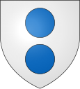
Les Cammazes
|
Les Cammazes Les Capmases |
||
|---|---|---|

|
|
|
| region | Occitania | |
| Department | Camouflage | |
| Arrondissement | Castres | |
| Canton | La Montagne Noire | |
| Community association | Lauragais Revel Sorèzois | |
| Coordinates | 43 ° 25 ' N , 2 ° 5' E | |
| height | 410-653 m | |
| surface | 7.68 km 2 | |
| Residents | 340 (January 1, 2017) | |
| Population density | 44 inhabitants / km 2 | |
| Post Code | 81540 | |
| INSEE code | 81055 | |
Les Cammazes ( Occitan Les Capmases ) is a French commune with 340 inhabitants (as of January 1, 2017) in the Tarn department in the Occitania region (before 2016 Midi-Pyrénées ). It belongs to the Arrondissement of Castres and the canton of La Montagne noire (until 2015 canton of Dourgne ).
Geography and infrastructure
It borders in the north-west on Revel , in the north on Durfort , in the east on Sorèze , in the south-east on Saissac , in the south on Villemagne , in the south-west on Verdun-en-Lauragais and in the west on Les Brunels . The Sor forms the municipal boundary in the northeast and leaves the Lac des Cammazes reservoir , which intersects with the municipal marker in the east.
The former Route nationale 629 leads via Les Cammazes.
Population development
| year | 1962 | 1968 | 1975 | 1982 | 1990 | 1999 | 2008 | 2015 |
|---|---|---|---|---|---|---|---|---|
| Residents | 262 | 213 | 201 | 174 | 179 | 209 | 319 | 315 |
Attractions
At Les Cammazes, the Rigole de la Montagne , a supply water channel for the Canal du Midi , flows through the 122-meter-long and three-meter-wide Percée des Cammazes tunnel , a building by Vaubans from 1686-88. As part of the Canal du Midi, it has been a UNESCO World Heritage Site since 1996 , and a Monument Historique since 1997 .

