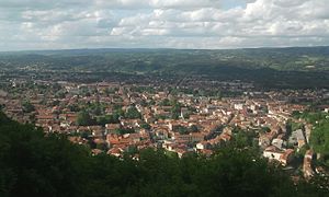
Mazamet
| Mazamet | ||
|---|---|---|

|
|
|
| region | Occitania | |
| Department | Camouflage | |
| Arrondissement | Castres | |
| Canton |
Mazamet-1 (main town) Mazamet-2 Vallée du Thoré (main town) |
|
| Community association | Castres Mazamet | |
| Coordinates | 43 ° 30 ' N , 2 ° 22' E | |
| height | 213-1,176 m | |
| surface | 72.08 km 2 | |
| Residents | 10,013 (January 1, 2017) | |
| Population density | 139 inhabitants / km 2 | |
| Post Code | 81200 | |
| INSEE code | 81163 | |
| Website | http://www.ville-mazamet.com/ | |
 Mazamet |
||
Mazamet is a French commune with 10,013 inhabitants (as of January 1, 2017) in the Tarn department in the Occitanie region . It belongs to the Arrondissement of Castres .
location
The city of Mazamet is located on the northern foothills of the Montagne Noire (Eng. "Black Mountains"), at the confluence of the rivers Arn and Arnette in the Thoré . Although the municipality lies within the intended limits of the Haut-Languedoc Regional Nature Park , the municipal administration has not signed the 2011 charter agreement.
history
The name Mazamet is derived from the Occitan Mas Aïmat, French la maison aimée = the beloved house; see also Languedoc language . It is in the historic province of Languedoc .
Population development
- 1962: 15.091
- 1968: 16.171
- 1975: 14.440
- 1982: 12,840
- 1990: 11,481
- 1999: 10,544
- 2006: 10.158
Personalities
- Moyse Garrigue , (* 1663 in Mazamet, † October 8, 1715 in Magdeburg ); Huguenot , jeweler and dealer; after the edict of Nantes was repealed , he fled to Brandenburg with his nephew Jacques Garrigue in 1686 and became a citizen of the French colony of Magdeburg .
- Jacques Garrigue (* 1677 in Mazamet, Languedoc, France; † August 24, 1730 in Magdeburg) was a jeweler and church councilor (ancien) of the French Reformed Church in Magdeburg.
- Laurent Jalabert , French professional cyclist , was born in Mazamet in 1968, as was his younger brother
- Nicolas Jalabert , French professional cyclist, born in Mazamet in 1973.
- François Girbaud , French fashion designer, born in Mazamet in 1945.
Tour de France
Mazamet was the starting point of the 14th stage of the 2007 Tour de France .
