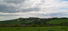
Rayssac
|
Rayssac Raiçac |
||
|---|---|---|

|
|
|
| region | Occitania | |
| Department | Camouflage | |
| Arrondissement | Castres | |
| Canton | Le Haut Dadou | |
| Community association | Monts d'Alban and Villefranchois | |
| Coordinates | 43 ° 49 ′ N , 2 ° 25 ′ E | |
| height | 357-711 m | |
| surface | 29.95 km 2 | |
| Residents | 242 (January 1, 2017) | |
| Population density | 8 inhabitants / km 2 | |
| Post Code | 81330 | |
| INSEE code | 81221 | |
Rayssac ( Occitan Raiçac ) is a southern French municipality with 242 inhabitants (as of January 1, 2017) in the Tarn department in the Occitania region (before 2016 Midi-Pyrénées ). Rayssac belongs to the Arrondissement of Castres and is part of the canton of Le Haut Dadou (until 2015 Montredon-Labessonnié ).
geography
Rayssac is on the edge of the Haut-Languedoc Regional Nature Park , about 29 kilometers south-east of Albi , on the Dadou , which borders the municipality in the north. Rayssac is surrounded by the neighboring communities of Paulinet in the north and east, Le Masnau-Massuguiès in the east and south-east, Lacaze in the south-east, Saint-Pierre-de-Trivisy in the south, Arifat in the south-west, Mont-Roc in the west and Teillet in the north-west.
Population development
| year | 1962 | 1968 | 1975 | 1982 | 1990 | 1999 | 2006 | 2013 |
| Residents | 416 | 372 | 324 | 313 | 310 | 295 | 268 | 250 |
| Source: Cassini and INSEE | ||||||||
Attractions
- Saint-Martin church from 1723
- Rayssac Castle from the 17th century

