Brand (Hückeswagen)
|
brand
City of Hückeswagen
Coordinates: 51 ° 11 ′ 16 " N , 7 ° 22 ′ 11" E
|
||
|---|---|---|
| Height : | 370-380 m above sea level NN | |
| Postal code : | 42499 | |
| Area code : | 02192 | |
|
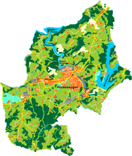
Location of brand in Hückeswagen |
||
Marke is a village in Hückeswagen in the Oberbergischer Kreis in the administrative district of Cologne in North Rhine-Westphalia ( Germany ).
Location and description
Marke is located in northeastern Hückeswagen near Radevormwald on federal road 483 (B483). Neighboring towns are Herweg , Hagelsiepen , Niederhagelsiepen , Pleuse , Oberbeck , Fockenhausen , Laake and Radevormwald- Vorm Holte .
The Hagelsiepen stream rises north of Marke . There is a connection to local public transport via bus lines 336 and 339 of the VRS .
history
The first mention of the place is dated to the year 1850. The Hückeswagen Landwehr crossed today's federal road at Marke.
Individual evidence
- ^ Klaus Pampus: First documentary naming of Oberbergischer places (= contributions to Oberbergischen history. Sonderbd. 1). Oberbergische Department 1924 eV of the Bergisches Geschichtsverein, Gummersbach 1998, ISBN 3-88265-206-3 , p. 159.

