Niederwinterhagen
|
Niederwinterhagen
City of Hückeswagen
Coordinates: 51 ° 8 ′ 46 ″ N , 7 ° 17 ′ 52 ″ E
|
||
|---|---|---|
| Height : | 300 m above sea level NN | |
| Postal code : | 42499 | |
| Area code : | 02192 | |
|
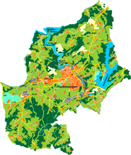
Location of Niederwinterhagen in Hückeswagen |
||
Niederwinterhagen is a residential area in Hückeswagen in the Oberbergisches Kreis in southern North Rhine-Westphalia within the administrative district of Cologne ( Germany ).
Location and description
Niederwinterhagen is located in the west of Hückeswagen on federal highway 237 . Neighboring towns are Winterhagen , Sonnenschein , Junkernbusch , Heidt , Dörpe and the larger district of Wiehagen .
The Winterhagener Bach , a tributary of the Dörpe Bach , flows through the village .
history
The place was mentioned for the first time in a document in 1407 : A Johan Wynterhaige , judge in Hokishouen , appears in a document about the waiver of Stael v. Holstein to the office of hereditary droplets and hereditary stewardship in Berg . Spelling of the first mention : Wynterhaige .
In the 18th century the place belonged to the Bergisches Amt Hückeswagen . In 1815/16 there were 22 residents in the village. In 1832 Niederwinterhagen belonged under the name of Oberwinterhagen to the Grand Honorship , which was part of the Hückeswagen external citizenship within the Hückeswagen mayor's office . The place, categorized as a hamlet according to the statistics and topography of the Düsseldorf administrative district , had three residential buildings and six agricultural buildings at that time. At that time, there were 20 residents in the village, twelve Catholic and eight Protestant.
In the municipality lexicon for the Rhineland province , five houses with 51 inhabitants are given for 1885. At that time the place belonged to the rural community Neuhückeswagen within the Lennep district . In 1895 the place had three houses with 26 inhabitants.
Until 2004, Niederwinterhagen was visually dominated by the very high embankment of the disused Wippertal Railway between Remscheid- Bergisch Born and Marienheide (timetable KBS412). In the summer of 2004, a large area of the railway embankment was removed and the tunnel of federal highway 237 was exposed through the embankment to remove this bottleneck. Until the closure of the Wipper valley course 1995, there were in Winterhagen a railway -Haltepunkt of at 51 ° 8 '54.2 " N , 7 ° 18' 4" O lay.
Individual evidence
- ^ Johann Georg von Viebahn : Statistics and topography of the administrative district of Düsseldorf. Part 2: Containing the statistical table of places and distances and the alphabetical index of place names. Schreiner, Düsseldorf 1836, p. 11 .
- ↑ Königliches Statistisches Bureau (Prussia) (Ed.): Community encyclopedia for the Rhineland Province, based on the materials of the census of December 1, 1885 and other official sources, (Community encyclopedia for the Kingdom of Prussia, Volume XII), Berlin 1888.
- ↑ Königliches Statistisches Bureau (Prussia) (Ed.): Community encyclopedia for the Rhineland Province, based on the materials of the census of December 1, 1895 and other official sources, (Community encyclopedia for the Kingdom of Prussia, Volume XII), Berlin 1897.

