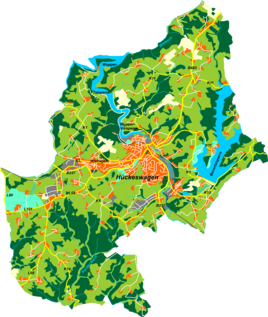
Schmitzberg (Hückeswagen)
|
Schmitzberg
City of Hückeswagen
Coordinates: 51 ° 8 ′ 48 ″ N , 7 ° 21 ′ 16 ″ E
|
||
|---|---|---|
| Height : | 290 m above sea level NN | |
| Postal code : | 42499 | |
| Area code : | 02192 | |
|
Location of Schmitzberg in Hückeswagen |
||
Schmitzberg is a settlement in Hückeswagen in the Oberbergischer Kreis in the administrative district of Cologne in North Rhine-Westphalia ( Germany ).
Location and description
Schmitzberg is located in the east of Hückeswagen in the Wupper valley near the main town. Other neighboring towns are Großberghausen , Kleinberghausen , Runkelsiedlung , Aue and Hartkopsbever . Schmitzberg can be reached via an access road between Aue and Großberghausen.
history
The topographic maps show the Schmitzberg settlement area on a delimited area with six individual building floor plans for the first time in 1927. The place name Schmitzberg is listed from the topographic map from 1979 onwards.
Hiking and biking trails
The following hiking trails touch the village:
- The district hiking trail ◇ 6 ( Wupperweg ) of the SGV district of Bergisches Land
- The road of work of the SGV district Bergisches Land
- The local hiking trail △ from Elberhausen to the Goldenbergshammer
- The local circular route A4
Individual evidence
- ^ Historika25, Landesvermessungsamt NRW, sheet 4810, Wipperfürth

