Runkelsiedlung
|
Runkelsiedlung
City of Hückeswagen
Coordinates: 51 ° 8 ′ 29 ″ N , 7 ° 21 ′ 23 ″ E
|
||
|---|---|---|
| Height : | 295 m above sea level NN | |
| Postal code : | 42499 | |
| Area code : | 02192 | |
|
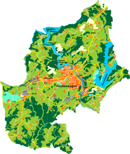
Location of Runkelsiedlung in Hückeswagen |
||
The Runkelsiedlung is a settlement in Hückeswagen in the Oberbergischer Kreis in the administrative district of Cologne in North Rhine-Westphalia ( Germany ) and nominally belongs to the Kleineichen district .
Location and transport links
The Runkelsiedlung is located in the southeast of Hückeswagen near the Bevertalsperre . The place forms a contiguous settlement area with Hartkopsbever . The settlement is named after its developer, the Remscheid company Runkel .
Other neighboring towns are Großberghausen , Dierl , Reinshagenbever and Schmitzberg . The place can be reached via an access road that branches off from the K5 district road at Kleineichen and also connects Hartkopsbever.
Hiking and biking trails
The following hiking trails lead through the village:
- The district hiking trail ◇ 6 ( Wupperweg ) of the SGV district of Bergisches Land
- The road of work of the SGV district Bergisches Land
- The local hiking trail △ from Elberhausen to the Goldenbergshammer
- The Hückeswagen circular route O


