Kleinenscheidt
|
Kleinenscheidt
City of Hückeswagen
Coordinates: 51 ° 8 ′ 14 ″ N , 7 ° 19 ′ 6 ″ E
|
||
|---|---|---|
| Height : | 320 m above sea level NN | |
| Postal code : | 42499 | |
| Area code : | 02192 | |
|
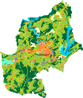
Location of Kleinenscheidt in Hückeswagen |
||
Kleinenscheidt is a court in Hückeswagen in the Oberbergischer Kreis in the administrative district of Cologne in North Rhine-Westphalia (Germany).
Location and description
Kleinenscheidt is located in western Hückeswagen in the source area of the Sohlbach .
Neighboring places are Grünenthal , Grünestrasse , Wegerhof , Großenscheidt , Schneppenthal , Altenhof , Westhoferhöhe and Westhofen .
The Hofschaft can be reached via a connecting road that branches off from the K5 district road near Kleinenscheidt and leads to the historic center of Hückeswagen.
history
The place was first mentioned in a document in 1487 . In the loan list for Duke William of Jülich-Berg are Johan zom Scheyde or Johan zo de vagina called. The original spelling was therefore Scheyde / Scheide .
In the 18th century the place belonged to the Bergisches Amt Bornefeld-Hückeswagen . In 1815/16 there were 20 people living in the village. In 1832, Kleinenscheidt, under the name of Kleinscheid, belonged to the Great Honorship , which was part of the Hückeswagen external citizenship within the Hückeswagen mayor's office . According to the statistics and topography of the Düsseldorf administrative district , all of them categorized as a hamlet of Protestant faith.
In the municipality lexicon for the Rhineland province , two houses with 21 inhabitants are given for 1885. At that time the place belonged to the rural community Neuhückeswagen within the Lennep district . In 1895 the place had two houses with 16 inhabitants, in 1905 two houses and 15 inhabitants.
Individual evidence
- ^ Johann Georg von Viebahn : Statistics and topography of the administrative district of Düsseldorf. Part 2: Containing the statistical table of places and distances and the alphabetical index of place names. Schreiner, Düsseldorf 1836, p. 11 .
- ^ Royal Statistical Bureau (Prussia) (Ed.): Community encyclopedia for the Rhineland province. Based on the materials from the census of December 1, 1885 and other official sources (= community encyclopedia for the Kingdom of Prussia. Vol. 12, ZDB -ID 1046036-6 ). Publishing house of the Royal Statistical Bureau, Berlin 1888.
- ^ Royal Statistical Bureau (Prussia) (Ed.): Community encyclopedia for the Rhineland province. Based on the materials from the census of December 1, 1895 and other official sources (= community encyclopedia for the Kingdom of Prussia. Vol. 12). Publishing house of the Royal Statistical Bureau, Berlin 1897.
- ^ Royal Statistical Bureau (Prussia) (Ed.): Community encyclopedia for the Rhineland province. Based on the materials from the census of December 1, 1905 and other official sources (= community encyclopedia for the Kingdom of Prussia. Vol. 12). Publishing house of the Royal Statistical Bureau, Berlin 1909.

