Wiebachmühle
|
Wiebachmühle
City of Hückeswagen
Coordinates: 51 ° 10 ′ 53 ″ N , 7 ° 19 ′ 55 ″ E
|
||
|---|---|---|
| Height : | 256 m above sea level NN | |
|
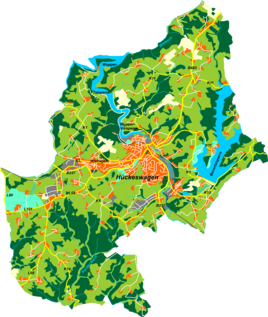
Location of Wiebachmühle in Hückeswagen |
||
|
Wiebachmühle in the Wiebachtal at the beginning of the 20th century
|
||
The Wiebachmühle even Wiebachhammer , Wiebe Shrouded hammer or short Wiebach was a mill plant and a residential space in Hückeswagen at the city limits to Radevormwald exit of the Wiebach tals at the mouth into the Wupper . The Wiebach pre-dam of the Wuppertal dam floods the area today.
In the vicinity of the mill, copper ore was mined in the Carolinagrube mine in the 19th century .
Location and description
The Wiebachmühle was located apart from other settlements in a deep valley at the confluence of the Wiebach and the Hulverscheider Bach , which were dammed up in a large mill pond, just before the mouth of the Wupper. Neighboring towns were Hammersteinsöge , Oberhombrechen , Mittelhombrechen , Vormwald , Berg and Ispingrade . A footbridge led from the mill directly to a pond.
history
The Wiebachmühle was first mentioned in a document in 1607 when a Niklas Hombrecher received permission to build a fulling mill at the mouth of the Wiebach . Another mention was in 1715, when a Johann Omminghaus had to pay a quarter of gold gulden recognition for this fulling mill. In 1748, the Kräwinklerbrück merchant Johannes Flender bought the facility and built two horizontal hammers in its place . His recognition then also looked after half a gold guilder.
In 1815/16 nine people lived in the village. In the map of the Topographical Survey of the Rhineland from 1824, a mill symbol is drawn below the mouth of the Hulverscheider Bach in the Wiebach . The name of the location is given with Wiebecke . The name suffix -beck is a Low German form of Bach .
In the first third of the 19th century, the water drive was leased to the operators Forstmann and Brand , who finally bought the system in 1831. The Prussian first recording from 1840 to 1844 also shows a mill in the same place. The inscription here reads bone mill .
In 1832 Wiechbachmühle, under the name Wiebeckerhammer , belonged to the Herdingsfelder Honschaft , which was part of the Hückeswagen external citizenship within the Hückeswagen mayor's office . The location, which was categorized as a factory facility according to the statistics and topography of the Düsseldorf administrative district , had a factory or mill and two agricultural buildings at that time. At that time, four people lived in the village, all of whom were Protestant.
In 1841 the system was converted into a spinning and fulling mill for cardigans by the Ludwig Freymann & Cie company . A few years later, on November 17, 1854, the Carolinagrube mine was officially mined for the first time for the first time. The deposit is likely to have been known and used earlier. When the spinning mill burned down in 1879, it was not rebuilt.
In the municipality lexicon for the Rhineland province in 1885, a house with 14 inhabitants is given. At that time the place belonged under the name Wiebach to the rural community Neuhückeswagen within the Lennep district . In 1895 the place had two houses with 15 inhabitants, in 1905 one house and twelve inhabitants.
From the official topographic map 1: 25,000 ( Prussian new record ) from 1893 to 1895, the name Wiebach is used. The private teacher Ferdinand Diekmann from Wuppertal maintained a school camp in another building at the Wiebach estuary until 1939 . The last building in which private individuals last lived was demolished in 1956. It was located directly on the Himmelswiese and was a popular local recreation destination. The topographic map 1: 25,000 from 1989 shows the location of the mill already flooded by the Wuppertalsperre.
Individual evidence
- ↑ a b c d The Wiebachmühle at wupperindustrie.de
- ↑ a b Johann Georg von Viebahn : Statistics and topography of the administrative district of Düsseldorf. Part 2: Containing the statistical table of places and distances and the alphabetical index of place names. Schreiner, Düsseldorf 1836, p. 13 .
- ↑ a b c Historika25, Landesvermessungsamt NRW, sheet 4809, Remscheid
- ^ Royal Statistical Bureau (Prussia) (Ed.): Community encyclopedia for the Rhineland province. Based on the materials from the census of December 1, 1885 and other official sources (= community encyclopedia for the Kingdom of Prussia. Vol. 12, ZDB -ID 1046036-6 ). Publishing house of the Royal Statistical Bureau, Berlin 1888.
- ^ Royal Statistical Bureau (Prussia) (Ed.): Community encyclopedia for the Rhineland province. Based on the materials from the census of December 1, 1895 and other official sources (= community encyclopedia for the Kingdom of Prussia. Vol. 12). Publishing house of the Royal Statistical Bureau, Berlin 1897.
- ^ Royal Statistical Bureau (Prussia) (Ed.): Community encyclopedia for the Rhineland province. Based on the materials from the census of December 1, 1905 and other official sources (= community encyclopedia for the Kingdom of Prussia. Vol. 12). Publishing house of the Royal Statistical Bureau, Berlin 1909.


