Hartkopsbever
|
Hartkopsbever
City of Hückeswagen
Coordinates: 51 ° 8 ′ 23 ″ N , 7 ° 21 ′ 21 ″ E
|
||
|---|---|---|
| Height : | 270 m above sea level NN | |
| Postal code : | 42499 | |
| Area code : | 02192 | |
|
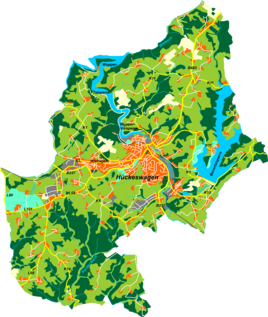
Location of Hartkopsbever in Hückeswagen |
||
|
Jung-Stilling-Haus in Hartkopsbever
|
||
Hartkopsbever , in the early 19th century also Philippsbever , is a village in Hückeswagen in the Oberbergisches Kreis in the administrative district of Cologne in North Rhine-Westphalia ( Germany ).
Location and transport links
Hartkopsbever is located in the southeastern Hückeswagen near the Bevertalsperre . The place forms a growing settlement area with the district Tannenbaum .
Neighboring places are Großeichen , Stahlschmidtsbrücke , Kleineichen , Tannenbaum, Steinberg , Dierl , Reinshagenbever and Heide . The place is on the district road K5 between the federal road 237 (B237) and the Bevertalsperre.
The Bever , dammed up into a small pond, flows past the place before it flows into the Wupper shortly afterwards .
history
The historical map Topographia Ducatus Montani from 1715 shows a single courtyard and names it "Bever" . The map topographical survey of the Rhineland from 1825 shows two enclosed courtyards at the Hartkopsbever site and also names them “Bever” . In the Prussian premiere from 1840 to 1844 the place is called "Phillips Bewer" . The name Hartkopsbever is used with the topographic map from 1894 to 1896.
In the 18th century the place belonged to the Bergisches Amt Bornefeld-Hückeswagen . On March 5, 1719, a hammer smith Johann Jacob Hartkop (* 1698), who immigrated from Cronenberg , licensed a Reckhammer on the Bever, a second took place on April 6, 1720 and a third on October 1, 1744. The third was together with founded by his son of the same name (1718–1797), who took over the hammer mill when he was just 21 years old. From a mill pond, which was extensively expanded in 1768 and still exists today, but partially silted up, three upper ditches led the water to the water wheels that drove the drop hammer and the forge blower. The raw material was transported from the Siegerland via the Bergische Eisenstrasse , which runs close by .
The second son, Johann Engelbert Hartkop , was the builder of what is now known as the Jung-Stilling-House in 1758 . The house was the home of the Hartkop family, where the ophthalmologist and writer Jung-Stilling worked as a private tutor from 1762 to 1763 . His biography, which he wrote himself, gives an insight into the life of the wealthy Bergisch hammer mill owner family. Because of the activities of the Hartkop family that dominated the place, the place was also called Hartkopsbever from now on. The third son, Peter Hartkop, expanded the Hammerteich in 1768 to operate all of the three sons' hammer mills.
In 1815/16 there were 21 residents in the village. In 1832 Hartkopsbever still belonged to the Berghauser Honschaft under the name Philippsbever , which was part of the Hückeswagen external citizenship within the Hückeswagen mayor . The place, categorized as a merchant's house and iron hammer according to the statistics and topography of the Düsseldorf administrative district , had two residential buildings, a mill or factory and four agricultural buildings at that time. At that time there were twelve people living in the village, four of whom were Catholic and eight were Protestant.
In the municipality lexicon for the Rhineland province , eight houses with 103 inhabitants are given for 1885. At that time the place belonged to the rural community Neuhückeswagen within the Lennep district . In 1895 the place had eight houses with 97 inhabitants, in 1905 nine houses and 71 inhabitants.
Attractions
In Hartkopsbever there are listed stone and half-timbered houses , including the Jung-Stilling-Haus.
Hiking and biking trails
The following hiking trails lead through the village or past it:
- The district hiking trail ◇ 6 ( Wupperweg ) of the SGV district of Bergisches Land
- The road of work of the SGV district Bergisches Land
- The Hückeswagen circular route O
- The local hiking trail △ from Elberhausen to the Goldenbergshammer
- The local circular route A4
The water quintet cycle route , a project as part of the Regionale 2010, runs through the village
Individual evidence
- ^ Historika25, Landesvermessungsamt NRW, sheet 4810, Wipperfürth
- ^ A b Wilhelm Blankertz: Our Bevertal as an industrial area. ( Online version ).
- ^ Johann Georg von Viebahn : Statistics and topography of the administrative district of Düsseldorf. Part 2: Containing the statistical table of places and distances and the alphabetical index of place names. Schreiner, Düsseldorf 1836, p. 13 .
- ^ Royal Statistical Bureau (Prussia) (Ed.): Community encyclopedia for the Rhineland province. Based on the materials from the census of December 1, 1885 and other official sources (= community encyclopedia for the Kingdom of Prussia. Vol. 12, ZDB -ID 1046036-6 ). Publishing house of the Royal Statistical Bureau, Berlin 1888.
- ^ Royal Statistical Bureau (Prussia) (Ed.): Community encyclopedia for the Rhineland province. Based on the materials from the census of December 1, 1895 and other official sources (= community encyclopedia for the Kingdom of Prussia. Vol. 12). Publishing house of the Royal Statistical Bureau, Berlin 1897.
- ^ Royal Statistical Bureau (Prussia) (Ed.): Community encyclopedia for the Rhineland province. Based on the materials from the census of December 1, 1905 and other official sources (= community encyclopedia for the Kingdom of Prussia. Vol. 12). Publishing house of the Royal Statistical Bureau, Berlin 1909.


