Grünestrasse
|
Grünestrasse
City of Hückeswagen
Coordinates: 51 ° 7 ′ 54 ″ N , 7 ° 19 ′ 32 ″ E
|
||
|---|---|---|
| Height : | 305 m above sea level NN | |
| Postal code : | 42499 | |
| Area code : | 02192 | |
|
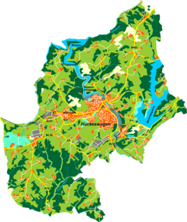
Location of Grünestrasse in Hückeswagen |
||
Grünestraße is a court in Hückeswagen in the Oberbergisches Kreis in the administrative district of Cologne in North Rhine-Westphalia (Germany).
Location and transport links
Grünestrasse is located in the southern part of Hückeswagen on the K5 district road. Neighboring places are Kleinenscheidt , Großenscheidt , Sohl , Neuenholte , Altenholte , Röttgen and Posthäuschen . Grünestraße is no longer farmed agriculturally, but houses a regionally known inn. The place on the watershed between Wupper and Dhünn borders on the forest and recreational area Mul .
history
1532, the town was first mentioned in records, " Engell, Kielgen his housewife and 3 children up to the Straitgen in Honschaft Duryfeld " are mentioned in a list of inhabitants. Spelling of the first mention : up der Straitgen .
Hiking and biking trails
The following hiking trails lead through the village or past it:
- The local hiking trail □ from the Wermelskirchener Bone Mill to the Bevertalsperre
- The local hiking trail ━ from Purd to the Wiebach-Vorsperre
- At Grünestraße there is a parking lot for hikers, where the local hiking trails A1, A2, A3, A4, A5 and A6 (Mul / Purd) begin.

