Elbertzhagerhäuschen
|
Elbertzhagerhäuschen
City of Hückeswagen
Coordinates: 51 ° 7 ′ 34 ″ N , 7 ° 19 ′ 52 ″ E
|
||
|---|---|---|
| Height : | 326 m above sea level NN | |
| Postal code : | 42499 | |
| Area code : | 02192 | |
|
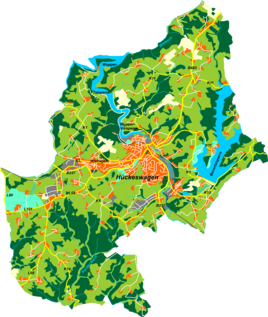
Location of Elbertzhagerhäuschen in Hückeswagen |
||
|
Fire station in Elbertzhagerhäuschen
|
||
Elbertzhagerhäuschen is a residential area in Hückeswagen in the Oberbergischer Kreis in the administrative district of Cologne in North Rhine-Westphalia ( Germany ).
Location and transport links
Elbertzhagerhäuschen is located in the southern Hückeswagen directly on the border with Wipperfürth on the edge of the forest and recreational area Mul . It forms a common area with the Elbertzhagen district of Wipperfürth , but is separated from it by the city limits. Other neighboring towns are Altenholte , Neuenholte , Sohl , Grünestrasse , Röttgen , Posthäuschen and Wipperfürth- Arnsberg . Neuenholte can be reached via a connecting road that branches off from the K5 district road at Altenholte and leads to federal road 506 at Wipperfürth-Schniffelshöh.
The Hofschaft lies on the watershed between Wupper and Dhünn . There is a fire station in the village .
history
Elbertzhagerhäuschen is already marked under this name on the topographical survey of the Rhineland from 1824.
In 1815/16 five residents lived in the village. In 1832 Elbertzhagerhäuschen belonged to the Great Honorship , which was part of the Hückeswagen external citizenship within the Hückeswagen mayor's office . The place, which was categorized as an inn according to the statistics and topography of the Düsseldorf administrative district , had a residential building at the time. At that time, six people lived in the village, all of whom were Protestant.
Hiking and biking trails
The following hiking trails lead through the village:
- The local hiking trail ━ from Purd to the Wiebach-Vorsperre
- The local circular hiking trails A1, A3 and A4 ( Mul / Purd)
Individual evidence
- ^ Johann Georg von Viebahn : Statistics and topography of the administrative district of Düsseldorf. Part 2: Containing the statistical table of places and distances and the alphabetical index of place names. Schreiner, Düsseldorf 1836, p. 10 .


