
San Bernardino Pass
| San Bernardino Pass | |||
|---|---|---|---|
 San Bernardino Pass: top of the pass with hospice |
|||
| Compass direction | north | south | |
| Pass height | 2067 m above sea level M. | ||
| Canton | Grisons | ||
| Watershed | Maseggbach → Hinterrhein → Rhine | Moësa → Ticino → Po | |
| Valley locations | Hinterrhein | San Bernardino | |
| expansion | Street | ||
| Built | 1821-1823 | ||
| Winter closure | December - April | ||
| Mountains |
Adula Alps (West) Tambogroup (East) |
||
| profile | |||
| Ø pitch | 5% (454 m / 9.1 km) | 6.1% (457 m / 7.5 km) | |
| Max. Incline | 9.7% | 9.7% | |
| map | |||
|
|||
| Coordinates | 732 992 / 151004 | ||

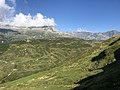
The San-Bernardino-Pass ( Eng. Little used also Sankt-Bernhardinpass or short Sankt Bernhardin , Italian Passo del San Bernardino , Romansh Pass dal Sogn Bernardin ) is a mountain pass in the Swiss canton Graubünden with a peak height of 2067 m above sea level. M. It connects the valleys Rheinwald on the northern and Misox on the southern side of the main road 13 and separates the west in the Adula Alps from the Tambogruppe the east. The air distance to the pass locations is four kilometers to Hinterrhein (located at 1620 m) and 12 km to Mesocco (790 m). The main European watershed and the language border between German and Italian run at the top of the pass .
Surname
The pass, previously known as Mons Avium or Vogelberg , got its name in the 15th century when a chapel was built in honor of St. Bernardine of Siena .
In German, the form of the San Bernardino Pass, newly formed in the 20th century, has largely replaced the historic Bernhardin Pass (Bernhardinberg) . Despite the similarity of names, there is no relation to the passes of the Great and Little Saint Bernard Passes .
History and route
The Romans already used the wide, topographically simple pass crossing. The path, which was used until the late Middle Ages, led about one kilometer east of today's pass road at the foot of Piz Uccello (German: Vogelhorn ).
Increased clearing increased the risk of avalanches. In order to benefit from the increasing transit traffic in the 15th century - the road through the Viamala was expanded after 1473 - the people of the inner Rheinwald and their Misox neighbors had to act. They relocated the route from the endangered foot of the slope to the middle of the wide saddle, a landscape with round bumps and small moors shaped by the ice age glacier cut . The construction of the Church of San Bernardino on the south side of the pass around 1450 also fell into this era. The one with paving and steps on the steep places very solidly built Saumweg ( mulattiera ) has well preserved and now serves as a historical trail.
Around 1770, the villages of Hinterrhein, Nufenen and Mesocco expanded the Bernhardin into a passable road. They eliminated the remaining avalanche-prone passage on the Geissberg , which led to the Alte Landbrugg , built in 1693 , by crossing the Rhine further west and accepting a greater incline in the Alt Wali . At the top of the pass, the path was also relocated to the west, so that it overcame the saddle at the deepest point. This little street - misleadingly called Strada Romana - can still be walked today.
On March 7, 1799, at the Laghetto Moesola on the pass, a military conflict broke out between a French army under General Claude-Jacques Lecourbe , which attacked the Austrians, and the 500 men of the Rheinwalder Landsturm. The French routed the Rhine forests and marched into the valley.
In 1817 the Graubünden government commissioned the road builder and State Councilor Giulio Pocobelli (1766–1843) to develop a project with a cost estimate for a road from the Ticino canton border over the pass to Chur. Within a few days, Pocobelli walked the 100-kilometer route and determined the route. He then received the contract for the construction from the Graubünden government as general contractor. Construction began on September 18, 1818. Lombardy and the Gotthard cantons of central Switzerland resisted construction . The road, which was built by the Kingdom of Sardinia-Piedmont and is still used by local motorists today, follows the route of 1770, but mitigates the inclines with many bends. A hospice was opened at the top of the pass .
At the south ramp, Pocobelli laid the road on the slope on the right bank of the Moësa and spanned it at its narrowest point with the Vittorio Emanuele bridge . Without counting the bridges in Reichenau , 52 bridges were built (6 of which were only expanded), all of which were made of stone, with the exception of three. The bridge near Hinterrhein was the only one to have several arches, the three arches each spanning 36 feet. 92,281 cubic meters of rock were blown up with 1,350 quintals of black powder. 42,900 cubic meters of stone were built into 9750 meters of retaining walls, plus 6650 meters of wall walls. The municipalities provided 32 kilometers of wooden railings free of charge. The extra post from Chur to Bellenz made the route in 14–15 hours after the opening.
South ramp

The pass from Piz Uccello from
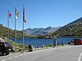
San Bernardino, top of the pass

Stagecoach of the San Bernardino Line


San Bernardino tunnel


On April 10, 1965, the tunnel of the San Bernardino tunnel ( Italian Galleria del San Bernardino ) between the villages of Hinterrhein (north portal at 1613 m above sea level ) and San Bernardino (south portal at 1631 m above sea level ) was broken through by mining and opened to traffic on December 1, 1967. The 6.6 km long road tunnel for the first time enabled a year-round connection for the southern Graubünden valleys Misox and Calancatal to the capital Chur and, as part of the national road N13 (today A13 ), connects eastern Switzerland with the southern side of the Alps and Ticino . After the Gotthard, it is the second most important road-Alpine crossing in Switzerland.
At the time of planning, today's traffic density could not be foreseen. The San Bernardino route served the international heavy traffic as an alternative route to the A2 , especially after the accident-related, temporary closure of the Gotthard tunnel in 2001, although the route has gradients of up to 8%, tight turns and the narrow tunnel is very unsuitable for trucks; the width of the lane is tight and the ventilation systems did not meet the requirements. The corresponding loads had made it necessary to renew the tunnel. The renovation work started in 1991 - flanked by safety measures such as the introduction of the red phase - was completed in 2006. A separate escape and rescue tunnel was built as part of the renovation and the following modifications were made:
- Lowering of the sole of the central canal
- Renewal of the drainage system (separation system) and the ducts
- Renewal of the electromechanical equipment
- Adapt operational and fire ventilation to today's requirements
- Creation of an escape and rescue tunnel (escape exits)
- Demolition and rebuilding of the road construction
- Renewal of the wall cladding panels
- Repairs while maintaining traffic
The total construction costs were around CHF 236 million (approx. 148 million euros).
Origin of the old name Vogelberg
The old name Vogelberg possibly refers to the migratory birds that pass here in large flocks every year.
However, due to the same proven designation "Vogelberg" for the Rheinwaldhorn and the entire mountain range as well as the only pass San Bernardino frequently used in antiquity or the earlier Vogelberg Pass of the Central Alps above ( Gotthard Pass and Lukmanier Pass were only opened later), the derivation of birds is very likely a folk etymology. Rather, the name is likely to come from Indo-European * uek / -uak / -uei (k) to Latin “vacillare” as “to be bent, bend, sway”, d. H. the entire mountain massif as well as the starting and target valleys of the pass crossing are different than usual crooked (twisted) to each other and are not aligned in the same way.

See also
- Shipping canal projects in the Alps , via u. a. the unrealized Gotthard, Greina and San Bernardino canals
literature
- Armon Planta : Traffic routes in ancient Raetia . Volume 4. Chur, 1990. ISBN 3-905241-06-4
- Jürg Simonett: San Bernardino (pass). In: Historical Lexicon of Switzerland . January 10, 2011 .
Web links
- Rehabilitation of the pass road
- San Bernardino Pass at ethorama.library.ethz.ch/de/node
Individual evidence
- ↑ top of the pass , on map.geo.admin.ch
- ↑ a b c J. Jakob Meyer: The new roads through the canton of Graubünden to Lake Langen and Lake Como. Zurich 1826, p. 92.
- ↑ Bündner Calendar 2010, p. 112
- ↑ San Bernardino Tunnel at ethorama.library.ethz.ch/de/node
- ^ Graubünden civil engineering department: San Bernardino tunnel: 40 years and completely renewed , September 2007
- ↑ cf. Pokorny, Indo-European Etymological Lexicon; Pp. 1130/1134
Ächerli • Agites • Aiguillon • Albis • Albula • Balmberg • Benkerjoch • Bernina • Böhler • Bözberg • Breitehöchi • Brünig • Buechenegg • Bürersteig • Chall • Challhöchi Pass • Champex • Chasseral • Chatzenstrick • Chilchzimmersattel • Croix • Croix • Croix de Coeur • Eichhöhe • Étroits • Etzelpass • Flüela • Forclaz • Furka • Ghöch • Givrine • glass • Glaubenberg • Glaubenbielen • Gottschalkenberg • Grimsel • Grosse Scheidegg • Gr.St.Bernhard • Gurnigel • Haggenegg • Hahnenmoos • Heitersberg • Hilferen • Hirzel • Hirzel Höhi • Hulftegg • Ibergeregg • Jaman • Jaun • Julier • Kerenzerberg • Klausen • Kunkels • Lein • Lenzerheide • Livigno • Lukmanier • Maloja • Marchairuz • Mollendruz • Mont Crosin • Monte Ceneri • Mont d'Orzeires • Montvoie • Morgins • Mosses • Mutschellen • Neggia • Nufenen • Oberalp • upper Hauenstein • Oberricken • oven • Orn • Passwang • Pierre Pertuis • Pillon • Planches • Pontins • Pragel • edge crossing • Rangiers • rates • Rengg • crocheted • Roches • 'groups • R üsler • Saanenmöser • Salhöhe • San Bernardino • Sanetsch • Santelhöchi • Sattel • Sattelegg • Schafmatt • Schallenberg • Schelten • Schönau • Schufelberger Egg • Schwägalp • Schwarzenbühl • Siblingerhöhe • Simplon • Splügen • St. Anton • St. Gotthard • St. Luzisteig • Staffelegg • Stoss • Susten • Tourne • Tronc • Umbrail • Unterer Hauenstein • Front Höhi • Vue des Alpes • Wasserfluh • Weissenstein • Wildhaus • Wissegg • Wolfgang