
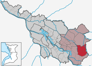
Osterholz (Bremen)
| District of Bremen Osterholz |
||
|---|---|---|
  |
||
| Basic data | rank | |
| Surface: | 12.896 km² | 12/23 |
| Residents : | 38,072 | 4/23 |
| Population density : | 2,952 inhabitants per km² | 8/23 |
| Proportion of foreigners: | 19.2% | 8/23 |
| Unemployment rate: | 11.8% | 10/23 |
| Coordinates : | 53 ° 4 ′ N , 8 ° 56 ′ E | |
| Districts: |
Ellener Feld Ellenerbrok-Schevemoor Tenever Osterholz Blockdiek |
|
| Postcodes : | 28307, 28309, 28325, 28327 | |
| District : | east | |
| Local office : | Osterholz | |
| Website: | Osterholz local office | |
| All area information as of December 31, 2014. All demographic information as of December 31, 2016. |
||
Osterholz ( Low German Oosterholt ) is a district of Bremen and belongs to the Bremen district east .
Geography and districts
Osterholz is located about eight kilometers east of Bremen city center. On Osterholz that the district boundaries Hemelingen related districts Mahndorf in the south, Arbergen the southwest and Sebaldsbrück in the west, the district of Vahr in the northwest, and the district Oberneuland in the north, and beyond the federal highway 27 the community Oyten in the east.
The center of the district with the former village of Ellen lies on a Geestinsel, which extends from Osterholzer Dorfstraße in the south to the Grenzwehr road in the north and from Osterholzer Friedhof in the west to Am Hahnenkamp in the east. The marshland to the northeast is drained by the Hollerfleet, which flows into the Wümme above Borgfeld. The area of origin of the Kleine Wümme extends to the west and south .
Ellener field
Geographical location: 53 ° 3 ′ 57 ″ N , 8 ° 55 ′ 42 ″ E
Area: 1.55 km², 3343 inhabitants
The district includes the Osterholzer Friedhof and the small-scale residential development adjoining it to the east up to Osterholzer Landstrasse . It corresponds to the western part of the old village of Ellen and, south of Kämenadeweg and An der Kämenade , of the Osterholzer Kornfeld.
Ellenerbrok-Schevemoor
Geographical location: 53 ° 4 ′ 17 ″ N , 8 ° 56 ′ 58 ″ E
Area: 2.23 km², 11,940 inhabitants
The primary school on Ellenerbrokweg is a four-class primary school with twelve class families and four year classes. 20 teachers, twelve supervisors and other employees are available for a total of around 330 primary school students (as of 2009). Lessons in grades one to three take place in cross-grade class families. The school is a support center with grades one to six and 80 children on site as well as for six neighboring primary schools. The offer includes: reading club, listening club, soccer club (boys and girls), theater club, school choir; Student council; School yard designed by parents and teachers; Muesli club (breakfast offer) and an open after-school care center.
The Ev. The parish of Ellener Brok on Graubündener Strasse has signed the Ev. Parish Blockdiek and the Ev. Tenever parish merges to form the Evangelical Trinity Parish Bremen . The three churches with their community centers and kindergartens will be retained and - in addition to pastoral work - will focus on content. For Ellener Brok, these are confirmation and youth work, as well as educational offers for adults (seminars, literary circles, memory training). The community center built by the architect Hermann Brede in 1968–1969 was the first sacred building entirely made of exposed concrete in Bremen. He is committed to the internationally widespread style of brutalism (from béton brut = formwork-rough exposed concrete). The church was divorced on May 31, 2015 and demolished in 2017.
Tenever


Geographical location: 53 ° 3 ′ 46 ″ N , 8 ° 57 ′ 50 ″ E
Area: 2.54 km², 10,018 inhabitants
The name of the district means 'to the bank', as was better recognized from the earlier spelling Tenöver , and is explained by the location on the edge of the Wümmewiesen east of the Ellener Geestinsel.
In the 1970s a large housing estate was built here with numerous apartment blocks with up to 21 floors and a total of over 2500 apartments. For the “demonstrative building project” and “exemplary housing development”, 4,600 apartments were planned based on the architects' model of “urbanity through density” - but the apartments were difficult to rent out.
In 2004, the renovation of the district began and around a third of these apartment blocks were demolished, managed by the Osterholz-Tenever property company founded for this purpose. The so-called Kessler Block and Block 410 have already been demolished, and natural meadows and a skate track have been set up on the areas. New concepts and an extension of tram line 1 are to make the district more attractive again after over 50% of the apartments were temporarily vacant. People of over 80 different nationalities live in the district. The renovation work as part of the urban redevelopment west funding program was completed in 2009.
The Ev. The parish of Tenever on Sankt-Gotthard-Straße started on January 1, 2008 with the Ev. Parish Blockdiek and the Ev. Parish of Ellener Brok merged to form the Evangelical Trinity Parish of Bremen . The three churches with their community centers and kindergartens will be retained and - in addition to pastoral work - will focus on content. For Tenever it is the community office and cross-generational offers.
Osterholz

Geographical location: 53 ° 3 ′ 14 ″ N , 8 ° 56 ′ 32 ″ E
Area: 5.36 km², 5153 inhabitants
The Osterholz district is separated from the other districts by Osterholzer Heerstraße . It consists of different parts of different characters:
The old village extends along the Osterholzer Dorfstrasse and the Holter Fleet. Although new single-family houses have been added to the old courtyards, it still looks village-like. The farmhouse at Osterholzer Dorfstraße 29 is a listed building.
In the 1930s to 1970s, an extensive residential area was built in the east of the Osterholzer Feldmark between Ehlersdamm and Osterholzer Fleet, and a small area west of the village was included in the "railway settlement " in Sebaldsbrück .
Businesses settled along Osterholzer Heerstrasse. Around 1990, an extensive industrial area was built east of the Osterholzer Fleet with a few DIY stores and specialist stores and the Weserpark shopping center - one of the largest in northern Germany.
Since around 2000, a new residential area has been created between Osterholzer Heerstraße and the old village location. The development of the Osterholzer Feldmark south of the old village, which has been considered for years, is controversial.
Block diek


Geographical location: 53 ° 4 ′ 33 ″ N , 8 ° 55 ′ 28 ″ E
Area: 1.21 km², 7022 inhabitants
The Blockdiek district was built in a modern style between 1965 and 1970 following the Neue Vahr . The name indicates the original state of the cultivated land. It is derived from “Diek” or “ Deich ” over a “Brock” or “Block”, ie over a lower area. The groundwater level in the district is kept constant with a drainage system via a system of receiving waters and ditches. This task is incumbent on the Bremischer Deichverband on the right bank of the Weser .
The Blockdiek housing estate, planned for around 10,000 residents, is divided into three quarters, each of which is connected to Ludwig-Roselius-Allee via just one street . The district, which was created under the client Neue Heimat Bremen (architect: Roland Birnstein), is based on the idea of an “ascending landscape”, in which the building heights rise steadily from the edges to the center. The development is graded from atrium and row houses over four-story blocks in courtyard-forming patterns and ends at Hauptstraße (Ludwig-Roselius-Allee) with two 14- and 18-story high-rise buildings and a shopping center.
Blockdiek is surrounded by the Osterholz cemetery , allotment areas and the Achterdieksee on the other side of the Autobahn 27 .
The elementary school on Düsseldorfer Straße has existed since 1967. The three- and four-class elementary school is today (2008) an all-day school with around 310 students and 28 teachers, educators and social workers. The profile as a moving school includes project work and working groups such as circus, theater, art, mediators, as well as a cooperation with the Kunsthalle Bremen . The Blockdiek neighborhood education center has been supporting the promotion of educational conditions for children and their parents since 2009 . It uses six group and work rooms at the primary school and is sponsored by the Hans Wendt Foundation . The offer for children and parents consists of advice, courses and group work as well as civic engagement. www.blockdiek-bremen.de
The Protestant community Blockdiek at the Guenther-Hafemann Street has as of 1 January 2008 with the Evangelical Church of Ellener Brok and the Evangelical Church of Tenever merged to form the Evangelical Trinity of Bremen . The three churches with their community centers and kindergartens will be retained and - in addition to pastoral work - will focus on content. For Blockdiek it's music and culture.
Politics, administration
Advisory Board
The Osterholz Advisory Board meets regularly and usually in public in the local office or in other institutions such as B. Schools. The advisory board is composed of the representatives of the political parties or individual candidates elected at the district level. The advisory board elections take place every four years, at the same time as the elections for the Bremen citizenship . The advisory board discusses all issues of the district that are of public interest and makes decisions on this, which are passed on to the administration, the state government and the townspeople. He forms specialist committees for his work. The advisory board has its own budget for district-related measures.
Local office
The Osterholz local office has been a local administrative authority since 1946. It supports the advisory board in its political work. It is intended to participate in all local tasks that are of public interest. It is led by a local office manager proposed by the advisory board and confirmed by the Senate. Ulrich Schlüter is the head of the local office.
history
prehistory
The landscape was shaped by the various ice ages - the Pleistocene - and the warm periods in between. The glacial valley of the Weser also shaped the Osterholz landscape with sand plates, swamps and small moors.
In the Younger Stone Age - around 4,000 BC. BC - an early settlement of the marshes may have taken place. Around 200-300 BC The settlement was carried out by the Germanic Chauken , as evidenced by finds a. a. on the present-day site of Daimler AG and urn graves from the Iron Age in the area of Stieglitzstraße and Am Hallacker as well as remains of settlements on Ellener Dorfstraße .
Middle Ages and Modern Times up to 1850

Osterholz was first mentioned as Osterholt (e) (wood in the east) in 1181, when the Archbishop of Bremen signed a contract with Dutch settlers about the settlement in the areas of Overnigelant, Rockwinkil, Osterholt et Vurhult . Osterholz - also written as Hosterholte in 1246 - then belonged to the Goh des Hollerland in 1426 . Osterholz belonged to the parish of Oberneuland until 1936 ; after that there was a separate parish with a church.
Tenever was called Tedenevere around 1246 , then also Thedenevere , Teddenervere and later Tenöver . Due to its location on a small river, the name Tenöver or To'n Oever - i.e. on or above the watercourse - is interpreted.
The village of Ellen was mentioned as Elen in 1300 and named Elne in 1354 . This highest located place belonged since 1426 like Osterholz to Goh Hollerland and later to the rural community Osterholz. Until 1377 the place belonged to the parish Arbergen , then Oberneuland and from 1936 to the parish Osterholz.
The Schevemoor , the crooked moor, was a common land - a communal pasture area - the Osterholz settlers. Schevemoor also belonged to the Goh Hollerland and was always part of Osterholz.
The first fifteen settlers in Osterholz were still free hoppers , i.e. full farmers . They had stately yards that were 40 hectares in size. The church and the nobility followed into the great rural areas. The free peasants lost their freedom over the centuries and became dependent on the aristocratic landlords in terms of meierrecht . The legal situation only improved in the middle of the 19th century. Now it was the owning farmers who controlled Osterholz.
According to the class suffrage in Bremen (see here ) of 1854, the 32 voters of the first two classes (15 full farmers , 11 half farmers, 1 one-thirds farmer, 5 Kötner ) had 530 votes and the 183 voters of the third and fourth class (68 Brinksitzer and 115 Häusler ) only 251 votes.
Infrastructure development
In 1670 Osterholz opened its own school for the first time. In 1812 only 433 people lived in Osterholz. From 1810 to 1813 the Osterholzer Heerstraße , which opened up the district but later separated it, was expanded. To the south of the road, the rural areas were preserved, while to the north, built-up urban structures developed increasingly. A windmill was built in 1836, some of which burned down in 1935 and was operated with motor power until the end of the 20th century. From 1847 on there was also an oil and paper mill.
Until the middle of the 19th century, Osterholz was shaped by the farms and the country estates. The estate between Osterholzer Heerstrasse and Hans-Bredow-Strasse , which the family of the mayor Georg Gröning had owned since 1815, was remarkable . After that it was to serve as the residence of the Hanover consul August Brauer. In 1951 the manor houses were demolished. The oldest, still preserved half-timbered building is the yard of the Lachmund family, which was built in 1755.
As early as the 14th century, the family of the famous mayor of Büren owned an estate in Tenever on Osterholzer Heerstraße. In the 18th century the merchant Gerhard Oelrichs (grandfather of Johann Carl Conrad Oelrichs ) bought the 55 hectare estate. Today the Egestorff Foundation's retirement home is here.
The farms of the peasants, on the other hand, were much more modest. In the 19th century, the merchant Heinrich Gottlieb Ehlers managed a small farm with 1.5 hectares and sold it to the cathedral parish in 1922 for the establishment of the St. Petri orphanage .
After 1882, a small park was laid out on parts of Johann Kropp's farm on Osterholzer Heerstraße and an estate was built, which today houses the Osterholz local office .
Developments after 1850
Psychiatry in Ellen and Osterholz
In the 18th century, the Rockwinkler physician Friedrich Engelken was supposed to introduce “family care for the insane ”. In 1884 112 foster children were housed with 58 families and in the 1930s over 200 former patients were living in family land care. From 1900 to 1904 and 1907 to 1915, according to plans by the architects Hugo Wagner and Hans Ohnesorge, the St. Jürgen Asylum was built for around 300 mentally and nervously ill people in the village of Ellen. A small village developed on 14 hectares. The houses and complex are now under monument protection (see list of cultural monuments in Osterholz ). In 1910 there were 553 patients and 191 employees in the institution and at the end of 1938 there were 851 patients and 250 employees. During the Nazi era, 409 sick people were murdered. From 1950 to 1970, psychiatric health care was fundamentally changed. In 1977 the new East Hospital was opened as a major hospital .
The Ellener Hof
In 1847, based on the model of the Rauen House , an educational institution for neglected children was built for initially 50 pupils . In 1930 there were 100 places in the home and after additions were made there were now 163 boys in 1968. For several years now, the Ellener Hof Association has been running a senior citizens' residential complex with assisted living on the site.
St. Petri Orphanage
In 1922 the St. Petri orphanage on Osterholzer Dorfstrasse was opened for 12 children. In 1926 50 boys lived here. Even today, the child and youth welfare service offers caring help in homes and after-school care centers.
Egestorff Foundation retirement home

The manor house from 1857 based on plans by Büren-Oelrichs and the outbuildings and the grounds of the Egestorff Foundation 's old people's home - Osterholzer Heerstraße 192 - were donated by Johann Heinrich Egestorff (1859-1905) in his will. After 1905 to 1912, the retirement home and the landscape garden with its sculptures from the 18th to 20th centuries were built according to plans by Werner Heyberger . Over 200 seniors lived in the home afterwards. After renovations and extensions were made, around 350 elderly people lived in the home around 1960. ( See the homepage of the Egestorff Foundation under web links )
Other social facilities
The mother and baby home in Tenever existed from 1910 and in 1925 had space for a hundred babies and toddlers and for 30-40 mothers. The building complex was demolished in 1959 for new residential construction.
The Osterholz cemetery
In 1907, the cemetery areas for Bremen had to be expanded. It was designed by the horticultural director Paul Freye and architect Franz Seeck of Osterholz cemetery . The area used as a farm until 1910 was dedicated as a cemetery in 1920. With over 80 hectares for over 100,000 resting places, it is currently the largest cemetery in Bremen.
Expansion of structures
Osterholz was and is mainly a place of residence. From the end of the 19th century, trade and industry settled in the neighboring Sebaldsbrück and Hemelingen . In 1920 the tram line 12 - which led to the Osterholzer Friedhof - opened and in 1926 the line was extended to Osterholzer Landstraße , but was dismantled again in 1939. Buses then supplied the district.
Housing construction in Osterholz
In the 1930s, Osterholz experienced a structural upswing for those willing to build who liked to build their houses in more rural areas. 47 small settlements were created on Oyterstrasse, 30 houses on Oewerweg, 160 apartments in the Rahdelandsiedlung, 90 apartments in the Focke-Wulf-Siedlung at Osterholz cemetery. In 1938 the Kuhkampiedlung was built.
time of the nationalsocialism
In 1933 Georg Schumacher had to give up his office as community leader as an SPD member. The National Socialists now dominate all offices, the clubs and the settlement. Only “honorable national comrades ”, “German Reich citizens ” or “related blood, politically reliable, racially impeccable and hereditary healthy” are allowed to resettle. New apartments have been reserved for SA members. Reichsbanner and SPD members experience reprisals and are fired from state-run companies. Forced labor camps were set up during the Second World War to the west of the Osterholzer Friedhof, on Oewerweg and Osterholzer Heerstraße as well as near the Ellener settlement.
After 1945
In 1921 the urban part of Osterholz became part of the urban area of Bremen. Osterholz was completely incorporated on December 1, 1945. Since December 14, 1946, the Osterholz local office has been responsible for all local and public tasks and is accompanied by an advisory board.
housing
Around 1956/58 the housing estates in Ellener Feld were built. From the 1960s, after the construction of the large housing estate in Vahr, a larger housing estate was built in Blockdiek with high-rise buildings and apartment blocks surrounded by row and single-family houses. At the same time, another apartment was built in Osterholz. The new housing estate was built in the Ellenerbrok between 1965 and 1972.
In the 1970s, a large housing estate was built in Tenever as a "demonstration project" based on plans by G. Dittrich with 2,769 apartments. The property developer was, among others, the Neue Heimat . Up to 21-storey residential high-rises were built and a pedestrian zone on the 1st level. "Little Manhattan ", as it was popularly known, was able to be restructured from 2005 onwards. Around 750 apartments were demolished and many buildings and apartments were renovated for 72 million euros. The special running level disappeared.
schools
The rapid population growth made it necessary to expand the existing school (1947: 28 classes and 1233 students) and to build new schools in Ellener Feld, on Graubündener Straße, in Blockdiek and in Tenever.
In 1972 the comprehensive school Bremen-Ost (GSO) was established on Walliser Straße as an integrated comprehensive school that is now open all day .
Churches in Osterholz
The Protestant Thank You Church was built in 1936, destroyed in the war and demolished in 1967.
In some new building areas, “roof-only churches” made of wood - so-called emergency churches - were initially set up, which disappeared again after the completion of a community center.
From 1968 to 1970, the evangelical community center Ellener Brok on Graubündener-Strasse was built from concrete according to plans by Hermann Brede , and the temporary emergency church was then demolished.
The Evangelical Church in Blockdiek also started with an emergency church in 1966 , which also received a community center with a church made of concrete, which was inaugurated on the 1st of Advent in 1971.
Later the evangelical community center in Tenever was built, a brick building with a multi-purpose church room, which includes a market place for events. The three Protestant congregations merged on January 1, 2008 to form the Evangelical Trinity Congregation Bremen .
The Catholic parish of St. Thomas am Grenzwehr began in 1968 with an emergency church . The new building was built in 1985 according to plans by Flügger and Schleuter (Bremen).
The Catholic St. Antonius Church on Oewerweg was built in 1960 as a brick church according to plans by Ostermann (Münster) and rebuilt by the architect B. Wessels in 1975.
The Catholic churches in the east of Bremen merged in early 2007 to form the Catholic parish of St. Raphael.
Further developments
The new line 1 of the Bremen tram was built in 1967 first to Blockdiek, then in 1968 to the terminus "Osterholz" (today "Schweizer Eck") as a light rail on its own route. However, it was not taken into account when the large housing estate Tenever was built in the 1970s and the Weser Park in the 1990s. Both were only connected in 2012, when line 1 was initially extended to Nusshorn and then to Mahndorf station in 2013.
In the east of Osterholz, an industrial area developed on Hans-Bredow-Straße towards the end of the 1960s. The first settlements included the Radio Bremen television studio (which has since moved to the Stephani district), a Philips development and manufacturing company (there is now a hardware store there) and a logistics center.
From the 1990s, a shopping and leisure area was created, including the Weserpark shopping center with around 120,000 m² of total space and 66,000 m² of rental space. At the end of October 2014, the Weserpark, enlarged by 12,500 m², opened an extension.
Hans-Bredow-Strasse was expanded until autumn 2008 for the planned establishment of another wholesale furniture and furnishings store on the former Radio Bremen site.
Population development
The population development in the Osterholz district was as follows:
- In 1812 there were 443 residents in all of Osterholz.
- In 1862 the population rose to 1410 citizens, who were mainly still active in agriculture.
- In 1900 the population was 1719, of which only a third lived from agriculture.
- In 1925, 4,300 people lived in Osterholz, around 500 of whom worked in agriculture; Industrial companies in Hemelingen and Sebaldsbrück provided work and growth.
- In 1950 there were just under 10,000 inhabitants.
- In 1965 there were around 25,000 residents.
- In 1968 there were over 30,000 inhabitants.
- 1979, 43,365 inhabitants lived in Osterholz, the highest number of inhabitants was reached.
- In 2007 around 37,500 people lived in 17,600 households in the district, 7,100 of them in Blockdiek, 3,300 in Ellender Feld, 5100 in the Osterholz district, 12,000 in Ellenerbrok-Schevemoor and 10,000 in Tenever. The proportion of foreigners is 16%.
In Tenever there were only 97 inhabitants in 1812, in 1974 there were 4,296 and in 1995 there were 13,565 inhabitants.
In Ellen and from 1974 in Ellener Feld there were 67 inhabitants in 1812, in 1885 there were already 682, in 1974 then in 1891 and in 1995 finally 3348 inhabitants.
In 1974 there were already 7,320 inhabitants in Ellenerbrok-Schevemoor and finally 12,132 in 1995.
In 1999, in Ellen / Schevemoor , 16,702 inhabitants were registered in both parts.
Culture and sights
Buildings
- The Egestorff Foundation retirement home is located in Tenever , built between 1909 and 1912 according to plans by Werner Heyberger . Architect Hans Budde designed the extension from 1978/80 .
- The farmhouse at Osterholzer Dorfstraße 29 is a classical hall house from around 1816; its enclosure is remarkable.
- The Protestant Melanchthon Church, Osterholzer Heerstraße 124, was designed by Heinz Lehnhoff in 1968.
- The Protestant church Ellener Brok, Graubünder Straße 12, was built in 1969 according to plans by Hermann Brede . The church was divorced on May 31, 2015 and demolished in 2017.
- The Protestant community center Blockdiek, Günther-Hafemann-Straße 44, from 1971 comes from Otto Andersen from Hamburg.
- The Evangelical Community Center Tenever from 1976 by architect Carsten Schröck
- The Catholic St. Thomas-von-Aquin-Church, Grenzwehr 61, was built in 1986 according to plans by Walter Flügger and Gerd Schleuter.
- The controversial demonstrative building project Osterholz - Tenever of the Northwest German Settlement Society (NWDS) and the Neue Heimat from 1968 to 1976 was developed by the Tenever Working Group ( Martin Zill , Nina Kessler and Gehrhard G. Dittrich (Nuremberg)). Instead of the originally planned 4600, 2600 apartments were built in high-rise buildings with up to 21 storeys. In 1975 the project was stopped. From 2004 to 2007, many apartments and parts of the upper pedestrian level were dismantled.
- The Blockdiek settlement for around 10,000 residents with residential buildings by architect Roland Birnstein (Bremen) was built between 1965 and 1970.
- The nine-storey Bremen-Ost Clinic , Züricher Straße 40, was built from 1973 to 1977 according to plans by Rudolf Schanty and Partners (Bremen).
Monuments, art
- Blockdieker Talks (1977 and 1982) sandstone sculpture and bronze sculpture on the stairs to the Mülheimer Straße pedestrian bridge,
- Froschkönig (1984) by Holger Voigts on the Osterholz-Tenever market square in Ludwigshafener Strasse,
- Kuh und Kälbchen (2003) by Eberhard Szejstecki on the founding history of the Kuhkampiedlung, Am Großen Kuhkamp,
- Mülheimer Strauss (1999) by Maren Koll in Blockdiek, Günther-Hafemann-Straße
- Death, Solidarity with the Mourners, Overcoming Mourning (1977) by Siegfried Neuenhausen in front of the Osterholz cemetery on Ludwig-Roselius-Allee.
Green spaces
- The Osterholzer Friedhof at Osterholzer Heerstraße 32/34 was built between 1910 and 1925.
- The landscape garden of the Egestorff Foundation retirement home was built from 1840; the sculptures are from the 18-20. Century
- The Osterholzer Feldmark is an agricultural area of around 250 hectares. Here are a number of Lower Saxony farms from the 18th and 19th centuries, including the Schimmelhof of the riding community of the same name with an inn.
Culture

- The Deutsche Kammerphilharmonie Bremen and the comprehensive school Bremen-Ost on Walliser Straße have been organizing the joint future workshop with projects from music, art and theater since 2007 .
- The cultural ensemble of Culture clinic at Klinikum Bremen-East consists of a gallery in the park with contemporary art, the Hospital Museum and special exhibitions and events. In the house in the park regularly classical and modern concert series will find the place and theater University of the Arts Bremen .
- The Ellener Village Festival has been taking place since 2008.
Public facilities

General
- The local office, Osterholzer Heerstraße 100. In front of the local office is the little Roland made of bronze as a symbol of freedom and civil rights. The model for statuette was the Little Roland on the Neuer Markt in the new town .
- The Osterholz police station, Osterholzer Heerstraße 100
- The Weser-Park police station, Hans-Bredow-Straße 16
- The Tenever Police Station, Otto-Brenner-Allee 44
- The volunteer fire brigade Bremen Osterholz, Osterholzer Möhlendamm 21
- The Bremen-Ost Clinic , a hospital with a focus on care with around 1170 beds and around 2100 employees.
schools


- The school at Züricher Straße 40 in Ellenerbrok-Schevemoor is a support center and hospital school.
- The school at Ellenerbrokweg 28 in Ellenerbrok-Schevemoor is a primary school and a support center.
- The school at Uphuser Straße 9 in Ellener Feld is a primary school. It was built in 1969.
- The school at Andernacher Straße 6 in Tenever is an all-day primary school.
- The school on Pfälzer Weg , Koblenzer Straße 10 in Tenever, is a primary school.
- The school at Düsseldorfer Straße 2 in Blockdiek is a primary school. It was built in 1967.
- The Osterholz school , Osterholzer Heerstraße 160 in Ellenerbrok-Schevemoor, is a primary school. She is over 150 years old.
- The Oberschule at Koblenzer Straße 15 is an all-day school for secondary level I in Tenever. It was built in 1974.
- Helmut Schmidt School , school center on Walliser Straße, (upper secondary school - secondary level II, vocational schools for business and administration), Walliser Straße 125
- After a school merger in 2005, the Albert Einstein Oberschule , Ellener Feld, Kolk 2, was created as an all-day school in lower secondary level with around 630 students.
- Built in 1964 from the former school center on Graubündener Straße , Graubündener Straße 4
- and from the former school center Im Ellener Feld Kolk 2, planned in 1956 by Huber Behérycz.
- The comprehensive school Bremen-Ost at Walliser Straße 125 (GSO) is an upper secondary school with the upper secondary school as an all-day school with 1350 students. It was built in 1972.
- The care competence center Züricher Straße 40 is an institution of the Bremen-Ost Clinic .
- The Free Waldorf School Bremen-Osterholz , Graubündener Straße 4, is an independent public school.
Social

- The approx. 15 kindergartens
- The mothers center Osterholz Tenever e. V. , Neuwieder Strasse 17
- The Blockdiek e. V. , Kölner Straße 2, entrance on Jülicher Weg
- The cultural meeting point on Max-Säum-Straße
- The non-alcoholic youth café Tenever , Walliser Straße 125
- The Sankt Petri Orphanage Foundation , Sudwalder Strasse 3
- The AWO service center Osterholz , Otto-Brenner-Allee 46
- The Tenever service center , Ludwigshafener Straße 2
- The Forum Ellener Hof , Ludwig-Roselius-Allee 183, is a day care center for the elderly and a home for the elderly
- The neighborhood meeting place Am Siek 43
- The neighborhood meeting place Blockdiek , Mülheimer Straße 1–3
- The Haus am Siek Nursing Home for Seniors , Am Siek 33
- The foundation village Osterholz of the Bremer Heimstiftung , Ellener Dorfstr. 3
- The Blockdiek district house of the Bremer Heimstiftung , Mülheimer Straße 1–3
- The district house OTe of the Bremer Heimstiftung , Ludwigshafener Str. 6
- The Egestorff Foundation retirement home , Stiftungsweg 2
- The house of the blind, retirement and nursing home , Am Hahnenkamp 6 C
- The day care center for people with mental and multiple disabilities (ASB) , Elisabeth-Selbert-Straße 4
- The regional office of Malteser Hilfsdienst e. V. , as well as the district office of Malteser Hilfsdienst non-profit GmbH , Am Hallacker 125
- As well as health advice, discussion groups, etc.
Churches

- The (merged) Evangelical Trinitatisgemeinde Bremen with the churches, daycare centers and community centers in
- Bremen-Blockdiek, Günther-Hafemann-Strasse 44
- Bremen-Tenever, St.-Gotthard-Str. 140
- The evangelical parish of Melanchthon in Bremen-Osterholz, Osterholzer Heerstraße 124
- The Catholic parish of St. Raphael with the churches in Bremen-Osterholz
- Sankt Thomas , Bremen-Blockdiek, Grenzwehr 61,
- St.-Antonius , Bremen-Osterholz, Oewerweg 40/42,
- as well as four other churches in Arbergen, Hemelingen and the Vahr
Sports
Investments
- The Blockdiek district sports facility with the Heinz Thiele Hall , Mülheimer Strasse 5
- The district sports facility in Osterholz-Tenever, Walliser Straße 117–121
- The OTeBAD indoor swimming pool in Tenever, Koblenzer Straße 3
societies
- The Ataspor Sport & Culture Association , Lausanner Strasse 4
- The Bremen Ladies Gymnastics Club , Everinghauser Weg 42
- The Bremer Tauchsportclub Sterntaucher , Heiligenbergstraße 26
- The Free Shooting Club Bremen , Kölner Strasse 6
- The Karate Dojo Shogai , Kölner Straße 13
- The Schimmelhof riding community , Osterholzer Dorfstraße 95
- The Weser Riding Club , Walter-Geerdes- Strasse 4
- The TSV Osterholz-Tenever shortly OT Bremen , Walliser Straße 119
Economy and Transport
economy
Osterholz is a residential location. Larger commercial areas are
- the Bremer Kreuz commercial area, accessible via the A1 motorway , Uphusen / HB-Mahndorf exit and the A 27 motorway , HB-Sebaldsbrück exit ,
- the commercial area on Hans-Bredow-Straße can be reached via the A 27 motorway, exit HB-Sebaldsbrück with the Weserpark shopping center and some shops and leisure facilities.
traffic
Public transport
The following tram and bus routes operated by Bremer Straßenbahn AG (BSAG) cross Osterholz:
- Tram line 1: Huchting - Mitte - Schwachhausen - Schweizer Eck - Weserpark - Mahndorf station
- Bus route 25: Weidedamm - Mitte - Osterholz / Schweizer Eck
- Bus route 33/34: Horn-Lehe - Oberneuland - Osterholzer Landstraße - Sebaldsbrück
- Bus route 37: Mahndorf train station - Osterholzer Heerstraße - Schweizer Eck - Sebaldsbrück
- Bus route 38: Weserpark-Süd - In den Ellern - Mahndorf station (from there continue as lines 41S, 44)
- Bus route 39: Weserpark-Süd - Mahndorf train station (from there continue as lines 40/41/44)
- Bus routes 40/41: Weserwehr - Arbergen - Mahndorf train station (from there continue as lines 38/39)
- Bus route 41S: Weserwehr - Arbergen - Mahndorf train station (without a stop between Weserwehr and Marschstraße, and from Mahndorf train station continue as line 38)
- Night tram line N1: Huchting - Mitte - Schwachhausen - Schweizer Eck - Weserpark - Mahndorf station
- Night bus route N3: Rablinghausen - Hbf - Horn - Oberneuland - Osterholzer Landstrasse - Osterholzer Heerstrasse - Am Großen Kuhkamp - Mahndorf station
- Night bus route N5: Domsheide - Hbf - Mercedes-Benz - Sebaldsbrück - Arbergen - Mahndorf station
Streets
Osterholz can be reached
- on the A27 , runs HB-Sebaldsbrück and HB-Vahr ,
- via the A 1 motorway , exit Uphusen / HB-Mahndorf ,
- from Mahndorf via Thalenhorststraße - Hans-Bredow-Straße ,
- from Hemelingen via the Sebaldsbrücker Heerstraße - Osterholzer Heerstraße ,
- from Oberneuland via Rockwinkler Landstrasse,
- from the Vahr over the Ludwig-Roselius-Allee.
The main inner-city access roads are Osterholzer Heerstrasse, Osterholzer Landstrasse / Rockwinkler Landstrasse, Hans-Bredow-Strasse, Ludwig-Roselius-Allee and Otto-Brenner-Allee .
Biking and hiking trails
Numerous paths lead to the Bultensee / Behlingsee / Königsmoor , over the Hodenberger Deich to the Wümme , the Wümme cycle path and to Ottersberg and to the Achterdieksee over the Heinrich-Boden-Weg .
Street names and their meanings
In Osterholz there are many street names that refer to the rural development of the district, the adjacent fields or the geographic situation.
Reference to rural and historical origin:
- The field names as Ackerweg, Am Grossen Kuhkamp (Kuhwiese) On Hahnekamp, Am Hallacker (field on bright water), On Hilgeskamp (Holy Kamp of the Teutonic Order) Am Knick (Wall hedge | terrain buckling), Auf der Horst (higher ground bush terrain) , On the Schevemoorer Heide, Bauleuteweg (full farmers' settlement), Beim Rethpohl (reed pond), Butenlake (outer pond), Ellenerbrok-, Große Laake (swamp), Große Vieren, Im Ellener Feld, Kurzer Hilgeskamp, Nusshorn, pawnshop ( cadastral designation ), (Rodeland).
- The owner or farm names such as Am Hirtengarten, An der Kämenade (caminata = permanent house), Beim Bohnenhof (type of settlement), Beim Plate-Buschhof, Ehlersdamm (Ehlers family), Engelkenweg (founder of the sanatorium), Kämenadenweg (farmer's family), Lachmundsdamm ( Farmer family), Stumpesweg (family Stumpe)
- The names from the local landscape geography such as Alte Wede (Wede = forest), Am Osterholzer Deich, Am Siek (Sik = lowland), Grenzwehr (dam on the border ditch), Oewerweg (riverside path), Poggenburg (Poggen = frogs i.e. marshland), Schevemoorer Landstrasse (the crooked moor), Schömoor (like Schevemoor), Teneverstraße (on the bank)
- Due to the street meaning, places or buildings refer to street names like Ellener Dorfstraße, Footpatt (footpath), Im Alten Dorf (from Osterholz), Osterholzer Dorfstraße, Osterholzer Heerstraße (Heerstraße from 1812), Osterholzer Landstraße , Osterholzer Möhlendamm (Mühlendamm), Rockwinkler Landstrasse, Schevemoorer Landstrasse.
Neighboring towns near Verden, among others, became street names in Ellener Feld, Ellener Brok but also in Osterholz:
Armsener- (near Verden ), Asendorfer- (near Bruchhausen-Vilsen ), Barmer Weg (near Verden), Borsteler- (near Achim ), Eisseler- (near Verden), Bückener- (near Hoya ), Etelser- (near Verden) , Everinghauser- (near Sottrum ), Eystruper - (near Verden), Fuhse - (tributary of the Aller ), Heiligenberg- (near Bruchhausen-Vilsen), Holtebütteler- (near Langwedel (Weser) ), Holtruper- (north of Vechta ) , Homfelder- (near Bruchhausen-Vilsen), Kirchlintelner- (near Verden), Kükenmoor (near Kirchlinteln), Laheiter- (near Achim ), Langwedeler- (near Verden), Lindheimer- (near Achim), Oyter - (near Bremen) , Posthauser- (near Ottersberg ), Quelkhorner- (near Ottersberg), Schollener- (near Bassum ), Sudwalder- (near Syke ), Tüchtener- (near Ottersberg), Uphuser- (near Achim), Vilsener- (near Diepholz ), Völkerser- (near Verden), Walseder- ( Rotenburg district ), Weitzmühlener- (near Verden), Wümminger Straße (near Ottersberg).
With city names the new streets of major housing developments after the Second World War were mostly provided:
- To cities from North Rhine-Westphalia in Blockdiek :
Aachen , Bocholter , Bottroper , Bonn , Borkener , Coesfelder , Dürener , Düsseldorfer , Erkelenzer , Euskirchener , Gladbeck , Geldern , Jülich , Klever , Cologne , Krefeld , Leverkusen - , Lüdinghausener -, Mülheimer -, Neusser -, Oberhausener -, Recklinghausener -, Remscheider -, Siegburger -, Viersener -, Wuppertaler street
Arosa , Basel , Brienz , Davos , Engadine , Graubuenden , Grindelwald , Gotthard , Interlaken , Lausanne , Lugano , Lucerne , Matterhorn , Schaffhausen , St. Gallen , St. Moritz -, Solothurn -, Ticino -, Walliser -, Winterthur -, Zermatt -, Züricherstraße
- To the Rhineland-Palatinate towns in Osterholz-Tenever :
Andernacher , Binger , Dürkheimer , Kaiserslautern , Koblenzer , Kreuznacher , Ludwigshafener , Neuwied , Pirmasenser , Palatinate , Wormser Strasse.
Personal names as street names are available in Osterholz as:
Hans-Bredow -Straße (electrical engineer, development of Radio Bremen), Otto-Brenner- Allee (union chairman of IG Metall ), Gottfried-von-Cramm -Straße (tennis player), Egestorffweg (Johann Heinrich Egestorff), Julius-Fauchert -Straße ( Journalist, economic politician ), Paul-Freye -Straße (horticultural director), Walter-Geerdes -Straße (director at Radio Bremen), Günther-Hafemann -Straße (architect), Heinz-Kerneck -Straße (director at Radio Bremen), Pollsdamm (Bernhard Polls, Mayor), Ludwig-Roselius- Allee (businessman), Max- Säum-Strasse ( architect), Schmidt-Barrien -Weg (writer), Elisabeth-Selbert- Strasse ( SPD politician)., Hannelore-Spies -Weg ( CDU politician), Werner-Steenken- , Carl-Teichmann- Strasse (country doctor in Oberneuland).
As Other street names include:
- Named after birds: Kondorstraße , Stieglitz- , Stößer- (popular for hawk , falcon ), Weihenstraße .
- As well as Neue Heimat (after the settlement company), Soltend (reference to the earlier salt smuggling) and Stiftungsweg (Egestorff Foundation).
Personalities
In alphabetic order
- Daniel von Büren the Elder († 1541), Mayor of Bremen, estate in Osterholz
- Daniel von Büren, councilor in Bremen, built his manor house in 1755 (later Egestorff Foundation )
- Johann Heinrich Egestorff (1859–1905), entrepreneur, founder of the Egestorff Foundation (1905)
- Heinz Hinners (1912–1990), local office manager and member of the Bremen citizenship (SPD)
- Carl Philipp Kunhardt (1782–1854), businessman, officer and senior citizen in Hamburg
- Berthold Lindemann (1929–2014), hobby historian, author and chronicler of Osterholz
- Bernhard Polls (1891–1946), farmer and mayor of Osterholz (1933–1945)
- Lu Säuberlich (1911–1976), actress and voice actress
- Georg Schumacher, SPD politician, community leader until 1933
- Hannelore Spies (1918–1986), school councilor and member of the Bremen citizenship (CDU)
- Sabine Uhl (* 1945), social worker, politician (SPD), Senator of the Free Hanseatic City of Bremen , grew up in Osterholz
literature
- Gerda Engelbracht: Osterholz 1860 - 1945 , Edition Temmen, Bremen 2001, ISBN 3-86108-666-2
- Herbert Black Forest : Bremen History ; Döll-Verlag , Bremen 1993, ISBN 3-88808-202-1 .
- Herbert Black Forest: The Great Bremen Lexicon . Edition Temmen , Bremen 2003, ISBN 3-86108-693-X .
- Monika Porsch: Bremer Straßenlexikon, Volume 8 Hemelingen, Osterholz , Verlag Schmetterling, Bremen 1998, ISBN 3-932249-06-2
- Berthold Lindemann : Roots of the Hollland rural community Osterholz. Retrieved November 28, 2011 .
- Wendelin Seebacher : ... we won't do that again. Bremen Osterholz-Tenever. History of a demonstration building project . Donat Verlag , Bremen 2013, ISBN 978-3-943425-19-2 .
Web links
- Osterholz on www.bremen.de
- Bremen Osterholz
- Homepage of the Egestorff Foundation
- Homepage of the Mothers Center Osterholz Tenever e. V.
Individual evidence
- ↑ Bremen small-scale information system at www.statistik-bremen.de - Table 449-01: Floor area according to type of actual use
- ↑ Bremen small-scale information system at www.statistik-bremen.de - Table 173-01: Population by gender
- ↑ Bremen small-scale information system at www.statistik-bremen.de - Table 173-61: Foreign population by nationality group and gender
- ↑ Bremen small-scale information system at www.statistik-bremen.de - Table 255-60: Unemployed according to selected groups of people and unemployment rate
- ^ Map of the village of Ellen, drawn by CA Heineken in 1804
- ↑ Mestischblatt 2919 Hemelingen, 1929 ( Memento of the original from January 16, 2014 in the Internet Archive ) Info: The archive link was inserted automatically and has not yet been checked. Please check the original and archive link according to the instructions and then remove this notice.
- ↑ a b c d e Statistical Yearbook 2009 (PDF; 4.0 MB) State Statistical Office Bremen, pp. 9–11 , accessed on June 15, 2010 .
- ↑ www.architekturfuehrer-bremen.de
- ↑ Bremen: Osterholz-Tenever (PDF; 306 kB) In: Martin Karsten, Felix Matthes . Federal transfer office for urban redevelopment west. Retrieved on March 25, 2010. ( Page no longer available , search in web archives ) Info: The link was automatically marked as defective. Please check the link according to the instructions and then remove this notice.
- ↑ www.architekturfuehrer-bremen.de - Blockdiek housing estate
- ↑ www.bewegteschule.de
- ^ Weser-Kurier dated December 1, 2008
- ↑ www.kirche-bremen.de - Blockdiek
- ↑ www.vereinellenerhof.de ( Memento of the original from October 6, 2008 in the Internet Archive ) Info: The archive link was inserted automatically and has not yet been checked. Please check the original and archive link according to the instructions and then remove this notice.
- ↑ a b c Once only arable farming and cattle breeding - tomorrow Osterholz will be 800 years old, Weser-Kurier of January 17, 1981, p. 15, online only for subscribers
- ↑ Architecture Guide Bremen: b.zb: 156
- ↑ Architecture Guide Bremen: b.zb: 424
- ↑ Architecture guide Bremen: b.zb: 281
- ↑ Architecture Guide Bremen: b.zb: 430
- ↑ Architecture Guide Bremen: b.zb: 434
- ↑ Architecture Guide Bremen: b.zb: 436
- ↑ Architecture Guide Bremen: b.zb: 175
- ↑ Architecture Guide Bremen: b.zb: 123
- ↑ Architecture Guide Bremen: b.zb: 289
- ↑ Architecture Guide Bremen: b.zb: 308
- ↑ The school association acquired the school on September 1, 2007; Waldorf School Bremen Osterholz
- ↑ www.kirche-bremen.de - Ev. Trinity Church
- ↑ www.raphael-bremen.de - St. Raphael website
Districts: Mitte (Bremen) | Ports (Bremen) | Neustadt (Bremen) | Obervieland | Huchting (Bremen) | Woltmershausen | Eastern suburbs | Schwachhausen | Vahr | Horn Lehe | Oberneuland | Osterholz (Bremen) | Findorff (Bremen) | Walle (Bremen) | Groepelingen | Burglesum | Vegesack | Blumenthal (Bremen) . Districts: Seehausen (Bremen) | Strom (Bremen) | Borgfeld | Hemelingen | Blockland .