
Vauxbuin
| Vauxbuin | ||
|---|---|---|
|
||
| region | Hauts-de-France | |
| Department | Aisne | |
| Arrondissement | Soissons | |
| Canton | Soissons-2 | |
| Community association | Communauté d'agglomération du Soissonnais | |
| Coordinates | 49 ° 22 ′ N , 3 ° 18 ′ E | |
| height | 46–157 m | |
| surface | 5.00 km 2 | |
| Residents | 786 (January 1, 2017) | |
| Population density | 157 inhabitants / km 2 | |
| Post Code | 02200 | |
| INSEE code | 02770 | |
_mairie.JPG) Mairie |
||

Vauxbuin is a commune with 786 inhabitants (as of January 1 2017) in the department of Aisne in the region of Hauts-de-France (former Region: Picardie ). The municipality belongs to the arrondissement Soissons and is part of the canton Soissons-2 and the community association Communauté d'agglomération du Soissonnais .
geography
The municipality connects directly to the south of Soissons . Other neighboring communities are Courmelles in the east and south, Saconin-et-Breuil in the southwest and Mercin-et-Vaux , to which a route of the Chaussée Brunehaut forms the border, in the west.
Population development
| year | 1962 | 1968 | 1975 | 1982 | 1990 | 1999 | 2008 | 2015 |
| Residents | 656 | 663 | 588 | 936 | 905 | 827 | 778 | 789 |
| Source: Cassini and INSEE | ||||||||
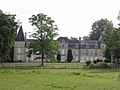
Attractions
- Saint Martin Church.
- War memorial (Monument aux morts).
- The French military cemetery Nécropole nationale de Vauxbuin with around 5,000 burials of French and British dead.
- Lock.

Saint Martin Church

War memorial
lock

Military cemetery
_%C3%A9glise_(02).JPG)

_ch%C3%A2teau_(03).JPG)
_N%C3%A9cropole_nationale_(05).JPG)
Personalities
- Olivier Harty de Pierrebourg (1908–1973), politician
Web links
Commons : Vauxbuin - collection of images, videos and audio files