Haramont
| Haramont | ||
|---|---|---|

|
|
|
| region | Hauts-de-France | |
| Department | Aisne | |
| Arrondissement | Soissons | |
| Canton | Villers-Cotterêts | |
| Community association | Communauté de communes Retz en Valois | |
| Coordinates | 49 ° 17 ' N , 3 ° 4' E | |
| height | 75-243 m | |
| surface | 12.24 km 2 | |
| Residents | 580 (January 1, 2017) | |
| Population density | 47 inhabitants / km 2 | |
| Post Code | 02600 | |
| INSEE code | 02368 | |
| Website | http://www.haramont.fr/ | |
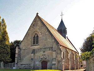
 Saint-Clément church |
||
Haramont is a commune with 580 inhabitants (as of January 1 2017) in the department of Aisne in the region of Hauts-de-France (former Region: Picardie ). The municipality belongs to the arrondissement of Soissons and is part of the canton of Villers-Cotterêts and the community association Communauté de communes Retz en Valois .
geography
The community on the edge of the Forêt de Retz domain forest and the border with the Oise department is located around 3.5 km northwest of Villers-Cotterêts on the D80 departmental road . The districts of Selve, Les Fossés, Le Moulinet and Longpré belong to Haramont. Neighboring communities are Retheuil , Taillefontaine and Vivières in the north, Largny-sur-Automne in the east and south and (all in the Oise department) Vez , Éméville , Bonneuil-en-Valois and Fresnoy-la-Rivière in the west.
Population development
| year | 1962 | 1968 | 1975 | 1982 | 1990 | 1999 | 2008 | 2015 |
| Residents | 383 | 359 | 393 | 441 | 518 | 573 | 605 | 583 |
| Source: Cassini and INSEE | ||||||||
Attractions
- Saint-Clément church from the 12th and 16th centuries, classified as a Monument historique in 1919
- Manoir des Fossés from the 16th century, classified as a Monument historique in 2003, was once built by Alexandre Dumas the Elder. Ä. inhabited
- Longpré Priory of the Order of Fontevrauld , registered as a Monument historique in 1995
- Menhir La pierre Clouise in the forest of Retz [1]
Individual evidence
- ↑ Saint-Clément Church in the Base Mérimée of the French Ministry of Culture (French)
- ↑ Manoir des Fossés in the Base Mérimée of the French Ministry of Culture (French)
- ^ Priorei Longpré in the Base Mérimée of the French Ministry of Culture (French)


