Noroy-sur-Ourcq
| Noroy-sur-Ourcq | ||
|---|---|---|
|
|
||
| region | Hauts-de-France | |
| Department | Aisne | |
| Arrondissement | Soissons | |
| Canton | Villers-Cotterêts | |
| Community association | Communauté de communes Retz en Valois | |
| Coordinates | 49 ° 12 ' N , 3 ° 13' E | |
| height | 67-172 m | |
| surface | 5.15 km 2 | |
| Residents | 130 (January 1, 2017) | |
| Population density | 25 inhabitants / km 2 | |
| Post Code | 02600 | |
| INSEE code | 02557 | |
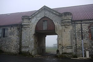
 Entrance to a homestead |
||
Noroy-sur-Ourcq is a French commune of 130 inhabitants (as of January 1, 2017) in the department of Aisne in the region of Hauts-de-France (former Region: Picardie ). The municipality belongs to the arrondissement of Soissons and is part of the canton of Villers-Cotterêts . The inhabitants are called Noiroisiens .
geography
The community is located around 12 km east-southeast of Villers-Cotterêts on the Savières river and north of the Ourcq . In the south, the railway line from La Ferté-Milon to Bazoches-sur-Vesles , which meets the line from Soissons to Reims , touches the municipality. Neighboring communities are Ancienville in the north, Chouy in the east, Marizy-Sainte-Geneviève in the south and Troësnes and Faverolles in the west. The municipality has a share of the Bois de Cresnes forest in the west.
Population development
| year | 1962 | 1968 | 1975 | 1982 | 1990 | 1999 | 2008 | 2015 |
| Residents | 84 | 84 | 62 | 76 | 91 | 122 | 154 | 135 |
| Source: Cassini and INSEE | ||||||||
