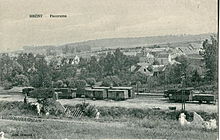
Breny
| Breny | ||
|---|---|---|
|
|
||
| region | Hauts-de-France | |
| Department | Aisne | |
| Arrondissement | Soissons | |
| Canton | Villers-Cotterêts | |
| Community association | Communauté de communes du Canton d'Oulchy-le-Château | |
| Coordinates | 49 ° 11 ′ N , 3 ° 21 ′ E | |
| height | 82–155 m | |
| surface | 4.52 km 2 | |
| Residents | 244 (January 1, 2017) | |
| Population density | 54 inhabitants / km 2 | |
| Post Code | 02210 | |
| INSEE code | 02121 | |
Breny is a municipality with 244 inhabitants (as of January 1 2017) in the department of Aisne in the region of Hauts-de-France (former Region: Picardie ). The municipality belongs to the arrondissement of Soissons and is part of the canton of Villers-Cotterêts . The inhabitants are known as Brenois (es).
geography
The community is located around 20 km (road distance) south of Soissons and 21 km north of Château-Thierry in the Ourcq valley , into which the Ru de Chaudailly stream flows, on the D1 departmental road and the Trilport – Bazoches railway (with a stop), which meets in Bazoches-sur-Vesles on the route from Soissons to Reims . The eastern boundary partially forms a route along the Chaussée Brunehaut with the Ponts Bernard bridges from the turn of the 17th and 18th centuries. Neighboring municipalities are Oulchy-la-Ville and Oulchy-le-Château in the north, Armentières-sur-Ourcq in the east, La Croix-sur-Ourcq in the south and Montgru-Saint-Hilaire in the west.
history
Neolithic, Gallo-Roman and Merovingian tombs have been found in the community.
Population development
| year | 1962 | 1968 | 1975 | 1982 | 1990 | 1999 | 2007 | 2015 |
| Residents | 295 | 260 | 250 | 219 | 212 | 238 | 272 | 252 |
| Source: Cassini and INSEE | ||||||||
Attractions
- Saint-Martin church from the 12th century with semicircular apse, classified as Monument historique in 1921 ( Base Mérimée PA00115557)


