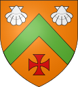
Brullioles
| Brullioles | ||
|---|---|---|

|
|
|
| region | Auvergne-Rhône-Alpes | |
| Department | Rhône | |
| Arrondissement | Lyon | |
| Canton | L'Arbresle | |
| Community association | Monts du Lyonnais | |
| Coordinates | 45 ° 46 ′ N , 4 ° 30 ′ E | |
| height | 380-817 m | |
| surface | 12.25 km 2 | |
| Residents | 816 (January 1, 2017) | |
| Population density | 67 inhabitants / km 2 | |
| Post Code | 69690 | |
| INSEE code | 69030 | |
Brullioles is a French municipality with 816 inhabitants (at January 1, 2017) in the department of Rhône in the region of Auvergne Rhône-Alpes . It belongs to the Arrondissement of Lyon and the Canton of L'Arbresle .
Neighboring communities
Neighboring municipalities of Brullioles are Montrottier and Saint-Julien-sur-Bibost in the north, Bessenay in the east, Brussieu in the southeast, Saint-Laurent-de-Chamousset in the southwest, and Longessaigne and Saint-Clément-les-Places in the west.
Population development
| year | 1962 | 1968 | 1975 | 1982 | 1990 | 1999 | 2013 |
| Residents | 446 | 429 | 425 | 441 | 559 | 574 | 812 |
Attractions
- Church of the Nativity of John the Baptist (Église de la Nativité-de-Saint-Jean-Baptiste)
- Château de Charfetain
- Plague Chapel Saint-Roch (1759)
Web links
Commons : Brullioles - collection of images, videos and audio files

