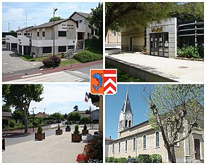
Pusignan
| Pusignan | ||
|---|---|---|

|
|
|
| region | Auvergne-Rhône-Alpes | |
| Department | Rhône | |
| Arrondissement | Lyon | |
| Canton | Genas | |
| Community association | Est Lyonnais | |
| Coordinates | 45 ° 45 ′ N , 5 ° 4 ′ E | |
| height | 199-271 m | |
| surface | 13.04 km 2 | |
| Residents | 4,114 (January 1, 2017) | |
| Population density | 315 inhabitants / km 2 | |
| Post Code | 69330 | |
| INSEE code | 69285 | |
| Website | www.mairie-pusignan.fr | |
 Pusignan |
||
Pusignan is a French municipality with 4114 inhabitants (as of January 1 2017) in the Rhône region of France in the region Auvergne Rhône-Alpes . The inhabitants are called Pusignanais .
geography
location
Pusignan is about 18 kilometers east of Lyon . Pusignan is surrounded by the neighboring communities Jonage in the north, Villette-d'Anthon in the north-east, Janneyrias in the east, Colombier-Saugnieu in the south and south-east, Genas in the west and south-west and Meyzieu in the west and north-west.
traffic
The Lyon Saint-Exupery Airport is located four kilometers away from the commune. The A432 autoroute and the former Route Nationale 346 run through the municipality .
history
Pusignan owes its name to an officer of Julius Caesar named Pusinius . Burgundy graves and traces of a Roman fort have been found in the city at a place called le Pavillon . This place was a guard post and military base, because from there one could see the important trade route from Lyon to Crémieu.
The castle, built in the 12th century, was destroyed in 1789 . However, the chapel still exists and is now in the center of the old cemetery.
In recent years, its proximity to Lyon has changed the appearance of the city. Numerous apartments were built. However, in order to maintain the quality of life and compensate for environmental damage, residential complexes with more than two floors are not permitted.
Population development
In 2013 the population of the municipality was 3756.
The population has risen sharply since the early 1960s.
| year | 1962 | 1968 | 1975 | 1982 | 1990 | 1999 | 2007 | 2008 | 2012 | 2013 |
|---|---|---|---|---|---|---|---|---|---|---|
| Residents | 1,060 | 1,249 | 1,800 | 1,876 | 2,720 | 3,098 | 3,482 | 3,506 | 3,730 | 3,756 |
Politics and administration
The municipality was part of the Isère department and in 1967 it became part of the Rhône department. With the cantonal elections in 2015, Pusignan was incorporated into the new canton of Genas , before that it belonged to the canton of Meyzieu . Pusignan is part of the Communauté de communes de l'Est Lyonnais .
- Mayor since 1980
| from | to | Surname |
|---|---|---|
| 2008 | Re-elected in 2014 | Gilbert Marboeuf |
| 1995 | 2008 | Chantal Genthon |
| 1980 | 1995 | André Pautet |
economy
Although Pusignan has remained outside the Grand Lyon area , the development of the municipality is nevertheless strongly linked to the Lyon metropolitan area.
The area used for agriculture is more than half of the total area of the municipality. Mainly maize, wheat, sunflowers and rapeseed are grown.
Attractions
- Ruins of Pusignan Castle , originally built in the 12th century
- Saint-Vierge church from the 19th century, with remains of foundations from the 5th and 6th centuries
- Romanesque chapel of Moifond Abbey from the 12th century with cemetery, monument historique since 1982
- Marais de Charvas a marshland that has been included in the natural areas organization zone naturelle d'intérêt écologique, faunistique et floristique .
Parish partnership
A partnership has existed with the German city of Schönwald in Bavaria since 1984 .
Personalities associated with the community
- Jean Parédès (1914–1998), actor, born here
- Rémy Vercoutre (* 1980), goalkeeper of the Olympique Lyonnais football club, lived in the municipality.
- Cédric Bardon (* 1976), former player of the Olympique Lyonnais and Stade Rennais football clubs , lives in the municipality. He coaches a young local football group.


