Pollionnay
| Pollionnay | ||
|---|---|---|

|
|
|
| region | Auvergne-Rhône-Alpes | |
| Department | Rhône | |
| Arrondissement | Lyon | |
| Canton | Vaugneray | |
| Community association | Vallons du Lyonnais | |
| Coordinates | 45 ° 46 ′ N , 4 ° 40 ′ E | |
| height | 280-785 m | |
| surface | 15.8 km 2 | |
| Residents | 2,637 (January 1, 2017) | |
| Population density | 167 inhabitants / km 2 | |
| Post Code | 69290 | |
| INSEE code | 69154 | |
| Website | www.pollionnay.fr | |
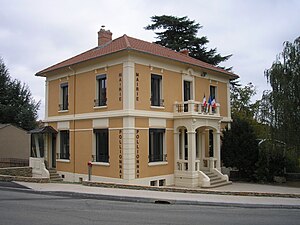
 Pollionnay Town Hall |
||
Pollionnay is a French commune with 2,637 inhabitants (as of January 1 2017) in the department of Rhône in the region of Auvergne Rhône-Alpes . It belongs to the Arrondissement of Lyon and the Canton of Vaugneray . The inhabitants are called Pollionnois (es) .
geography
Pollionnay is about 13 kilometers west of Lyon at the foot of the Monts du Lyonnais . Pollionnay is surrounded by Lentilly in the north, Sainte-Consorce in the east and northeast, Grézieu-la-Varenne in the south and southeast, Vaugneray in the south and southwest, Chevinay in the west and Saint-Pierre-la-Palud and Sourcieux-les-Mines in the Northwest.
The commune belongs to the Coteaux du Lyonnais wine-growing region .
Population development
| year | 1962 | 1968 | 1975 | 1982 | 1990 | 1999 | 2006 | 2011 |
| Residents | 533 | 676 | 866 | 1,088 | 1,262 | 1,580 | 1,823 | 2.151 |
Attractions
- Pollionnay Castle from the 15th century, Monument historique
- Saint-Jean-Baptiste church, former chapel of Pollionnay Castle, built between 1688 and 1692
- Romanesque chapel Saint-André in Larny, mentioned in 1313, probably built in the 13th century, restored in the 17th century
- Notre-Dame chapel by Lorette, built in the second half of the 16th century
Web links
Commons : Pollionnay - collection of images, videos and audio files

