
Trassem
| coat of arms | Germany map | |
|---|---|---|

|
Coordinates: 49 ° 35 ' N , 6 ° 32' E |
|
| Basic data | ||
| State : | Rhineland-Palatinate | |
| County : | Trier-Saarburg | |
| Association municipality : | Saarburg-Kell | |
| Height : | 180 m above sea level NHN | |
| Area : | 7.54 km 2 | |
| Residents: | 1160 (Dec. 31, 2019) | |
| Population density : | 154 inhabitants per km 2 | |
| Postal code : | 54441 | |
| Area code : | 06581 | |
| License plate : | TR, SAB | |
| Community key : | 07 2 35 136 | |
| Community structure: | 2 districts | |
| Association administration address: | Schloßberg 6 54439 Saarburg |
|
| Website : | ||
| Local Mayor : | Roland Konter ( CDU ) | |
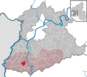
| Location of the local community Trassem in the district of Trier-Saarburg | ||
  |
||


Trassem is a municipality in the Trier-Saarburg district in Rhineland-Palatinate . It belongs to the Saarburg-Kell association.
geography
Trassem is located on the Leuk , a small tributary of the Saar . Trassem consists of the main town Trassem and the district Perdenbach, which is connected to the town.
history
Finds from the Stone Age and the urn field stage in the community forest at the beginning of the 20th century suggest an early settlement. An important find is the hoard from the Bronze Age , which is kept in the Rheinisches Landesmuseum Trier . It consists of a bracelet and a needle made of gold, gold spirals and a short sword and bronze ax blades. It was hidden between stones about 3600 years ago. The find is considered an offering to divine powers, but could also represent an equipment made during lifetime for the afterlife. Since finds of Bronze Age metal objects are relatively rare in this region, this find is an important testimony to this epoch.
Trassem was first mentioned as "Sent Erasmen" in 1337 in a feudal deed of Freudenburg , the district of Perdenbach as Pertenbach around 1450. Trassem has been part of this since the establishment of Kurtrier . In 1689 the "House of Meiers of the electoral court in Trassem" was built (today: Kirchstrasse 25).
In 1794, Trassem was occupied by French revolutionary troops , as was the entire area on the left bank of the Rhine in Germany . Annexed to French legal and national territory until 1814. In the course of the redistribution of Europe at the Congress of Vienna (1815), the village came to Prussia in 1816 as part of the Saarburg district in the Trier administrative district in the Rhine Province .
During the Second World War , the population of Trassem was evacuated twice due to its proximity to the front: in 1939, families were evacuated to Saxony-Anhalt and Mecklenburg with their belongings. This takes place again in autumn 1944, but only as far as the Hunsrück-Nahe area.
On July 18, 1946, Trassem, together with 80 other municipalities in the districts of Trier and Saarburg , was annexed to the Saar area , which was separated from the rest of the French occupation zone in February 1946 and which at that time was no longer under the Allied Control Council. On June 6, 1947 this territorial outsourcing was withdrawn to 21 municipalities, so that Trassem came to the 1946 newly formed state of Rhineland-Palatinate .
Population development
The development of the population of Trassem, the values from 1871 to 1987 are based on censuses:
|
|
politics
Municipal council
The local council in Trassem consists of 16 council members, who were elected in a personalized proportional representation in the local elections on May 26, 2019 , and the honorary local mayor as chairman.
The distribution of seats in the local council:
| choice | SPD | CDU | WGR | total |
|---|---|---|---|---|
| 2019 | - | 10 | 6th | 16 seats |
| 2014 | 4th | 9 | 3 | 16 seats |
| 2009 | 5 | 9 | 2 | 16 seats |
| 2004 | 3 | 9 | 4th | 16 seats |
Local mayor
- until 2014: Wolfgang Benter (CDU)
- since 2014: Roland Konter (CDU)
economy
The local community Trassem-Perdenbach is a commuter community to the upper center Trier , the middle center Saarburg and to Luxembourg . The most important local employer is the tourism industry .
The federal highway B407 runs through Trassem . Until the end of the 1980s, the B51 federal road was also used . These forked at the southern end of the village. The B51 was relocated to the right bank of the Saar in the course of the canalisation of the Saar. The nearest train station is in Saarburg, the nearest airport is Luxemburg-Findel .
Personalities
- Ulrich Nussbaum (* 1957), lawyer and independent politician, Finance Senator in Berlin from 2009 to 2014.
See also
literature
- Ernst Wackenroder : The art monuments of the Saarburg district . (= Paul Clemen (Hrsg.): Die Kunstdenkmäler der Rheinprovinz , Volume 15, III. Department). L. Schwann, Düsseldorf 1939 (reprint from the Academic Bookshop Interbook, Trier 1982), pp. 267–270.
Web links
- Internet presence of the local community Trassem
- To search for cultural assets of the local community Trassem in the database of cultural assets in the Trier region .
- Link catalog on the subject of trassem at curlie.org (formerly DMOZ )
Individual evidence
- ↑ State Statistical Office of Rhineland-Palatinate - population status 2019, districts, communities, association communities ( help on this ).
- ↑ State Statistical Office Rhineland-Palatinate (ed.): Official directory of the municipalities and parts of the municipality. Status: January 2019 [ Version 2020 is available. ] . S. 126 (PDF; 3 MB).
- ↑ Hartwig Löhr: Findings: from prehistory to modern times . Ed .: Rheinisches Landesmuseum Trier (= series of publications by the Rheinisches Landesmuseum . Volume 36 ). Theiss, Stuttgart 2009, ISBN 978-3-923319-76-3 , pp. 24 f .
- ↑ State Statistical Office Rhineland-Palatinate: My village, my city. Accessed July 31, 2019 .
- ^ The Regional Returning Officer Rhineland-Palatinate: Local elections 2019, city and municipal council elections. Accessed July 31, 2019 .

Aach | Ayl | Baldringen | Bekond | Notification | Beuren (high forest) | Bonerath | Damflos | Detzem | Ensch | Farschweiler | Fur | Fish | Pine | Franzenheim | Freudenburg | Geisfeld | Greimerath | Grimburg | Gusenburg | Gusterath | Gutweiler | Heddert | Stalling | Herl | Hermeskeil | Hinzenburg | Hinzert-Pölert | Hockweiler | Holzerath | Hedgehog | Irsch | Kanzem | Chasuble | Kastel-Staadt | Kell am See | Kenn | Kirf | Klüsserath | Conc | Cord | Korlingen | Köwerich | Lampades | Langsur | Leiwen | Lunge | Longuich | Lorscheid | Mandern | Mannebach | Mehring | Mertesdorf | Merzkirchen | Morscheid | Naurath (Eifel) | Naurath (forest) | Neuhütten | Newel | Nittel | Upper cheap | Ockfen | Ollmuth | Onsdorf | Osburg | Palzem | Paschel | Pellingen | Pluwig | Pölich | Ralingen | Swift oath | Reinsfeld | Riol | Riveris | Saarburg | Schillings | Schleich | Schoden | Schömerich | Schondorf | Schweich | Serrig | Sommerau | Taben-Rodt | Tawern | Temmels | Thomm | Thörnich | Trassem | Trierweiler | Trittenheim | Vierherrenborn | Waldrach | Waldweiler | Wasserliesch | Wawern | Waves | Welschbillig | Wiltingen | Wincheringen | Zemmer | Zerf | Züsch