
Bad Radkersburg
|
Borough Bad Radkersburg
|
||
|---|---|---|
| coat of arms | Austria map | |
 |
|
|
| Basic data | ||
| Country: | Austria | |
| State : | Styria | |
| Political District : | Southeast Styria | |
| License plate : | SO (from 1.7.2013; old: RA) | |
| Surface: | 30 km² | |
| Coordinates : | 46 ° 41 ′ N , 15 ° 59 ′ E | |
| Height : | 209 m above sea level A. | |
| Residents : | 3,178 (January 1, 2020) | |
| Postal code : | 8490 | |
| Area code : | 03476 | |
| Community code : | 6 23 76 | |
| NUTS region | AT224 | |
| Address of the municipal administration: |
Hauptplatz 1 8490 Bad Radkersburg |
|
| Website: | ||
| politics | ||
| Mayor : | Heinrich Schmidlechner ( ÖVP ) | |
|
Municipal Council : (2020) (21 members) |
||
| Location of Bad Radkersburg in the district of Southeast Styria | ||
  |
||
.jpg) Main square of Bad Radkersburg |
||
| Source: Municipal data from Statistics Austria | ||

Bad Radkersburg ( Slovenian Radgona ; Hungarian (historical): Regede ) is a municipality with 3178 inhabitants (as of January 1, 2020) in the Austrian state of Styria in the district of Southeast Styria and in the judicial district of Feldbach . Bad Radkersburg was the district capital of the former Radkersburg district until December 31, 2012 .
geography
Geographical location
The city lies at an altitude of 208 m on the Mur , which forms the state border with Slovenia. The community (Bad Radkersburg 216 ha, Radkersburg area 2,783 ha) covers an area of 30 km². The former southern part of the city has been part of Gornja Radgona in Slovenia since 1919 .
Community structure
The municipality includes the following ten localities (population in brackets as of January 1, 2020):
- Altneudörfl (507)
- Bad Radkersburg (1406)
- Dedenitz (69)
- Goritz near Radkersburg (270)
- Hummersdorf (150)
- Laafeld (329)
- Parish Village (109)
- Pridahof (62)
- Sicheldorf (168)
- Zelting (108)
The community consists of the cadastral communities Altneudörfl, Dedenitz, Goritz bei Radkersburg, Hummersdorf, Kellerdorf, Laafeld, Leitersdorf I, Pfarrsdorf, Pridahof, Radkersburg, Sicheldorf and Zelting.
Neighboring communities
| Kloch | Cankova ( Slovenia ) | |
| Halfway |
.svg)
|
Tišina ( Slovenia ) |
| Gornja Radgona ( Slovenia ), former southern part of the city | Radenci ( Slovenia ) |
climate
|
Average monthly temperatures and rainfall for Bad Radkersburg
|
||||||||||||||||||||||||||||||||||||||||||||||||||||||||||||||||||||||||||||||||||||||||||||||||||||||||||||||||||||||||||||||||||||||||||||||||||||||||||||||||||||||||||||||||||||
history
When Radkersburg was developed as a settlement, where it was and who founded it, cannot be clearly reconstructed. The time from which Radkersburg came under sovereign rule is also unknown. The first documentary mention is in 1182 as "Rakersburg" (1211 the older form "Rategoyspurch" is attested, the starting word is the Slavic personal name Radigoj ), it is mentioned as a market in the Ottokar land register of 1265/67. Probably Radkersburg was originally an own property, so it did not belong to the sovereign, but to a nobleman who was given a gift directly from the king.
According to the current state of research, Radkersburg was not rebuilt as a city by the Bohemian king Ottokar II (1232–1278) , as was assumed for a long time , but by the Habsburg king Albrecht I (1255–1308). The appearance of today's city is based on a precise construction plan. As early as the end of the 13th century, the city was surrounded by a wall with towers. The place was first mentioned as a city in 1299.
Radkersburg was repeatedly involved in armed conflicts since the 13th century because of its border location with Hungary . The population survived the so-called Baumkircher feud (1469) and the ten-year Hungarian rule (1480-1490) relatively unscathed.

The clashes with the Ottoman Empire in the 16th century made it necessary to renew and modernize the fortress. Italian builders were brought to Austria because of their excellent knowledge of fortress construction. With the construction management of which was, as in Graz, province of Como coming Domenico dell'Allio commissioned. The main features of the Renaissance fortifications were bastions , curtains and a deep moat. Radkersburg was elevated to an imperial fortress by the Reichstag in Augsburg in 1582 .

In the 1880s, a national conflict began to unfold, which primarily affected the language issue in schools, offices, courts and political representation. The language of the Radkersburg citizens was generally German. Their servants, on the other hand, and the rural population of the surrounding communities down the Mur river spoke mostly Slovene. The nationality conflict escalated politically and militarily in the First World War . The town was a garrison town of the Austro-Hungarian Army , and in 1914 the second squadron of Hussar Regiment No. 16 was located here . After the end of the First World War, troops of the SHS state (Kingdom of Serbs, Croats and Slovenes) occupied Radkersburg and its surrounding communities on the left bank of the Mur. It came to the betrayed and failed uprising of the German-speaking population under Johann Mickl on February 4, 1919. The SHS troops only vacated the area in July 1920 in exchange for the Abstaller basin, which was also largely German-speaking . The city was divided, the district of Oberradkersburg (Gornja Radgona) on the other, right bank of the Mur became part of Slovenia or the SHS state. The peace treaty of Saint-Germain finally made Radkersburg a divided border town.
In the Second World War , the nationality problem was taken to extremes by National Socialism . The result of the policy of the Greater German Reich was not only the destruction of the city - only 4 of 321 houses remained undamaged - but for the time afterwards a climate of mistrust that shaped the border population on both sides of the border; the forcible expulsion of the German-speaking population from the area to the right of the Mur (e.g. Abstaller Basin ) after 1945 also had a lasting negative effect on relations across the Mur.
The reopening of the Mur Bridge on October 12, 1969 led again to a rapprochement between Austria and the Socialist Federal Republic of Yugoslavia.

In 1975 the municipality of Radkersburg was declared a health resort and has been called Bad Radkersburg since 1976. Another thermal spring was developed in 1978 , then the Parktherme Bad Radkersburg thermal bath was built and expanded in several stages.
With the accession of the Republic of Slovenia to the European Union on May 1, 2004 and the accession to the Schengen Agreement on December 21, 2007, the borders are open again. Numerous cross-border projects offer an opportunity for reconciliation between Austrians and Slovenes.
On January 1, 2013, the Radkersburg district was connected to the Feldbach district to form the Southeast Styria district . The official building on the main square in Bad Radkersburg is now used as the official building of the District Commission of Southeast Styria.
On January 1st, 2015, Bad Radkersburg was merged with the municipality of Radkersburg Umgebung as part of the municipal structural reform in Styria . The new community bears the name "Bad Radkersburg".
Population development

Culture and sights

In 1978 Bad Radkersburg was the only city in Austria to be awarded the European Gold Medal for the Preservation of Monuments . The city is a member of the Association of Small Historic Cities . All important architectural styles can be found in Bad Radkersburg, from Romanesque (when the city was founded) to Art Nouveau and the present.
a.jpg)
- Town hall tower : landmark of the city; the first three floors are from the Gothic period. The upper part of the tower was rebuilt after being destroyed by fire in 1806.
- Catholic parish church : the nave of the three-aisled Gothic basilica emerges from a former defensive tower; on the outside wall of the church there is a fragment of a fresco by John Aquila.
- Evangelical Christ Church
- Catholic branch church Mariahilf on Frauenplatz
- The Gothic Augustinian Hermit Church is used as a wine cellar.
- Marian column: reminds of the plague of 1680; In front of the column, the years are engraved in the paving stones, which are reminiscent of the Counter-Reformation around 1600.
- Herberstorff Palace : The building from 1583 has the most beautiful Renaissance arcade courtyard in the city.
- Pistorkaserne : In the Pistorkeller (Hauptplatz No. 30) are the oldest secular frescoes in Austria by Johannes Aquila.
- Museum in the old armory : Regional museum . The armory with the two-story arcades is one of the most beautiful buildings in the city.
- The abandoned Mickl barracks in the east of the city.
- Parktherme Bad Radkersburg
- Kulturhof-Johannes-Aquila

- In the former community of Radkersburg
- Wayside shrine in Dedenitz
- Village cross in Goritz near Radkersburg
- Kamniker tomb in Goritz near Radkersburg
- Hutweide barrows in Hummersdorf
- War memorial in Laafeld
- Maria Schnee village chapel in Sicheldorf
- Customs guard residence and farm building in Sicheldorf
- Boundary stone in Sicheldorf
- Wayside shrine and boundary stone in Zelting
Economy and Infrastructure
Bad Radkersburg is a spa resort with an 80 ° C hot thermal spring . Together with the longest sunshine in Austria, this makes the city an attractive tourist destination. With around 500,000 overnight stays per year, tourism is an important economic factor. In addition to a few spa and rehabilitation facilities, there are also several spa and health hotels.
Bad Radkersburg is located on the Mur Cycling Path , which runs from the border near Sicheldorf through Slovenia and Croatia. Furthermore, two Austrian long-distance hiking trails start or end here, the Eastern Austrian Grenzlandweg and the Südalpenweg .
traffic
Bad Radkersburg is connected on the Radkersburger Bahn by the S-Bahn line 51 with hourly intervals via Spielfeld-Straß with the provincial capital Graz . The route continued to Slovenia, but was interrupted for six kilometers. Austria and Slovenia are planning to restore the rail link. The South Styrian border road B 69 leads through the town, which curves around the old town and leads to Gornja Radgona ( Slovenia ).
politics
.jpg)
mayor
With Heinrich Schmidlechner (ÖVP) a new mayor was elected on April 29, 2015 during the constituent meeting of the municipal council. Schmidlechner was the mayor there until the Radkersburg Umgebung community was dissolved. He succeeds Josef Sommer (ÖVP), who served as mayor from March 2010 to December 31, 2014 and as government commissioner until the election in early 2015. Then he stepped back into the second row. The Bad Radkersburg citizens' list submitted an election proposal with former mayor Peter Merlini as the so-called people's mayor and was supported by the SPÖ. Ultimately, Schmidlechner was able to prevail over Merlini with 12: 9 votes.
The city council , which has been expanded by two members , also includes the first deputy mayor Josef Sommer (ÖVP), the second deputy mayor Christian Duric (SPÖ), financial officer Sonja Witsch (Greens) and Manfred Mikl (BBR) as additional members.
City Office Director is Franz Brandner.
Municipal council
The council has been extended due to the community pooling by 6 members seats and now has 21 members who are following the local elections in 2015 as composed follows:
- 10 mandataries of the ÖVP
- 5 SPÖ mandataries
- 4 members of the Bad Radkersburg citizens' list
- 1 mandate from the FPÖ
- 1 mandatar of the Green
The last municipal council elections brought the following results:
| Political party | 2015 | 2010 | 2005 | 2000 | |||||||||||||||||
|---|---|---|---|---|---|---|---|---|---|---|---|---|---|---|---|---|---|---|---|---|---|
| Large community | B. Radkersburg | Radkersburg U. | B. Radkersburg | Radkersburg U. | B. Radkersburg | Radkersburg U. | |||||||||||||||
| be right | % | Mandates | St. | % | M. | St. | % | M. | St. | % | M. | St. | % | M. | St. | % | M. | St. | % | M. | |
| ÖVP | 879 | 45 | 10 | 468 | 48 | 8th | 723 | 60 | 10 | 295 | 32 | 5 | 645 | 57 | 9 | 300 | 31 | 5 | 636 | 60 | 10 |
| SPÖ | 449 | 23 | 5 | 172 | 18th | 2 | 346 | 29 | 4th | 228 | 25th | 4th | 274 | 24 | 4th | 196 | 20th | 3 | 185 | 17th | 2 |
| FPÖ | 162 | 9 | 1 | 16 | 2 | 0 | 59 | 5 | 0 | not running | 75 | 7th | 1 | 60 | 6th | 1 | 166 | 16 | 2 | ||
| The green | 131 | 7th | 1 | 62 | 6th | 1 | 86 | 7th | 1 | 108 | 12 | 1 | 137 | 12 | 1 | not running | 79 | 7th | 1 | ||
| Bad Radkersburg citizens' list | 348 | 17th | 4th | 260 | 27 | 4th | not running | 298 | 32 | 5 | not running | 406 | 42 | 6th | not running | ||||||
| Eligible voters | 2,724 | 1,235 | 1,518 | 1,273 | 1,484 | 1,302 | 1,369 | ||||||||||||||
| voter turnout | 73% | 80% | 83% | 75% | 78% | 76% | 80% | ||||||||||||||
badges and flags
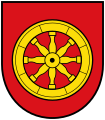
The award of speaking municipal coat of arms took effect on 1 January 1994.
Blazon (Coat of Arms description):
- "An eight-spoke gold wheel in a red shield."
Due to the amalgamation of the municipalities, the coat of arms lost its official validity on January 1st, 2015. The re-award took place on October 1, 2015.
The city flag has two stripes in red and yellow with the city coat of arms.
Coat of arms of the old town of Bad Radkersburg

Current coat of arms display

Town twinning
Personalities
sons and daughters of the town
- Andreas Walsperger (* around 1415), Frater in St. Peter's Monastery in Salzburg (from 1434)
- Carl I. Ferdinand Count of Montenari (* 1632), military
- Franz Leopold von Nádasdy (1708–1783), military
- Johann Nepomuk Hermann Nast (1754–1817), porcelain manufacturer
- Marie Egner (1850–1940), painter
- Carl Mayr-Graetz (1850–1929), painter
- Hubert Schnofl (1868–1936), politician
- Leopold Vietoris (1891–2002), mathematician
- Paul Anton Keller (1907–1976), writer
- Aribert Heim (1914–1992), German-Austrian physician and concentration camp doctor
- Maximilian Hendler (* 1939), Slavist, musicologist, composer
- Wolfgang Gombocz (* 1946), philosopher
- Desirée Treichl-Stürgkh (* 1964), journalist and author
- Wolfgang Fasching (* 1967), extreme athlete
- Andreas Lackner (* 1968), politician
- Peter Luttenberger (* 1972), racing cyclist
- Eduard Fuchs (* 1975), extreme cyclist
Honorary citizen
- 1920 Franz Kamniker (1870–1928), mayor of the city
- 1930 Johann Mickl (1893–1945), Lieutenant General in the German Wehrmacht
- 1976 Franz Wegart (1918–2009), Deputy Governor
- 2011 Karl Niederl (1941–2016), pastor of Bad Radkersburg 1976–2011
People related to the city

- Johannes Aquila (mid-14th to early 15th century), painter and head of a medieval painting workshop
- Johann Puch (1862–1914), industrialist, learned the locksmith's trade in Bad Radkersburg
- Dietrich Kittner (1935–2013), German cabaret artist, lived in Bad Radkersburg
literature
- Bad Radkersburg. From the border fortress to the spa town. In: Konrad Maritschnik : Land on the border. History - culture - adventure world. Southwest Styria. Slovenia. Herbert Weishaupt Verlag, Gnas 1995, ISBN 3-7059-0024-2 , pp. 116-127.
- Hermann Kurahs , Erwin Reidinger , Sepp Szedonja, Johann Wieser: Bad Radkersburg. Natural area and population. History, urban layout, architecture. City of Bad Radkersburg, Bad Radkersburg 1997.
- Ileane Schwarzkogler with Helga Császár u. a .: Yougend. Styrian national exhibition 1998. Bad Radkersburg. Cultural Department of the Styrian Provincial Government, Graz 1998, ISBN 3-901704-04-3 .
- Heimo Halbrainer: The other Radkersburg. Tours in the footsteps of Protestants, Jews, Roma and Slovenes in and around Bad Radkersburg. Article VII Cultural Association for Styria, Graz 1998.
- Andrea Haberl-Zemljič: Leave the language in the village. Holding on to and giving up the Slovene language in the Radkersburg area. Article VII Cultural Association for Styria, Graz 2004.
- Bettina Habsburg-Lothringen , Beatrix Vreča : Bad Radkersburg. City and region. Tourist association Bad Radkersburg and Radkersburg surroundings, Bad Radkersburg 2009, ISBN 978-3-200-01642-2 .
- Hermann Kurahs: Denied home. The Jewish history of Radkersburg from the Middle Ages to the present. With seal drawings by Ludwig Freidinger, research on the historical regional studies of Styria Volume 63, Historical Provincial Commission for Styria (ed.), Lit Verlag, Vienna 2014, ISBN 978-3-643-50571-2 .
Web links
- Tourism website of the municipality of Bad Radkersburg
- 62376 - Bad Radkersburg. Community data, Statistics Austria .
- Bad Radkersburg on 24cities.eu, Competence Center Steirisches Thermenland -Oststeiermark
Individual evidence
- ↑ a b Kleine Zeitung of April 29, 2015: “BBR” coup thwarted , accessed on April 30, 2015
- ↑ Statistics Austria: Population on January 1st, 2020 by locality (area status on January 1st, 2020) , ( CSV )
- ↑ Fritz Frhr. Lochner von Hüttenbach: On the name property of the early Middle Ages in Styria (= magazine of the Historical Association for Styria . Volume 99 ). Böhlau Verlag, Vienna 2008, p. 55 ( historerverein-stmk.at [PDF; 16.9 MB ]).
- ↑ a b story. Beginnings. (No longer available online.) In: Stadt & Region. Bad Radkersburg tourist region, archived from the original on May 18, 2014 ; accessed on May 6, 2009 (with historical map). Info: The archive link was inserted automatically and has not yet been checked. Please check the original and archive link according to the instructions and then remove this notice.
- ↑ Development of the city over the centuries. In: Walled Towns from division to co-division. Almadomus, Università degli studi di Bergamo, accessed on May 6, 2009 (German, with historical views and extensive analysis of the city walls).
- ↑ Erwin Reidinger : The medieval town system of Radkersburg . In: Bad Radkersburg: Natural space and population, history - city layout - architecture. Bad Radkersburg 1997, pp. 185-213.
- ↑ Statistics Austria: dissolutions or associations of municipalities from 1945
- ^ Announcement of the Styrian regional government of September 26, 2013 on the unification of the municipality of Bad Radkersburg and the municipality of Radkersburg Umgebung, both political districts of Southeast Styria. Styrian Provincial Law Gazette of October 14, 2013. No. 97, 28th issue. P. 554.
- ↑ Article by the Federal Monuments Office (BDA) on the oldest known profane frescoes in Austria in the Pistorkeller in Bad Radkersburg (December 2006)
- ↑ steiermark.com: Mur Cycle Path
- ^ City of Bad Radkersburg: Members of the City Council of Bad Radkersburg (accessed April 30, 2015)
- ^ Website of the Bad Radkersburg Citizens' List
- ^ Announcements from the Styrian State Archives 44/45, 1994/95, p. 48.
- ↑ 72. Announcement of the Styrian state government of September 10, 2015 on the granting of the right to use a municipal coat of arms to the municipality of Bad Radkersburg (political district of Southeast Styria) , accessed on September 23, 2015
- ↑ Entry on Bad Radkersburg on the Kommunalflaggen.eu page

Bad Gleichenberg |
Bad Radkersburg |
German Goritz |
Edelsbach near Feldbach |
Eichkögl |
Fehring |
Feldbach |
Gnas |
Halbenrain |
Jagerberg |
Kapfenstein |
Kirchbach-Zerlach |
Kirchberg an der Raab |
Kloch |
Mettersdorf am Saßbach |
Mureck |
Paldau |
Pirching am Traubenberg |
Riegersburg |
Sankt Anna am Aigen |
Sankt Peter am Ottersbach |
Sankt Stefan im Rosental |
Straden |
Tieschen |
Unterlamm
61 communities in the former Feldbach district were dissolved between 1945 and 1969. Altenmarkt bei Riegersburg |
Aschau am Ottersbach |
Axbach |
Dirnbach |
Erbersdorf |
Fischa |
Frutten |
Geisselsdorf |
Gleichenberg village |
Gniebing |
Grasdorf |
Grub II |
Gutendorf |
Hague |
Habegg |
Hainsdorf-Brunnsee |
Carrying up |
Höflach |
Hohenbrugg an der Raab |
Jamm |
Kaag |
Karbach |
Clapping |
Koelldorf |
Krennach |
Krottendorf im Sassal |
Lembach near Riegersburg |
Lichtenegg |
Lugitsch |
Maggau # |
Magland |
Mahrensdorf |
Mitterfladnitz |
Muggendorf |
Neustift |
Obergnas |
Oberlamm |
Oberrakitsch |
Oedt near Feldbach |
Petersdorf I |
Petzelsdorf near Fehring |
Plesch |
Rettenbach in East Styria |
Risola |
Rohr an der Raab |
Saaz |
Scheinz |
Slate |
Stang near Hatzendorf |
Sulzbach |
Trössengraben |
Ungerdorf |
Unterlabill # |
Waldsberg |
Waltra |
Weinberg an der Raab |
Weißenbach near Feldbach |
Wetzelsdorf near Kirchbach |
Wilhelmsdorf |
Wörth near Kirchberg an der Raab |
Ziprein 59 communities of the former Radkersburg district were dissolved between 1945 and 1969 Altneudörfl |
Dedenitz |
German Haseldorf |
Diepersdorf |
Dietzen |
Donnersdorf |
Dornau |
On top |
Edla |
Deinendorf am Ottersbach |
Goritz near Radkersburg |
Greater |
Gruisla |
Hard at Straden |
Farmsteads near Deutsch Goritz |
Hummersdorf |
Huerth |
Jörgen |
Karla |
Krobaths |
Kronnersdorf |
Laafeld |
Laasen |
Landorf |
Lichendorf # |
Marktl |
Nägelsdorf |
New set |
Oberpurkla |
Oberschwarza # |
Patzen |
Perbersdorf near Sankt Peter |
Perbersdorf near Sankt Veit # |
Parish village |
Pichla at Mureck # |
Pichla near Radkersburg |
Pölten |
Pridahof |
Radishes |
Rannersdorf am Saßbach |
Rohrbach am Rosenberg |
Salsach |
Schrötten near Deutsch Goritz |
Schwabau |
Seibersdorf near Sankt Veit # |
Sicheldorf |
Siebing # |
Spitz at Deutsch Goritz |
Unterpurkla |
Unterschwarza # |
Waasen am Berg |
Weitersfeld on the Mur # |
Weixelbaum |
Wieden-Klausen |
Wiersdorf |
Wittmannsdorf |
Zehensdorf |
Zelting 50 communities in the district of Southeast Styria were dissolved between 2015 and 2020 Auersbach |
Aug-Radisch |
Bavarian Kölldorf |
Baumgarten near Gnas |
Bierbaum am Auersbach |
Breitenfeld on the Rittschein |
Dietersdorf am Gnasbach |
Precious perennials |
Eichfeld |
Fladnitz im Raabtal |
Frannach |
Frutten-Gießelsdorf |
Glojach |
Gniebing-Weißenbach |
Gosdorf |
Gossendorf |
Grabersdorf |
Hatzendorf |
Hof bei Straden |
Hohenbrugg vineyard |
Johnsdorf-Brunn |
Kohlberg |
Kornberg near Riegersburg |
Krusdorf |
Leitersdorf im Raabtal |
Lödersdorf |
Maierdorf |
Merkendorf |
Mitterlabill # |
Mühldorf near Feldbach |
Murfeld # |
Oberdorf am Hochegg |
Oberstorcha |
Oberstorcha |
Perlsdorf |
Pertlstein |
Petersdorf II |
Poppendorf |
Raabau |
Radkersburg area |
Raning |
Ratschendorf |
Schwarzau in the Schwarzautal # |
Stainz near Straden |
Studenzen |
Trautmannsdorf in East Styria |
Trössing |
Unterauersbach |
Weinburg am Saßbach # |
Zerlach # former community was at the resolution District Leibnitz assigned