Steinberg (Hückeswagen)
|
Steinberg
City of Hückeswagen
Coordinates: 51 ° 8 ′ 37 ″ N , 7 ° 20 ′ 18 ″ E
|
||
|---|---|---|
| Height : | 300 m above sea level NN | |
| Postal code : | 42499 | |
| Area code : | 02192 | |
|
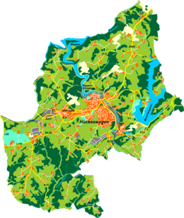
Location of Steinberg in Hückeswagen |
||
Steinberg is a settlement in Hückeswagen in the Oberbergischer Kreis in the administrative district of Cologne in North Rhine-Westphalia (Germany).
Location and transport links
Steinberg is located in the southern Hückeswagen on the edge of the approaching residential areas of the main town and can be reached via a connecting road that branches off from the district road K 5 between Grünestraße and Altenholte , leads to the Hückeswagen center and also connects Sohl , Hambüchen and Knefelsberg . Steinberg is not to be confused with the past also in Hückeswagen Steinberg south of the dam of Bevertalsperre .
history
In the Prussian first recording from 1840 to 1844, the location is performed in an enclosed courtyard. The place name is "Stone B." .
The Hückeswagen hospital was located near Steinberg from 1866 to 1993. In 1979 the buildings were sold to a private investor who converted them into a "medical service and therapy center".
Hiking and biking trails
The following hiking trails lead through the village:
- The local hiking trail ━ from Purd to the Wiebach-Vorsperre
- The local hiking trail □ from the Wermelskirchener Bone Mill to the Bevertalsperre
Individual evidence
- ^ Historika25, Landesvermessungsamt NRW, sheet 4810, Wipperfürth
- ^ Siegfried Berg: Festschrift for the 925th anniversary of the Hückeswagen 1085–2010. City of Hückeswagen, Hückeswagen 2010, digital version (PDF; 1.78 MB) .

