
Wilhelmsburg (Western Pomerania)
| coat of arms | Germany map | |
|---|---|---|

|
Coordinates: 53 ° 38 ' N , 13 ° 51' E |
|
| Basic data | ||
| State : | Mecklenburg-Western Pomerania | |
| County : | Vorpommern-Greifswald | |
| Office : | Torgelow-Ferdinandshof | |
| Height : | 11 m above sea level NHN | |
| Area : | 47.04 km 2 | |
| Residents: | 720 (Dec. 31, 2019) | |
| Population density : | 15 inhabitants per km 2 | |
| Postal code : | 17379 | |
| Primaries : | 039778, 039607 | |
| License plate : | VG, ANK, GW, PW, SBG, UEM, WLG | |
| Community key : | 13 0 75 143 | |
| Office administration address: | Bahnhofsstr. 2 17358 Torgelow |
|
| Website : | ||
| Mayor : | Ulf Wrase | |
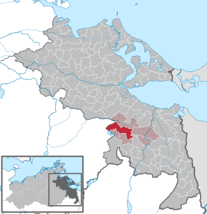
| Location of the municipality of Wilhelmsburg in the Vorpommern-Greifswald district | ||
 _in_SVO.svg) |
||

Wilhelmsburg is a municipality in the district of Vorpommern-Greifswald in the east of Mecklenburg-Western Pomerania (Germany). It is administered by the Torgelow-Ferdinandshof office based in the city of Torgelow .
geography
Wilhelmsburg is located on the eastern edge of the Friedländer Großer Wiese in an extensive lowland. To the south, there are forest areas that belong to the Ueckermünder Heide .
Community structure
The districts belong to the municipality
|
|
history
On July 1, 1950, the previously independent communities of Eichhof and Friedrichshagen were incorporated.
Friedrichshagen
The king's son, Friedrich the Great , also settled Palatinate colonists in the area, and the district of Friedrichshagen was created.
Wilhelmsburg
On an order from Friedrich Wilhelm I , the construction of a glassworks began in 1722 (Johannesberg district). The king named the settlement near this glassworks Wilhelmsburg. From the middle of the 18th century the place was settled by colonists from the Palatinate . Until the end of the Second World War there was a Remonteamt in Wilhelmsburg .
The image of the community has improved in recent years, numerous houses have been renovated, streets and paths renewed.
politics
Community representation
The Wilhelmsburg municipal council has 8 members.
| Electoral group | |
|---|---|
| Citizens' Alliance Uecker-Randow | 6th |
| Farmers' Association-Rural Area | 1 |
| Single applicant Fischer | 1 |
(Status: 2014 local elections)
State election
In the state election in Mecklenburg-Western Pomerania in 2011 , 26.8 percent of the voters voted for the NPD (2006: 27.9), 26.3 percent for the SPD (23.8), 17 percent for the CDU (23.3) and 15.9 percent for Die Linke (14.4).
Coat of arms, flag, official seal
The municipality has no officially approved national emblem, neither a coat of arms nor a flag . The official seal is the small state seal with the coat of arms of the region of Western Pomerania . It shows an upright griffin with a raised tail and the inscription "GEMEINDE WILHELMSBURG * LANDKREIS VORPOMMERN-GREIFSWALD".
Attractions
- The small village church in Wilhelmsburg from 1952/53 with a roof turret over the entrance is an example of church construction from that time in the GDR.
- Manor house in Mariawerth
Sports
There is a motocross track in the community, which is also used nationwide.
Transport links
In the nearby community of Ferdinandshof there are connections to the federal road network ( B 109 Berlin - Greifswald ) and the rail network ( Berlin - Stralsund ). There is a connection to the Federal Motorway 20 via the Strasburg junction.
Web links
Individual evidence
- ↑ Statistisches Amt MV - population status of the districts, offices and municipalities 2019 (XLS file) (official population figures in the update of the 2011 census) ( help ).
- ↑ http://www.torgelow.de/joomla/files/wahl_2014/gv_wilhelmsburg.pdf
- ↑ Results of the state election 2011
- ↑ Main Statute, Section 1, Paragraph 2 (PDF).
Ahlbeck | Old Tellin | Altwarp | Altwigshagen | Anklam | Bandelin | Bargischow | Behrenhoff | Bentzin | Benz | Mountain wood | Blankensee | Blesewitz | Boldekow | Boock | Brietzig | Brünzow | Bugewitz | Buggenhagen | Butzow | Daberkow | Dargelin | Dargen | Dersekow | Ducherow | Eggesin | Fahrwalde | Ferdinandshof | Garz | Glazov | Görmin | Grambin | Grambov | Greifswald | Gribow | Gross Kiesow | Groß Luckow | Great Polzin | Gützkow | Hammer ad Uecker | Hanshagen | Heinrichswalde | Heringsdorf | Hinrichshagen | Hintersee | Iven | Jarmen | Jatznick | Comb teeth | Karlsburg | Karlshagen | Katzow | Kemnitz | Klein Bünzow | Koblentz | Korswandt | Koserow | Krackow | Krien | Kröslin | Kruckow | Krugsdorf | Krummin | Krusenfelde | Lassan | Leopoldshagen | Levenhagen | Liepgarten | Löcknitz | Loddin | Loissin | Loitz | Lubmin | Luebs | Luckow | Luetow | Medow | Meiersberg | Mellenthin | Mesekenhagen | Mölschow | Mönkebude | Murchin | Nadrensee | Neetzow-Liepen | New Boltenhagen | New Kosenow | Neuenkirchen | Neuenkirchen | Low | Papendorf | Pasewalk | Peenemünde | Penkun | Plow | Polzow | Postlow | Pudagla | Ramin | Rankwitz | Rollwitz | Rossin | Rossow | Rothemühl | Rothenklempenow | Rubenov | Rubkov | Sarnow | Sassen-Trantow | Sauzin | Schmatzin | Schönwalde | Spantekow | Stumble on the Peene | Stolpe on Usedom | Strasburg (Uckermark) | Torgelow | Trassenheide | Tutow | Ückeritz | Ueckermünde | Usedom | Square | Vogelsang-Warsin | Völschow | Wackerow | Weitenhagen | Wilhelmsburg | Wolgast | Wrangelsburg | Wusterhusen | Zemitz | Zempin | Zerrenthin | Ziethen | Zinnowitz | Zirchow | Züssow