
Dörpe (Hückeswagen)
|
Dörpe
City of Hückeswagen
Coordinates: 51 ° 8 ′ 54 ″ N , 7 ° 17 ′ 42 ″ E
|
||
|---|---|---|
| Height : | 286 m above sea level NN | |
| Postal code : | 42499 | |
| Area code : | 02192 | |
Location of Dörpe in Hückeswagen |
||

Dörpe is a village in Hückeswagen in the Oberbergischer Kreis in the administrative district of Cologne in North Rhine-Westphalia ( Germany ).
Location and description
Dörpe is located in western Hückeswagen, right on the border with Remscheid, near the larger Wiehagen district . Parts of the place are in the Remscheid area. The place is on the federal road 237 (B237), from which the access road to Niederdorp and Remscheid-Sonnenschein branches off.
Other neighboring towns are Busenberg , D Körpersteeg , Winterhagen , Remscheid-Siepen and Remscheid-Karlsruhe. In Dörpe, the Winterhagener Bach flows into the Dörpe brook of the same name .
history
The place was mentioned for the first time in 1189 in a " pledge of property, including a mill in Duripe - by Count Heinrich v. Hückeswagen to Count Engelbert v. Mountain ". Spelling of the first mention : Duripe .
Dörpe was to 2004 by the very high embankment of disused Wipperdorf Talbahn between Remscheid- Bergisch Born and Marie Heide ( Kursbuch route optically dominated KBS412). In the summer of 2004, a large area of the embankment was removed and the B237 tunnel exposed through the embankment in order to remove this bottleneck.
Hiking and biking trails
The following hiking trails lead through the village:
- the Röntgenweg (hiking trail around Remscheid)
Views

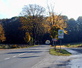
View of Dörpe

The Remscheid part of Dörpe
The embankment removed in 2004


Altenhof | Altenholte | Aue | Berbeck | Bergerhof | Bochen | Buck hoe | Böckel | Braßhagen | Bridge | Brunsbach | Buchholz | Bush | Busenbach | Busenberg | Dierl | Dörpe | Dkörpersteeg | Dörpfeld | Dörpfelderhöhe | Three trees | Dürhagen | Eckenhausen | Oak trees | Elbertzhagerhäuschen | Elberhausen | Engelshagen | Alder Ore | Fockenhausen | Frohnhausen | Forward | Drove | Funkenhausen | Goldenberg's Hammer | Großberghausen | Großeichen | Großenscheidt | Grand cat | Grünental | Grünestrasse | Hailstones | Halfmannsberghausen | Hambüchen | Hammerstein | Hangberg | Hartkopsbever | Heinhausen | Heydt | Heather | Heidt | Herweg | Height | Höhsiepen | Leguminous bush | Hummeltenberg | Junkernbusch | Käfernberg | Kaisersbusch | Kammerforsterhöhe | Karquelle | Karrenstein | Cherry syrups | Kleinberghausen | Small oaks | Kleinenscheidt | Kleinhöhfeld | Small cats | Knefelsberg | Kobeshofen | Kormannshausen | Kotthausen | Short field | Laake | Linden tree | Maisdörpe | Brand | Mickenhagen | Mitberg | Mittelbeck | Middle crest | Mühlenberg | Neuenherweg | Neuenholte | Neukretze | Niederbeck | Niederburghof | Niederdahlhausen | Niederdorp | Niederhagelsiepen | Niederhombrechen | Niederlangenberg | Niederwinterhagen | Oberbeck | Oberburghof | Oberdorp | Oberhombrechen | Oberlangenberg | Odenholl | Odenhollermühle | Pixberg | Pixbergermühle | Pixwaag | Pleuse | Post office | Purd | Raspenhaus | Rautzenberg | Reinshagenbever | Röttgen | Runkelsiedlung | Crossroads | Scouring | Schmitzberg | Schnabelsmühle | Schneppenthal | Schückhausen | Siepersbever | Sole | Stahlschmidtsbrücke | Steffenshagen | Steinberg | Steinberg (Bevertalsperre) | Stoote | Strasbourg | Straßweg | Strucksfeld | Fir tree | Ulemannssiepen | Vogelsholl | Vormwald | Vosshagen | Libra | Warth | Wefelsen | Wegerhof | West Bridge | Westhofen | Westhoferhöhe | Wickesberg | Wiehagen | Wiehagerhöhe | Winterhagen | Desert | Zipshausen
Lost farms and living
spaces Bbruch |
Fröhlenhausen |
Gillesbever |
Girkenhausen |
Hagermühle |
Hammersteinsöge |
Hummeltenbergermühle |
Petticoat |
Oberdahlhausen |
Oberkretze |
Platzhausen |
Rasselstein |
Rotterdam |
Spinning |
Fulling Mill |
Wiebachmühle