
Helmeroth
| coat of arms | Germany map | |
|---|---|---|

|
Coordinates: 50 ° 44 ' N , 7 ° 44' E |
|
| Basic data | ||
| State : | Rhineland-Palatinate | |
| County : | Altenkirchen (Westerwald) | |
| Association municipality : | Altenkirchen-Flammersfeld | |
| Height : | 180 m above sea level NHN | |
| Area : | 3.57 km 2 | |
| Residents: | 186 (Dec. 31, 2019) | |
| Population density : | 52 inhabitants per km 2 | |
| Postal code : | 57612 | |
| Area code : | 02682 | |
| License plate : | AK | |
| Community key : | 07 1 32 048 | |
| Community structure: | 5 districts | |
| Association administration address: | Rathausstrasse 13 57610 Altenkirchen |
|
| Website : | ||
| Local Mayor : | Paul Stefes | |
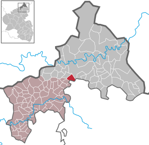
| Location of the local community Helmeroth in the Altenkirchen district (Westerwald) | ||
  |
||

Helmeroth is a municipality in the Altenkirchen (Westerwald) district in Rhineland-Palatinate . It belongs to the community of Altenkirchen-Flammersfeld .

geography
Geographical location
Helmeroth is a village in the Westerwald , in one of the oldest protected landscape areas in Rhineland-Palatinate, the " Nistertal ", a part of Kroppacher Switzerland .
Expansion of the municipal area
The community consists of the five districts of Helmeroth, Helmerotherhöhe, Flögert, Eng and Helmerothermühle. The municipality covers an area of 3.57 km², 45% of which is forest.
Langenbach ( Bruchertseifen ) is located in the north of the main town ; the Eng district is in the west on the other side of Nister towards Burbach , the Flögert district and the Helmerother Mühle in the south towards Stein-Wingert , the Helmerotherhöhe district is 297 m above sea level near the B 256 between Eichelhardt and Bruchertseifen.
history

The first documentary mention of the place Helmeroth, together with neighboring Langenbach (today part of Bruchertseifen), can be found in a list of the goods of the church in Hilgenroth , which was made out in 1446 at the parish court of Altenkirchen. In 1451, the Walpoden von der Neuerburg , Lords von Reichenstein, were granted tithe rights in the parish of Kroppach and were also named Helmeroth. The Helmerother mill is first mentioned in 1492.
Helmeroth belonged to the county of Sayn and after its division since the 17th century to the county of Sayn-Altenkirchen . Within the county, Helmeroth belonged to the parish Altenkirchen, which also represented a secular administrative unit and exercised the lower jurisdiction . In 1803 the county and with it Helmeroth was assigned to the Principality of Nassau-Usingen (1806 Duchy of Nassau ) and came to Prussia in 1815 as a result of the resolutions of the Congress of Vienna in 1815 . Under the Prussian administration, Helmeroth belonged to the mayor's office in Altenkirchen in the newly formed district of the same name in the administrative district of Koblenz , which was part of the Rhine province from 1822 onwards.
On May 30, 1943, a Vickers Wellington bomber crashed not far from Flögert . While the crew was able to save themselves with the parachute, the pilot (Sergeant Ferguson) was seriously injured in the crash landing. He was taken to the hospital according to his knowledge and was taken prisoner of war after his recovery.
In 1946 the community became part of the state of Rhineland-Palatinate .
Until 1974, the part of the Langenbach district , which is now part of the municipality of Bruchertseifen , and which lies to the right of the Langenbach , also belonged to the municipality of Helmeroth, while the part of Langenbach to the left of the Bach has always belonged to Bruchertseifen.
Ecclesiastically, Helmeroth was assigned to the Altenkirchen branch church in Hilgenroth . Originally the parish of Altenkirchen belonged to the Archdiocese of Cologne . As a result of the Saynic Reformation, the inhabitants of Helmeroth were introduced to the Lutheran doctrine in 1561 and the Reformed doctrine in 1605. Even today, around 60% of the residents are mostly members of the Evangelical Church.
- Statistics on population development
The development of the population of Helmeroth in relation to today's municipality area; the values from 1871 to 1987 are based on censuses:
| year | Residents |
|---|---|
| 1815 | 142 |
| 1835 | 162 |
| 1871 | 210 |
| 1905 | 243 |
| 1939 | 243 |
| 1950 | 265 |
| 1961 | 237 |
| year | Residents |
|---|---|
| 1970 | 235 |
| 1987 | 206 |
| 1997 | 211 |
| 2005 | 217 |
| 2011 | 188 |
| 2017 | 179 |
politics
Municipal council
The local council in Helmeroth consists of six council members, who were elected by a majority vote in the local elections on May 26, 2019 , and the honorary local mayor as chairman.
mayor
In the direct election on May 26, 2019, Paul Stefes was confirmed in office for a further five years with a share of the vote of 89.38%.
Attractions
In Helmeroth there are some listed cultural monuments.
- The Helmerother mill, located near the district of Flögert, was a former count's ban mill, whose origins go back to the 15th century (mentioned in a document in 1492) and was used as an oil and grain mill. Today's buildings are half-timbered buildings, some of them massive, from the 19th and early 20th centuries. The mill and the living quarters are from 1871, the former servants' house from 1920. It was one of the most modern mills on the Nister until the 1940s, and in 1959 operations ceased.
- In the districts of Helmeroth and Flögert there are five half-timbered houses that date from the 17th and 18th centuries.
- Next to the Helmerother mill there is also a pedestrian bridge called the Flögert rope suspension bridge. First built around 1920 for farmers who brought their grain to the Helmerother mill, the newly built in 2010 and with 37 meters formerly longest suspension bridge in Rhineland-Palatinate is now used by hikers to cross the Nister.

literature
- Daniel Schneider: The mill trade in the county of Sayn-Altenkirchen , in: Heimat-Jahrbuch des Kreis Altenkirchen 59 (2016), pp. 219–237.
- Daniel Schneider: The development of denominations in the county of Sayn in plan , in: Heimat-Jahrbuch des Kreis Altenkirchen 58 (2015), pp. 74-80.
Web links
Individual evidence
- ↑ State Statistical Office of Rhineland-Palatinate - population status 2019, districts, communities, association communities ( help on this ).
- ↑ State Statistical Office Rhineland-Palatinate (ed.): Official directory of the municipalities and parts of the municipality. Status: January 2018 [ Version 2020 is available. ] . S. 7th f . (PDF; 2.2 MB).
- ↑ State Statistical Office of Rhineland-Palatinate - Infothek
- ^ Hellmuth Gensicke : Landesgeschichte des Westerwaldes . 3. Edition. Historical Commission for Nassau, Wiesbaden 1999, pages 198, 391, 417, 451, ISBN 3-922244-80-7 . For the development of the mill cf. Daniel Schneider: The milling industry in the county of Sayn-Altenkirchen , pp. 219–237.
- ↑ Oliver Greifendorf: Westerwald War Theater , ISBN 3-938208-05-8 .
- ↑ Local community of Bruchertseifen on the website of the Hamm (Sieg) association. Retrieved December 24, 2019 .
- ↑ On denominational development cf. Daniel Schneider: The development of denominations in the county of Sayn in the plan , pp. 74-80.
- ↑ State Statistical Office Rhineland-Palatinate - regional data
- ^ The Regional Returning Officer Rhineland-Palatinate: Local council election 2019 Helmeroth. Retrieved December 25, 2019 .
- ^ The Regional Returning Officer of Rhineland-Palatinate: direct elections 2019. see Altenkirchen-Flammersfeld, Verbandsgemeinde, 22nd line of results. Retrieved December 25, 2019 .
- ^ General Directorate for Cultural Heritage Rhineland-Palatinate (ed.): Informational directory of cultural monuments - Altenkirchen district. Mainz 2019, p. 18 f. (PDF; 5.2 MB).
- ↑ On the development of the mill cf. Daniel Schneider: The milling industry in the county of Sayn-Altenkirchen , pp. 219–237.
- ↑ Former longest rope suspension bridge in the country leads at Helmeroth over the Nister at ak-kurier.de on May 14, 2019, accessed on June 29, 2019

Almersbach | Alsdorf | Altenkirchen (Westerwald) (city, seat of the district administration) | Bachenberg | Berod near Hachenburg | Berzhausen | Betzdorf (city) | Birch honey meal | Birch bump | Birnbach | Bitches | Brachbach | Breitscheidt | Bruchertseifen | Bürdenbach | Burglahr | Busenhausen | Daaden (city) | That | Dickendorf | Eichelhardt | Oak trees | Elves | Elkenroth | Emmerzhausen | Ersfeld | Etzbach | Eulenberg | Fensdorf | Fiersbach | Flammersfeld | Floodlight | Forest | Forstmehren | Friedewald | Friesenhagen | Fürthen | Gebhardshain | Gieleroth | Giershausen | Grünebach | Güllesheim | Hamm (victory) | Harbach | Hasselbach | Helmenzen | Helmeroth | Hemmelzen | Herdorf (city) | Haylofts | Hilgenroth | Hirz-Maulsbach | Horhausen (Westerwald) | Hövels | Idelberg | Ingelbach | Isert | Katzwinkel (victory) | Chew | Kescheid | Kettenhausen | Churchib | Churches (victory) (city) | Kraam | Krunkel | Malberg | Mammelzen | Mauden | More | Michelbach (Westerwald) | Mittelhof | Molzhain | Mudersbach | Nauroth | Neitersen | Niederdreisbach | Niederfischbach | Niederirsen | Niedersteinebach | Nisterberg | Obererbach (Westerwald) | Oberirsen | Oberlahr | Obernau | Obersteinebach | Oberwambach | Oils | Orfgen | Peterslahr | Pleckhausen | Splendor | Racksen | Reiferscheid | Rescuers | Rosenheim (District of Altenkirchen) | Roth | Rott | Scheuerfeld | Schöneberg | Stokes | Schutzbach | Seelbach (Westerwald) | Seelbach near Hamm (victory) | Soaps | Selbach (victory) | Sörth | Steinebach / Victory | Steineroth | Stürzelbach | Volkerzen | Wallmenroth | Walterschen | Weitefeld | Werkhausen | Weyerbusch | Willroth | Knowledge (city) | Wölmersen | Goat grove