
History of the city of Soltau

The history of the city of Soltau includes the development of the Lower Saxony city of Soltau from prehistory to modern times .
Archaeological finds show that the region around Soltau was inhabited by reindeer hunters towards the end of the last glacial period and that isolated peasant houses had been inhabited since the later Neolithic around 6000 years ago. The first written mention of the Curtis salta settlement comes from the year 936, when it passed into the possession of the Quedlinburg monastery . In the following centuries the village of Soltouwe emerged , which was granted city rights in 1388 by the dukes of the Principality of Lüneburg . The village center had previously been relocated to the confluence of the Böhme and Soltau rivers to protect them from robber barons . The Battle of Soltau in 1519 was the decisive conflict in the Hildesheim collegiate feud . The city was repeatedly destroyed by wars and fires, in particular the Thirty Years' War was a turning point in the history of the city. From 1803 to 1813 Soltau was occupied by Napoleon's troops and at times belonged to the French Empire. After the annexation of the Kingdom of Hanover , Soltau belonged to Prussia from 1866 to 1947 . During the First World War , the largest German prisoner-of-war camp was in Soltau. During the Second World War , several units of the Wehrmacht were stationed in the city, at times the front ran through Soltau. In 1974 16 surrounding communities were incorporated , the population of Soltau rose to 20,000. In the district reform that took place three years later, Soltau lost its seat by merging the districts of Soltau and Fallingbostel. From the 1970s, Soltau developed into a tourist center on the Lüneburg Heath .
Prehistory and early history (12,000 BC to 800 AD)
Reindeer hunters (around 12,000 and around 10,000 BC)
Human traces can only be found in the Soltau area from the last "Ice Age" . Towards the end of the Vistula glaciation and after the slowly disappearing post-glacial lake landscapes, today's surface structure of the North German Plain and the Lüneburg Heath emerged . Three phases of strong cooling interrupted the slow warming and prevented human settlement during the extremes. So it happened around 10,700 BC. Chr. To a last strong cooling ( Younger Dryas Period ), which allowed the reindeer, which had evaded to the north, to return to the area of the expanding tundra for the last time .
Such herds were already followed in the warmer Meiendorf Interstadial (12,700–11,900 BC) by highly specialized hunters who are considered members of the Hamburg culture ( Heber site ). With the Ahrensburg culture , reindeer hunters appeared for the last time in the area around Soltau, after an interruption of about a thousand years due to the cold again, which is proven by stone tools from the region. One of the finds is an arrow shaft straightener made from Deimern , which indicates the early use of the bow and arrow. A hunting camp is also assumed there (Deimern 45). In 1959 the 187 m² site was excavated. It contained 12,776 pieces of flint, of which 629 were tools, 12,005 pieces were cuts and 142 millstones. With the advancing forests, the reindeer herds and with them the hunting cultures finally disappeared.
Rural cultures (from 4000 BC)

Around 4000 BC The first peasant settlers also settled in the Soltau region after the peasant culture had displaced hunters and gatherers further south in the middle of the 6th millennium. Numerous Neolithic tools such as hatchets, axes, knives and clubs have been found in various places around Soltau, such as in Schüttenbusch, Wiedingen , Tetendorf and Harber , since the 19th century . The large stone graves in the region also date from the same period . The English historical researcher John Mitchell Kemble submitted an inventory of the grave fields in the old district of Soltau as early as 1853. Among other things, he recorded several burial mounds in Alm , Barmbruch and more than a hundred barrows in Stübeckshorn .
In the settlement area around today's Soltau, due to the barren soil, only isolated farms with an average of two to three square kilometers of self-used surrounding area were common in the following centuries. Through livestock farming and partially slash and burn the forests for the arable land, huge tree-free areas were created around the settlements. Heather soon settled in these partly swampy areas . Later the heather farming developed there as an independent form of economy , the basis of which was the heather sheep farming . After all, long-distance trade towards the south can be proven for Fallingbostel in the Bronze Age, because an eyelet collar was discovered there, which was considered a means of payment at that time. However, the site is on the northwestern edge of its distribution area.
Longobards and Saxons (1st to 8th centuries)

Around the birth of Christ, the traces of the Jastorf culture disappeared , as can be demonstrated in Behringen , for example . The following processes are largely unexplained. At the turn of the ages the core area of the Longobards extended west of the Lower Elbe . In the year 5 AD these were defeated in the immense war by Roman legions under Tiberius . The tribe was able to evade submission through an archaeologically tangible retreat behind the Elbe. As early as the 2nd century, the Lombards largely left the area between the Weser and Elbe . They do not appear again in the sources until 166 AD.
The transition to settlement of the region by the Saxons and their internal organization has long been controversial and shaped by the respective time-bound ideas. According to the idea developed in the 19th century - which was used to administrative state hierarchies - the Saxons divided their settlement area into Gaue, which in turn were divided into Goe. According to this construction of an administrative structure in "Old Saxon" times, the Go Soltau belonged to the Loingau , which is now considered obsolete. The existence of Saxon districts at that time has meanwhile been doubted; Matthias Springer considers it a “creation” of Charlemagne or his successor. Friedrich Grütter's view of 1899 and 1901 has also become doubtful, who ascribed a relatively small proportion of the total population of Loingau to the Saxons who had emigrated, the majority of which consisted of latices and slaves. From the place names, some of which still exist today (with the endings “-ding” and “-ing”), he concluded that the Loingau had already been settled by various Germanic tribes such as Angrivarians , Cherusci , Chauken , Longobards and others. Grütter also added some Slavic turns to the population of that time; To this day, however, there is hardly any reliable knowledge about the inhabitants of what is now the city today.
Numerous grave fields near Soltau suggest that there was settlement in the 4th and 5th centuries; of Soltau vessel called type to date from the 6th century, according to Alfred Keseberg. A trade route ran south of Soltau, which was mentioned in the year 788 as " Folkwechsel " in the Gesta Hammenburgensis ecclesiae pontificum of Adam of Bremen , but which only wrote in the 11th century. The three Go facilities - again according to Alfred Keseberg (p. 23) - considered typical were to be found in Soltau: the Goburg on today's Burg square , the Dingstätte (people's court) near Tiegen - Keseberg refers to a documented one here Tradition from the year 1337 for the name "Tidinghe" (p. 24) - and the cult site at the Weiher farm . A widespread existence of districts can at best be discovered in the High Middle Ages or even before that; they can only be proven in the late 12th century.
Soltau in the Middle Ages
Franconian Empire, Christianization, Villication (9th and 10th centuries)

With the end of the Saxon Wars in 804, Charlemagne incorporated the Saxony area into the Franconian Empire . The conquered area was divided into counties. One of them was the county of Lainga (also Loingo), which was assigned to the diocese of Minden ; Keseberg suspects that one of the centers of this county was Soltau. The location of the royal court can be localized at the site of today's St. John's Church , which, according to Keseberg, is also where the St. Peter's Chapel, founded by Priest Liudger , stood. When and by whom the Soltau parish was founded is unknown. The Parish Soltau was first mentioned in 1086.
During the 9th and 10th centuries took over secular and spiritual landlords whose property in Villikationen was structured to take control of the lands and living there, soil working and livestock-holding population. The rural population, increasingly tied to the ground, largely lost their prominent legal status and increasingly fell into bondage . The Go Soltau was divided into the Villication Stübeckshorn in the east with around 30 to 40 courtyards and the Villication Soltowe (also Soltouw) in the south with around 50 courtyards in the Villikationsverband. There were also villages and individual farms in the west, which did not belong to any villication, but continued to belong to individual landlords. As a result of the granting of the count's office and allotments from the Franconian royal estate, the bardons acquired considerable property in the course of the 9th century.
Soltau appears in the sources for the first time in 936. On September 13th of this year, King Otto I issued a document stating that the manor of Soltau, known as “curtis salta”, changed hands and became the property of the Quedlinburg monastery . This deed of gift is also the first written evidence of the existence of the Soltau settlement. The document also mentions that the Soltau estate had previously changed hands as a gift from Bardo's mother Adred to King Heinrich I. It can be assumed that the first donation was an attempt by the Bardones to reconcile with the king after Adred's sons Burchard and Bardo had joined an uprising against the Liudolfingers in 913 , which was however suppressed.
High and late Middle Ages
Quedlinburg Abbey (from 1069), Verden Cathedral Chapter (from 1304/1321)
In 1069, Adelheid, abbess of the Quedlinburg monastery, made Duke Magnus of the Billunger family the secular protector of the Soltau estates, who thus held the bailiff's rights . In 1106 the Guelphs took over power in Saxony from the Billungers, who had died out in the male line. The size of the Villication Soltau ("Soltowe") and the distance to the Quedlinburg Abbey meant that in 1230 there was a four-year conflict between the Villicus Basilius Brachmeier and the Quedlinburg convent over ownership and inheritance claims; the dispute was finally ended by a settlement. In a document dated January 13, 1234 for the return of office, the Villicus vowed to waive all claims in return for compensation.
For financial reasons, the Quedlinburg convent had to sell the Villication Soltau to the cathedral chapter in Verden on October 13, 1304 . At the time of the sale, the owner of the Vogtei Soltau was the county of Schwerin , which in 1306 ceded the bailiff's rights as an after-fief to the miner Johann von der Heide. In 1321, the Count of Schwerin finally renounced the Soltau bailiwick rights in favor of the cathedral chapter in Verden, so that after a 250-year separation, the manor and bailiff were once again in one hand.
The castle and relocation of the "olen Dorps" (1383–1388)

It has long been claimed that the Gohburg was located at the confluence of the Böhme and Soltau rivers as early as "old Germanic times" . Other documents were interpreted in this direction simply because they contained the words bevestinge and burgenses . However, Ernst Reinstorf determined in 1944 after evaluating sources that no longer exist today that Soltau Castle was only built between 1312 and 1379. During construction work on the weir of the Ratsmühle in 2010, palisade structures were discovered that were verifiably built in 1241. The wood of the twenty or so recovered posts comes from the time of Emperor Frederick I Barbarossa (1152). It is believed that the palisade fortification was a forerunner of the castle. Further evidence of the existence of the castle were found in two documents from the years 1448 and 1452, the pledge and then selling the apparently still obtained at this time the keep regulated.
The War of the Lüneburg Succession from 1370 to 1388 left its mark throughout the country, on January 21, 1379 Soltau was also involved as the starting and end point of a campaign. In the years that followed, all seven farms outside the village were destroyed, and there was repeated looting. In a contract dated August 23, 1383 between the dukes of Lüneburg and the cathedral chapter of Verden, which also referred to a “dorp Soltouwe” (village of Soltau) in Low German for the first time, it was decided that “dat ole dorp” - a collection of several relatively far apart farms, which formed the center of what was then Soltau (in the area between the St. Johannis Church and the Waldmühle ) - to protect against robber barons at the confluence of the Böhme and Soltau rivers near Hagen and Burg , which now form the city center, should be relocated. About 25 families with their buildings were relocated between 1383 and 1388. The new settlement had a much narrower development and smaller lots. Archaeological investigations by John Loftus (1990) brought more detailed information about the fortifications with two city gates (Walsroder Tor and Kirchentor), a rampart, ditches and palisades. The area of the “nygen stadt” (new city), including the castle area, was 3.7 hectares in an almost round shape. The grid-like floor plans customary at the time with additional spaces for the market, the town hall and the church were not possible in Soltau due to the soil conditions.
In the Lüneburg Peace Treaty of June 30, 1388, it was determined that "dat Slot Soltowe", which in this context meant the Soltau Castle, should be laid down, ie destroyed.
Granting of the soft image right 1388, urban development, Lüneburg Highness (from 1478)
On 17 July 1388 the Dukes awarded Bernhard and Henry of Brunswick and Lüneburg the resettled village Soltau as compensation for the demolition of the castle the precincts of law . This was accompanied, among other things, by the right of fortification with land defenses, ditches and barriers and the right of municipal jurisdiction. In 1392, the market rights were confirmed as part of the Lüneburg Sate and with it the permission to hold two free annual markets . In 1400 the duke allowed the craftsmen to set up a joint guild , in 1440 the blacksmiths, tailors, shoemakers as well as the sheet and cloth makers received their own guild letters. From 1400 at the latest, the administration of the city consisted of mayors (proconsules) and three other council members (Radmannen or consules ); It is not known whether these were already elected by the citizens or determined by the bailiff. Each of the councilors had their own area of responsibility for which they were responsible. Initially, no representative from Soltau took part in a meeting in the state parliament of the principality, this was the case for the first time in 1637.
The consequences of the War of Succession were clearly felt in Soltau and prevented the city from growing rapidly in the first few decades. There was hardly any development and the population stagnated at around 40 households, but around 1500 all the building areas in Hagen must have been completely built on. Conditions were miserable and many farms were ruined. In addition, Soltau was far away from the rulership, so that there was hardly any direct support and no feeling of belonging to a rulership could arise. The citizens kept their cattle in the houses and cultivated fields that were outside the city walls. Later, a barn district was also built outside of the city for livestock. The first construction of a stone church at the site of today's St. John's Church took place between 1460 and 1470. At the same time, a chapel ("tom hilligen Lichnam") was built within the city walls.
Although the Verden landlords were over Soltau, the Principality of Lüneburg never gave up its territorial claim to the area and from the end of the 14th century regularly collected taxes in Soltau without resistance from Verden. With three purchase contracts from the years 1479, 1481 and 1482, the Lüneburg dukes manifested their sovereignty with the official takeover of the property. At that time, Wilke von Schönbeck was the Obedientiar von Soltau. The princely district bailiwick in Soltau must have been established around this time, although it was not mentioned in writing until 1519.
Modern times
Devastating city fires (1511, 1567)
In 1511 there was a serious fire disaster in which all buildings within the city fortifications were destroyed. The responsible citizen Reinecke Wischhof was deprived of all property as a punishment. The reconstruction of the 50 or so houses must have taken several years. There was another major fire in 1567. It is likely that there were several other fires in the 16th century, but details about this have not been passed down. One reason for the lack of information is the loss of the book of thought begun in 1452 , a log book of the city council that was destroyed in 1943.
The Battle of Soltau and the Hildesheim Collegiate Feud (1519)

From 1515 a conflict developed between the Hildesheim monastery and the Guelph principalities of Braunschweig-Wolfenbüttel and Calenberg . The reason was the redemption of pledged lands and tax claims, which the Hildesheim bishop was striving for. In 1519 an open war broke out that affected large parts of north-west Germany. On June 28, 1519, the so-called Battle of Soltau took place as the military climax of this Hildesheim collegiate feud on the Wiehe Holt near Soltau (near Langeloh ) , which has long been referred to as the "last knight's battle ", which is now considered outdated because in In fact, no turning point is recognizable in the conduct of the war. In this battle the Brunswick lost between 3000 and 4000 men and were subject to the Hildesheim-Lüneburgers.
It should only be thanks to a ruse by the Soltau citizen Harm Tyding, who pretended to the advancing Brunswick that a large Lüneburg army was stored and led them to take a detour, that the city was not destroyed again.
Period of the Reformation (from 1527)


In 1527, Duke Ernst the Confessor obtained the approval of the Principality of Lüneburg for the introduction of the Reformation . From the parish of Soltau there are no known disputes during the introduction of the Lutheran creed, and there were hardly any assets over which a dispute could have broken out. In 1533 the regional church donated the “tom hilligen Lichnam” chapel to the city for use as the first town hall. The two-storey half-timbered house stood in Fleckenstraße (today's Marktstraße) at the entrance to the Hagen, the building - or possibly a successor building on the same spot - was used as the town hall until the 19th century.
Around 1528, an official bailiff was established in the Soltau District; previously, only the Grand Bailiff from Celle had held court since the 14th century . Gradually the bailiff took over the powers of the grand bailiff. The only major change of area in the long history of the district bailiff took place in 1579, among other things Wolterdingen was separated and exchanged for the village of Meinersen (near Walsrode).
On the initiative of the princely government in Celle , school lessons were started in the middle of the 16th century, which initially took place from 1563 in the parlor of the sexton. In 1588, the church community built the first schoolhouse in Soltau at the southern end of Marktstrasse near the Walsroder Tor as a school authority. The construction costs of 200 marks were financed by donations from citizens and the pastor.
Thirty Years War: plague and depopulation (1626), destruction of the city (1642)

The Thirty Years War , which began in 1618, did not initially affect the growing town of Soltau. As early as 1600 there were no more building plots within the city walls, whereupon the citizens began to build outside in front of the Walsroder Tor (on today's Walsroder Straße). In 1612 there was a dispute between several citizens and the city council. As a result, mainly young citizens' sons and newcomers applied for a building site in front of the gates. Ten of these applications were approved in 1621 and ten new settler positions were created around 300 meters from the Walsroder Tor in the southeast of the city by 1624, which were grouped together as the peasantry "Bomheide" (Böhmheide) and were directly subordinate to the Vogt. The city grew slowly, according to the tax lists, the bailiwick of Soltau in 1628 included the city of Soltau, which was directly subordinate to the ducal chancellery in Celle , and another 16 peasant communities.
For the first time in March 1620, Lower Saxon troops stayed in Soltau, subsequently more troops occasionally moved through the city, but they were still spared from direct war events. When the Danish King Christian IV invaded Lower Saxony in 1625, the fighting took place predominantly in southern Lower Saxony. After a severe defeat of the Danes in the Battle of Lutter in August 1626, however, they then withdrew to the north and came close to Soltau. The victorious troops of Tilly , who had taken up the pursuit, subsequently devastated the area around Soltau. There were numerous reports of rape, looting and arson of Soltau and the Lüneburg Heath.
As a result of the outbreak of the plague as a direct consequence of the war, more than 500 people died in Soltau from 1626. According to a tradition by Jacobus Koch (1650–1705), Soltau pastor from 1680 to 1705, only seven married couples and one child survived the "black death". The burial of the dead took place in an area east of today's street Zum Ahlftener Flatt, which was known as "Totenkamp" until the 20th century.
Swedish troops came to the city several times between 1632 and 1642 and besieged it. After a Swedish camp that was set up in 1641 and moved on in early 1642, almost all of the houses were devastated or destroyed. Only one building from that time has been preserved. The so-called Schwedenstein, a large boundary stone in the village of Ellingen, testifies to the Swedish rule in the adjacent Duchy of Verden from 1648 . Although the Peace of Westphalia ended the war in 1648, the effects were devastating. The slow but continuous growth of Soltau had stopped abruptly and was set back by decades; it took a long time for Soltau to recover from the consequences.
Urban development in the 17th and 18th centuries
Reconstruction (1650 to 1750), cloth making, cloth manufacture (from 1712)
_298.jpg)
In the second half of the 17th century the number of inhabitants increased again, in 1695 770 inhabitants lived in the city and 1050 in the surrounding countryside. The craft was also revived. The sheet makers were the main economic branch of the city, but still had problems to support their families with their craft. Petitions to the duke are known from the years 1622 and 1680, in which the sheet makers complained of their suffering and asked for tax rebates. After the unification of the Principality of Lüneburg with the Electorate of Hanover in 1705, the government tried to support the city's sheet makers. In 1711 she ordered that coarse sheets ("Groeveken"), i.e. cloth made from heather wool of lower quality, should be produced in Soltau. Also on behalf of the government, Faktor Baumann was commissioned to found cloth factories in Soltau and Walsrode . The Soltau cloth manufacture was opened on April 1st, 1712. Although it provided several dozen Soltau families with a steady income, there were always disagreements between Baumann and the masters as well as with the Soltau merchants. A few decades after it opened, the factory closed again. But also in the following hundred years, the cloth making was still the most important handicraft branch of the city.
The Office Soltau was the 17th century in continuation of Amtsvogtei the ordinary local court or administrative authority. From June 1674 on, his areas of responsibility included not only the jurisdiction but also the administration of the landed property, the collection of the appraisal and the contribution and services related to the military. Previously, the state rulers had essentially directly exercised jurisdiction in the Soltau area. The main tasks of the office often included arbitration judgments in border disputes between neighboring landlords; At that time there were no defined boundaries between the villages and farms or the individual offices. The Office Soltau had no subdistricts, all residents of the rural areas were subordinate to it. The city of Soltau itself was the economic center of the district bailiff, but was not subject to it, as it was “office-like”. It was therefore still subject to the Duke's office in Celle in all administrative matters. Instructions to the mayor of Soltau could only come from there. Despite the clear legal situation, the officials tried again and again to exert influence on the respective mayor. There were often presumptions of office and disputes between the city and the office, which made a decision by the Celle government necessary. The highlight was probably June 7th, 1702, when the bailiff and 300 of his “subordinates” besieged the city to enforce his demands. However, the mayor was tough and the argument was adjourned. In 1756 the district bailiffs in Fallingbostel and Soltau were combined - with the official seat in Fallingbostel. Only one bailiff remained in Soltau, and the office building there was sold. The reason for this amalgamation is no longer fully understandable today, but the office probably had too few subjects to pay the official's salary.
In 1716, the citizens were allowed to prepare about one acre of arable land on the site of today's Bohemian Forest ("Altes Rottland"). In 1753, a further area of around 600 square meters around today's New Gardens was designated for the creation of 138 gardens. However, the citizens asked for more space because the food requirement could not be covered, so in 1756 the so-called New Rottland (about two acres) was laid out on both sides of today's Lüneburger Strasse. Because of the outbreak of the Seven Years' War and the resulting additional burdens for the citizens, it took a few years for this area to be fully used. Since the conversion to arable land had significantly reduced the pastureland, the citizens asked for a new plant. In 1764, against the will of the Senate, the area "Neue Weide" was cultivated accordingly.
Seven Years War, garrison town (from 1712)
Soltau became a garrison town for the first time in 1712. Until the end of the Seven Years' War in 1763, various troops were quartered in the town. The combined troops of the Hanoverians, Hesse and Brunswick came through Soltau on their retreat after the lost battle of Hastenbeck in 1757. As a result, the French occupied the area of Lower Saxony and on August 28, 1757 also reached Soltau. In the months that followed, the citizens of Soltau suffered from the French occupation and their demands for natural produce, tools and money. Even after the liberation from the French occupation, there was hardly any improvement in the living conditions for the citizens, as the Hanoverian troops now had to be supported and a war tax had to be paid.
The still existing old city pharmacy was opened in 1796 as Soltau's first pharmacy . From 1802 on, Soltau was represented as part of the urban state estate in the landscape of the Principality of Lüneburg . Even today, the city is one of the members of the landscape of the former principality of Lüneburg .
The “long 19th century” as a time of change and growth
Occupation by Napoleon and the French era (1803 to 1813)

Napoleonic troops occupied the city in 1803. Again, the citizens were heavily burdened by war taxes, natural deliveries and required services. From April to October 1806 Soltau briefly belonged to Prussia before the Electorate of Hanover fell back to the French. As a result, French, Spaniards, Dutch and Bavarians came through the city in constant rotation and demanded taxes, the entire region was plundered. From January 14, 1810, Soltau belonged to the canton of Harburg in the Lower Elbe department of the Kingdom of Westphalia founded by Napoleon, and the Electorate of Hanover was dissolved.

After a further restructuring in December 1810, Soltau and the areas on the North Sea coast were added to the French Empire . The official name of the city was now Commune Soltau, Canton Walsrode, Arrondissement Nienburg, Département des Bouches-du-Weser , Empire Français . Soltau had also become a border town to the Kingdom of Westphalia; this meant that Soltau itself now belonged to France, but the Böhmheide and other areas east of the Bohemian continued to be part of the Kingdom of Westphalia. Customs guards were positioned at both mills and on Wilhelmstrasse, the main trade route. As a result, the farmers east of the Bohemia could no longer sell their products in the city, which led to a flourishing smuggling .
After several previous battles in the Lüneburg region, the arrival of Lützow hunters and Cossacks in Soltau on October 11, 1813 ended the ten-year period of occupation (" French time "). The last mayor of the Commune Soltau was Captain Isenbart from 1811 to 1813. The Kingdom of Westphalia was finally dissolved. At the Congress of Vienna on October 12, 1814, the Kingdom of Hanover was established , to whose administrative district Landdrostei Lüneburg Soltau belonged from now on.
In the following battle at Waterloo on June 18, 1815, the Hanoverian troops played a decisive role. Two people from Soltau, Heinrich Dietrich Müller and Jasper Alven, died. To commemorate this, on the 50th anniversary of the battle in 1865, the city planted the Waterloo oak on Bergstrasse, which still exists today under the name Friedenseiche.
The difficulties with the debt settlement and compensation payments promised during the war dragged on for many years. On May 5, 1827, Soltau finally received compensation in the form of 1,557 Reichstalers as well as the payment of the open shares of state lottery tickets. However, these payments were far too small to compensate for the material damage. The residents suffered from the poor economic and financial situation until the 1830s.
Kingdom of Hanover: common division and administrative reforms (1814 to 1866)

The community division order for the Principality of Lüneburg , which was adopted in 1802, was intended to regulate the border area around the individual communities. Before that, there had been no set boundaries, which often led to arguments. Soltau was divided into the city and the peasant communities Vorsoltau and Böhmheide. To this end, negotiations had to be conducted with the surrounding villages of Ahlften, Öningen (Oeningen), Tetendorf, Wiedingen and Harber mit Tiegen, the single-digit farms Alben (Alm), Frielingen and Weyher and the two farms in Leitzingen. Due to the French occupation, the survey and the inventory were delayed, in 1809 they were interrupted for the time being. Work on the general division continued in 1815 and ended in 1820. The procedure was fully completed in 1830. The entire border around the municipality of Soltau, which now comprised an area of 1488 hectares, was marked with a border ditch. From October 1830, the special division officially began, i.e. the privatization of the land and distribution to the citizens, and consequently the end of the manorial rule ( peasant liberation ). The planning for path networks and drainage systems also began. On November 10, 1851, this procedure was also completed.
After years of clashes between the 1821 instructions from the government legal inserted Counsel John FD Jaep and the Soltau Council for the Mayor Carl Dietrich Dransfeld on the need for a new town hall - Dating back to the 15th century former building was in disrepair - arose in 1826 still today used old town hall on Poststrasse.


The first written evidence of planning to unite the three previously independent municipalities of Soltau, Bomheide (Böhmheide) and Vorsoltau comes from the year 1827; The latter was located in the repopulated area of the former "olen Dorps". The bailiff of the city of Soltau (1139 inhabitants) resisted the merger because it would have reduced his income, while the city councilor Weinlig and the Landdrostei in Lüneburg campaigned for it. After numerous arguments lasting several years, a public survey took place on January 12, 1835 in the towns of Vorsoltau (194 inhabitants) and Bomheide (78 inhabitants), which had previously been part of the Fallingbostel District Bailiwick, in which 21 voters were in favor of unification and 14 against. It was not until August 1, 1844 that the association finally came into force and the three districts were merged to form the city of Soltau. At the same time, the city's magistrate gained independence from the bailiwick and a new constitution, which was signed by King Ernst August I on June 18, 1844 . After the unification, a continuous house numbering was initially introduced, although some street names were already in use at that time.
Shortly thereafter, however, Soltau decided to give up the right to municipal self-government and constitution, as a result of which the Soltau Office was re-established in 1852 and split off from the Fallingbostel Office . From now on the city was subordinate to the office and no longer independent. As compensation, the administrative office and the court were moved to Soltau. The administrative and judicial district of Soltau comprised the parishes of Soltau, Bispingen , Munster , Wietzendorf and Dorfmark . In 1859 the Soltau office was expanded to include the communities of Schneverdingen , Neuenkirchen , Wolterdingen and others from the dissolved Schneverdingen office . On August 29, 1861, a new constitutional statute came into force for the city, in which it was regulated, among other things, that in future there should no longer be any distinction between real, full and petty bourgeois law . However, it took a while until this was fully implemented in everyday practice.
Prussia, German Empire: district town (from 1885)
After the German War in 1866, the Kingdom of Hanover was annexed by Prussia and incorporated into its kingdom as the Province of Hanover , so Soltau was again under Prussian rule. The Prussian troops marched from Harburg via the old Poststrasse (today's B 3 ) through Soltau to Hanover without any acts of war or resistance . Apart from the confiscation of the post office and tax office, nothing serious happened in Soltau. The German Empire was founded in 1871 . Another change in the administrative division in 1885 meant that the previous offices were converted into districts and the six Hanoverian Landdrosteien into administrative districts . The Soltau district became the Soltau district . Soltau was made a district town , at that time the city had around 2000 inhabitants.
Infrastructure and Industry Growth (1870 to 1920)

After the annexation of the Kingdom of Hanover by Prussia, the capital Berlin was to be connected to the ports on the North Sea by the shortest route. The Bremen – Berlin route ran directly through Soltau. After the city had been bypassed a few years earlier when planning the route from Hamburg to Hanover in favor of the more important cities of Lüneburg and Celle, a "second class" station was built in Soltau from 1870 onwards. The Soltau (Han) station was built on Walsroder Strasse at the request of the city. On May 15, 1873, the first passenger train ran on the Uelzen – Langwedel section and also passed Soltau. 1901 followed with the Heidebahn another connection between Buchholz (south of Hamburg) and Hanover. As a result, several small railway lines were opened to Celle (from 1910), Lüneburg (from 1913) and Neuenkirchen (from 1920). In 1922, the owners of the three small railways agreed to share the small station Soltau Süd . Soltau could therefore be reached from seven different directions and - also in connection with the main trade routes and post roads in the triangle of Hamburg, Hanover and Celle, which also ran through Soltau - had become one of the most important transport hubs in the region.

As part of the industrial revolution in Germany , Soltau also made the transition from small craft businesses to manufactories and factories. Of particular importance for the economic development was the old Röders family, whose various branches of the family founded several companies that were important for the city. The pewter foundry G. A. Röders (founded in 1814, still produces cast parts today) and the former bed spring factory Carl Breiding & Sohn (founded in 1836) should be mentioned in particular ; At the turn of the century, more than 10 percent of Soltau residents worked in the factory, which had to file for bankruptcy in 2005. There were also other companies such as the Rödersche fruit wine factory (1868 to around 1900) and the still existing felt factory Gebr. Röders AG (founded in 1851 as a department by Carl Breiding & Sohn, an independent company since 1922). The Bornemann family of dyers, the building contractor Lorenz Wiegels and the Mundschenk printing company are also of greater importance for Soltau's industrial history .

Towards the end of the century, the industrialist families Röders / Breiding and Bornemann were also involved in local politics, in the beginning club life in the areas of culture and sport, and in the beautification of the cityscape. So they created parks such as the Breidings Garden or the Böhmewald with the Schlageter Island . Other important activities to improve the infrastructure during this period were the opening of the gas station to supply gas and electricity in 1896 and the construction of a river bathing establishment on the Böhme with a bathhouse and an outdoor swimming pool in 1902.

On Christmas night in 1906, the St. John's Church - the only Protestant church in Soltau at that time - burned down completely, only the outer walls remained. It was then rebuilt in the neo-baroque style within 18 months according to the plans of the architect Eduard Wendebourg . The service took place temporarily in the municipal gym. After the construction of a second church had been discussed since 1899, the fire gave the decisive impetus to concretise the plans. Construction began in May 1910 and the Luther Church was inaugurated in December 1911 . The Catholic community, which had grown significantly due to the influx of numerous soldiers, received its own church in 1915 with the St. Mary's Church .
In 1904 a contract was signed with a Cologne company on the rights to drill tests for crude oil and potash salt . In 1911, the construction of a potash mine began on a site on Winsener Strasse. After the outbreak of war, work was initially stopped. In the 1920s there were renewed attempts to use it; it is unclear whether potash mining ever actually took place. In 1919 a 2000 cubic meter gas tank was built. Until its demolition in 1971, it was considered a symbol of Soltau.
Soltau in the First World War (1910 to 1920)
Officer riding school and the Soltau camp
In 1910, the Prussian state parliament determined the city of Soltau to be the location of an officer's riding school due to the possibilities of using the heath as a maneuvering area . The barracks were opened in October 1913. Practice ended just a few months after the outbreak of the First World War . During the war, up to 6,000 troops were stationed there and in the rest of the city.

Although Soltau was far from the front, the citizens of the city came into contact with the events of the war very early on. To the north of Soltau, in the area of today's districts of Ahlften and Dittmern , a camp for wounded and prisoners from the western front was set up ten days after the start of the war. The Soltau camp with more than 70 barracks was the largest German prisoner of war camp in the First World War, in which 10,000 to 12,000 prisoners were housed at the beginning of the war; later the number rose again significantly. Different sources speak of around 75,000 to 180,000 prisoners who were housed or cared for there - with a population of less than 6,000 in Soltau at the time. Over time, a small town with three churches, its own railroad connection, a hospital and a cemetery where more than 1,400 deceased were buried. During work assignments in the area, the prisoners laid, among other things, a toboggan run in the Boehmewald and cultivated twelve acres of wasteland in the surrounding area every day . On November 22, 1914, a hundred wagons with refugees from East Prussia arrived in Soltau, and the families were housed on farms in the area for three months.
The war and the numerous soldiers, prisoners and refugees in the city had a major impact on the life of the Soltau people and were soon part of the cityscape. At this time, as everywhere in the German Reich, the Soltau citizens had to struggle with considerable restrictions in their daily life; the supply of food, clothing and other essentials was miserable. Nevertheless, the Soltau's willingness to help was unbroken, the soldiers were supported despite the food shortage. In the summer and autumn of 1917, the Soltau district took in 600 children from the even worse affected cities of Bremen , Oberhausen , Hanover and Harburg .
November Revolution and end of the war
On November 8, 1918, three sailors from Wilhelmshaven reached Soltau and openly called for a revolution in the Soltau camp and in the city. In the afternoon there was a rally at the Friedenseiche with reports from the Kiel sailors' uprising . The three present, Louis Brandt, Ernst Battermann and Erich Malender - none of them citizens of Soltau - were designated as council members on the spot. Major General Thiemig, the commander of the garrison at the riding school, negotiated with the newly formed workers 'and soldiers' council and finally handed it over to military and civil authority, provided that law and order were maintained. After the emperor's abdication and the proclamation of the republic in Berlin on November 9th, an armistice was agreed two days later.
But even after the November Revolution and the end of the war, there was still no improvement in the living situation of the Soltau people. At first, the Workers 'and Soldiers' Council continued its work, there were demonstrations and rallies almost every day. Nevertheless, the revolution in Soltau was largely peaceful. The first soldiers returned from the front in December 1918, but their return home was delayed in some cases until March 1919. 278 Soltau residents had died in the war. In October 1919, the officers 'riding school was closed because, according to the Versailles Treaty, only one officers' school was allowed per class of service.

Everyday life returned very slowly. In particular, the dissolution of the largest German prisoner of war camp and the return of the prisoners to their homeland was a major challenge. While the repatriation of the English, French and 14,000 Belgians had already been completed in January 1919, there were still around 5,000 Russian prisoners in Soltau in 1920, as all border states such as Poland and Romania refused to let the prisoners through. Due to the inadequate food supply, the city also suffered robbery and looting by former prisoners. On the other hand, there was also a lively cultural exchange with the citizens of the city. On August 30, 1920, the last prisoners left the camp by train from the so-called Belgian train station. But already in the next few weeks Red Army soldiers came to the camp again, who had been forced into East Prussian territory during the Polish-Soviet War and captured there. Within a very short time the number rose again to 6000, so Soltau had basically become a Russian garrison town. After several months of negotiations, the last inmates finally left the Soltau camp on May 27, 1921. The camp was then closed, the barracks and furnishings were sold. Today, apart from the preserved cemetery, nothing indicates the camp.
To commemorate the fallen soldiers, Soltau was one of the first cities in Germany to erect a heroes' grove as a memorial over an eight-year planning and construction period, which was inaugurated on October 15, 1922. The large wall painting of the Johanniskirche from 1921 also reminds of the fallen Soltau people.
Weimar Republic (1918 to 1933)
In the first election to the National Assembly after the establishment of the Weimar Republic on January 19, 1919, 3098 Soltau residents cast their votes. Although the SPD was the strongest party with 1,369 votes, the six bourgeois parties achieved a majority with a total of 1,733 votes. More than a quarter of the votes went to the German-Hanoverian party , loyal to the welf , which was founded in protest against the annexation of the Kingdom of Hanover by Prussia and which advocated the independence of the State of Hanover. Anti-Prussian attitudes were particularly widespread in rural areas. In Soltau, on the other hand, there were hardly any disputes between the increasingly organized workers and the bourgeoisie.
In the 1920s, the residents of Soltau had to contend with severe housing shortages and the extreme inflation that peaked in 1923. As a result, this led to the ruin of several Soltau companies and to unemployment and poverty in the population. After the collapse of the New York Stock Exchange in 1929, the Great Depression went to himself, was enhanced in need. The unemployment rate in Soltau rose to almost 40 percent.
In March 1925, the mayor Bartels offered the neighboring community of Tetendorf to the city of Soltau to incorporate the two newer districts of Neutetendorf and Celler Strasse. However, due to the expected additional costs for the necessary infrastructure expansions, the Soltau Council initially rejected this. After several reports and negotiations, Soltau finally agreed and increased its population by 271 on July 1, 1928 to a total of 6389. After years of efforts, Soltau also received back the town charter it had voluntarily given in 1852 on October 25, 1929 and was allowed to move from now on officially call again "City of Soltau". On October 1, 1932, however, there was another setback in terms of independence when the districts of Fallingbostel and Soltau were temporarily merged under the name of the Fallingbostel district and the district seat fell to the significantly smaller Fallingbostel . Politics, business and the media from Soltau immediately opposed this downgrading, 14,000 signatures were collected in the district. The operation was finally successful, exactly one year after the merger, the circles were separated again.
Nazi era and World War II (1933 to 1945)
National Socialists take power
Between 1929 and 1933 the problems of communal finances and mass unemployment worsened throughout the state, which favored the rise of the National Socialists . The last democratic local election in Soltau on March 12, 1933 took place after Hitler came to power in January 1933 and can therefore hardly be described as regular. For example, there were no advertisements from the SPD or KPD in the press. In the election, the NSDAP , whose local branch in Soltau was founded in 1928, won the most votes with 42 percent compared to the SPD (22 percent), the KPD (2 percent) and the Stadt Soltau list (33 percent).

The constituent meeting of the magistrate and the council of mayors after the election took place on March 23, 1933. Hans Wengert, local group leader and spokesman for the NSDAP parliamentary group, called for all three senatorial seats for his party and for the bourgeois parties to work with the NSDAP, both of which were subsequently fulfilled. In the next three meetings, the three SPD MPs Gevers, Bargmann and Panning were still present, but at the meeting on June 30, 1933, Senator Wengert announced that they - after they had previously refused to voluntarily waive their mandate - by a Police decree on the basis of the ban on activities against the SPD were no longer allowed to exercise their mandate. As a result, the NSDAP took more and more control of urban affairs. District leader Schulz even led some of the council meetings and thus pushed Mayor Willy Klapproth into the background. Unwelcome councilors were dismissed for "political unreliability". On January 1, 1934, the city councils were completely dissolved. The city councilors (previously senators) and councilors (previously mayor) were no longer elected by the population, but were appointed by the district administrator at the suggestion of Gau leader Otto Telschow ( Gau Ost-Hannover ) and also only had an advisory function. Soltau was divided into five cells or two local groups (east and west), which were led by six group leaders.
For a year there was a power struggle for the post of mayor between the incumbent Klapproth and the local group leader and city councilor Wengert, which was finally decided in favor of Klapproth by an intra-party disempowerment of Wengert.
Soltau under the swastika
On May 2, 1933, the synchronization in Soltau began with the occupation of the Volkshaus in Hagen by the SA . The Volkshaus, which had served as a meeting place for workers' organizations and trade unions and also had a restaurant, was from then on under the control of the German Labor Front . The building was foreclosed in 1936. The Soltau club life was also affected by the synchronization. Several clubs were banned or dissolved. The MTV Soltau and the SV Soltau were merged "until further notice" by order of the National Socialists to form the MTSV Soltau.
In 1934, by order of the SA from Berlin, an accommodation originally planned as a sports camp for up to 700 inmates was built in what is now the Soltau district of Wolterdingen . The Wolterdingen camp covered over 200 hectares and was taken over by the SS in 1935 . It served as accommodation for the SS-Einsatzstruppe III./SS Germania until July 1937 and then for the I./SS Germania until the beginning of 1938. From 1938 various troops held landwehr exercises in the camp ; At that time around 1200 men lived there and helped shape the cityscape. From 1937 onwards, the Soltau site administration also included the Marinesperrzeugamt and from 1939 the Reichsarbeitsdienstlager in Harber as well as the auxiliary ammunition facility in Schneverdingen with the ammunition depots in Lünzen , Hillern and Wintermoor .
During a festival week in August 1937, Soltau celebrated the thousandth anniversary since it was first mentioned in a document, although it was already known at the time that the document in question had been issued in September 936. It was the first city in the administrative district of Lüneburg that was entitled to celebrate its millennium. 17 festival committees were charged with planning the festival. There were cultural exhibitions and demonstrations as well as sporting competitions. According to the organizers, around 30,000 people attended the main event and the parade on the last day. The foreign press also praised the celebrations as extremely successful.
There was never a larger Jewish community in Soltau, only individual families who went to the synagogue in Walsrode to attend church services. The last burial in the Jewish cemetery took place in 1926. In 1936 the cemetery was devastated and money from an estate intended for preservation was confiscated by the mayor. During the November pogroms there were attacks on the morning of November 10, 1938. A large group of people, including schoolchildren, gathered in front of the textile shop of the Jewish citizen Sally Lennhoff at Marktstrasse 8. Slogans were shouted, windows and doors were destroyed and the interior was devastated. The Lennhoff family - at that time the only Jewish family in the city - was taken into “protective custody” by the police, Sally Lennhoff and his son-in-law had to spend four weeks in the concentration camp . After his release he sold the house on Marktstrasse and went to Bremen. There he planned to emigrate to the USA , which his daughters had already completed. However, that did not happen. In 1942 the Lennhoff couple were deported to the Theresienstadt ghetto , where Sally Lennhoff died in 1943. Today the Sally-Lennhoff-Gang in Soltau reminds us of his fate.
The second World War
After the beginning of the Second World War in September 1939 - sometimes even in the preceding months - the war preparations and precautionary measures determined life in Soltau: rationing of food and clothing, switching off all lights in the city at night and regular air defense exercises.
During the war, the grounds of the Wolterdingen camp were occupied until November 1940 by the Naval Trunk Division North, which was preparing for a landing in England with 2,000 to 4,000 men. Until the end of the war, the area was used by the Wehrmacht from Munster. At times, the camp also provided temporary accommodation for up to 150 civilians who had lost their roof over their heads in bombing.
While everyday life in Soltau has been relatively calm and "normal" since the beginning of the war, apart from the restrictions mentioned, the picture changed from around October 1941. Now, for the first time, bombs could be heard in Soltau. Leaflet campaigns also made the citizens aware that enemy planes had flown over the area. The city was hit by aerial bombs for the first time on January 25, 1942: The Oelshof in Marbostel and the Weiß Jagdhaus were badly damaged, killing eleven people. The harsh winter and worsened war conditions meant that the food rations were reduced again in April 1942. In May 1942, the church bells of the Luther Church and St. John's Church were confiscated for melting down. The objection from experts, who described the bells of the Johanniskirche as the second best in northern Germany, was not heard.
After the call for total war by Goebbels in February 1943 the situation worsened increasingly in Soltau. Houses and business premises were confiscated in order to set up hospitals and storage facilities there. From the summer of 1943, public alarms became the norm, and by the end of December 1944 there were a total of 360 air raids in Soltau . In July 1943 Hamburg suffered severe bomb damage and the homeless population fled into the surrounding area, initially 850 people came to Soltau, by the end of 1944 the number rose to 3,500.
Since the Allied bombings in the last phase of the war endangered production in the Volkswagen factory in the "City of the KdF-Wagens" (today's Wolfsburg ), part of the production of small parts for engines and transmissions was transferred to the small railway line Celle – Soltau to Tetendorf in June 1944 relocated. Around 320 people temporarily worked in the factory known as the "forest", mostly Italian and Russian prisoners of war. After the end of the war, production had to be stopped, and under the supervision of the British, production began again in the Soltau branch of Wolfsburg Motor Works in summer 1945 . At that time there were around 80 employees, mostly returnees and young people. After a few months, the production machines and tools were brought to the main plant in Wolfsburg, and production in Soltau was ended.
On July 21, 1944, the day after the assassination attempt on Hitler , all persons who could be counted as potential resistance were arrested in Soltau at 5 a.m. Some of the suspects were detained for several weeks. On October 1, 1944, the Soltau train station suffered a first low-flying attack that caused considerable damage. From autumn 1944 until the beginning of the fighting on the Allerfront in March 1945, the divisional headquarters and a battalion of the 27th SS Volunteer Division , which consisted mainly of voluntary Flemings , were quartered in Soltau . From mid-February 1945 the first refugees from East Prussia and Pomerania arrived, by the summer there were about 4,000 refugees.
Assassination of escaped concentration camp inmates and liberation by British troops (April 1945)
From mid-April 1945 the front rolled towards Soltau. During these days there were repeated air raids, which hit and partly destroyed the Soltau train stations in particular.
April 11, 1945 was a particularly tragic day for the city of Soltau. Without warning, 20 British planes bombed the city. The four bomb carpets completely destroyed about 60 houses and many more partially. 65 dead - including seven soldiers - were mourned after this attack, which lasted only ten to twelve minutes. Many other residents were injured. Due to the circumstances, the fatalities were only poorly buried, many were buried in a collective grave without an appropriate memorial service. Dignified commemorations took place only after the war.

Shortly before the liberation of the city by Allied troops, there was a serious crime against escaped concentration camp prisoners. They were able to free themselves from a freight train that had broken down due to the bombing in Soltau. In the days that followed, over 100 of them were hunted and captured by members of the Wehrmacht , the SS and the local Hitler Youth as well as some Soltau citizens and then killed or shot on the spot or at assembly points in the city. A few citizens supported refugees with food and clothing at risk for their own lives. Trials against those involved in the post-war period ended in acquittals for lack of evidence. To commemorate these people murdered in Soltau, the erection of a memorial has been discussed since 2005 , which should originally be located directly at the train station. The discussion about the memorial and the location, especially an online vote by the Böhme-Zeitung , in which the majority of the participants spoke out against the memorial after a call in a right-wing extremist forum, caused a national sensation. The memorial in memory of the victims and all victims of National Socialist tyranny was finally erected near the killing site in the Siberian Forest from eight model steles from the Berlin Holocaust memorial and inaugurated in April 2007 with the participation of the Soltau population. The choice of a somewhat remote location on the outskirts instead of the more central train station caused criticism. The Soltau history workshop compiled an extensive study of the crimes in April 1945 on behalf of the Soltau City Council, evaluating numerous eyewitness testimony.
On April 12, the British crossed the Aller after fierce fighting near Essel and Rethem . Lieutenant Colonel Körner, who had been appointed combat commander of Soltau only three days earlier, was summoned to divisional command in Walsrode on April 14th. There it was decided that the Bremen-Soltau-Uelzen railway line should be set up as the new main battle line and that Soltau should be declared a “fortified place”, which had to be held under all circumstances to stop the advance towards Hamburg. Soltau thus moved into the center of the fighting.
On April 15, a special command of the OKW held a stand trial in the Soltau barracks. Three soldiers were sentenced to death for desertion , a citizen of Soltau was sentenced to death for telling a political joke. They were executed that same day.
The fight in the Soltau area began on April 16 at 3 p.m. with the first contact with the enemy. On April 17th, around 7 p.m., British troops finally entered Soltau after heavy artillery fire. Since the remaining units in Soltau resisted the invasion and shot down several British tanks, the British marched through the center of Soltau with a column of tanks and armed with flamethrowers and tank shells and razed the area around Rühberg, Hagen, Marktstrasse and Poststrasse to the ground. A second attack spike had reached the barracks around 9 p.m. At around 11 p.m., Lieutenant Colonel Körner reported to the commander of the combat group, Colonel Grosan, that the soldiers had surrendered and that the city had been surrendered. In the early morning of April 18, the British captured all soldiers in the barracks. The young first lieutenant and later Chancellor Helmut Schmidt was among them. Mayor Klapproth received instructions on how the population should behave, including a 24-hour total curfew.
Contemporary history
Post-war period (1945 to 1970)
Military government and a fresh start in local politics

On April 18, 1945, the German government was replaced by the Military Government Detachement 116 - BAOR WO 171/7914 under the command of Lieutenant Colonel Martin. The military government quartered itself in the two villas of the Röders brothers at Wilhelmstrasse 22 and 24.

Following the CCS 551 directive , the military government quickly began to implement the measures planned before the end of the war to eradicate National Socialism and democratize Germany. The main priority was to maintain law and order and to provide the population with food. All prisoners of war and foreign foreign workers ( displaced persons ) housed in Soltau were moved from their previous accommodations to the Wolterdingen camp. The camp housed refugees and former forced laborers until around 1960. On April 26, 1945, the British arranged a dignified burial for the murdered people found in a mass grave. This also applied to 268 dead in a mass grave in Wolterdingen.
After the surrender of the German Wehrmacht on May 8, 1945, the 130th Infantry Brigade moved into Soltau as a garrison on May 20 and took control of the district. As a result, the clean-up operations in the local government began in Soltau. The deposed people included Mayor Klapproth, City Inspector Krüger and Gestapo inspector Dose. The lawyer Werner Peterssen was appointed as the new mayor on June 11, 1945, and Heinrich Marquardt was appointed as the new district administrator. The problems of the supply of food and coal increasingly burdened the population. Only after the Potsdam Conference in mid-July did the situation in Soltau noticeably normalize. Travel restrictions were lifted and public film screenings were allowed again. From September onwards, a party landscape developed again. On October 1, the German police took over responsibility for carrying weapons and overseeing the curfew. From October 18, the Soltau District Court resumed its work.
On November 17, 1945, an electoral body determined the candidates for the first city advisory committee. The governor approved this selection and the eight people were considered elected. From January 1946 the committee met regularly to solve the most pressing problems. The first free local elections took place on September 15, 1946, four parties ( NLP , CDU , SPD and KPD ) ran for election. The bourgeois parties obtained a majority and the first meeting took place on September 24, 1946. The previously determined mayor Hermann Wilkens (NLP) was confirmed in his office. The most important tasks were to combat the housing shortage and the shortage of school rooms.
From 1949 parts of the 7th Armored Division of the British Army were stationed on the premises of the former riding school. After the end of the occupation in 1951, the stationing ran under the NATO troop statute for more than 40 years under the name Bournemouth Barracks .
Reconstruction and urban expansion
After the end of the war, 108 houses in Soltau were no longer habitable, and another 116 had suffered severe damage. In just six days of the war, 447 people from Soltau had become homeless. The large number of 4,000 refugees and displaced persons and the seizure of 50 houses by the British occupying forces made the housing shortage even worse. The clean-up work began quickly, but the lack of building materials delayed reconstruction. The old town area around Hagen and Marktstrasse was almost completely destroyed and the city administration was forced to completely restructure the properties in this area in order to enable reconstruction. This fundamentally changed the cityscape that had existed for 560 years. On September 3, 1948, the remeasurement was completed and construction could begin. In 1953 the construction of a completely new inner city was largely completed.
In parallel to the reconstruction of the inner city, measures to provide new building land were also decided from 1946. A new development plan was quickly drawn up. The order for the implementation went to Otto Meffert's engineering office in Hanover. Seven years after the end of the war, 600 new apartments had already been built. In the 1950s and 1960s, there was a real construction boom in Soltau, which noticeably reduced the housing shortage, with numerous building areas emerging on the outskirts of the city. In 1968 the full supply of living space was finally achieved - despite the fact that the number of inhabitants had doubled since 1939 to around 15,000.

The classroom shortage put a lot of strain on the citizens. Immediately after the war, all 2450 pupils were taught makeshift lessons in a school building (today's Freudenthal School). Soon there were plans to divide the elementary school students into three schools, but this had to be done from scratch . In 1955 there were three elementary schools, the Freudenthal School, the Hermann Billung School and the Hermann Löns School, which, however, offered too little space when they opened, so that further additions followed in the 1960s. There were also new buildings for the middle school (1949), which later became a secondary school (new building in the Böhmewald from 1970) and the Soltau grammar school (1958). With the new main building of the AOK (1955), the cadastral office (1962) and the Federal Property Office (1965), several important administrative buildings were built during this period.
Present (from 1970)
Incorporation and loss of the district seat

.svg)
In the 1970s, the state government decided on a comprehensive regional reform in Lower Saxony . On October 25, 1972, the reorganization law for the Soltau area was introduced in the state parliament. In the original plan, 22 communities, including six from the Wietzendorf parish , were to be incorporated into the city of Soltau. The protest from Wietzendorf was successful, however, so that the Wietzendorf community remained independent. The Reorganization Act finally came into force on March 1, 1974; On this date, the communities of Ahlften , Brock , Deimern , Dittmern , Harber , Hötzingen , Leitzingen , Marbostel , Meinern , Mittelstendorf , Moide , Oeningen , Tetendorf , Wiedingen , Woltem and Wolterdingen were incorporated. The latter two in particular had hoped to remain independent due to their historical independence, which was in vain. The expanded city of Soltau thus covered an area of 203 square kilometers with around 20,000 inhabitants.
A district reform followed the municipal reform. The design was presented on January 13, 1975, and it was an unpleasant surprise, especially for Soltau. The ministry had changed the largely accepted report by Werner Weber , in which Soltau was proposed as a district seat due to its higher centrality, in several places. In § 15 it was stated without justification that the previous districts of Soltau and Fallingbostel should be dissolved and re-established as a new district Fallingbostel with a district seat in the smaller Fallingbostel . The city council of Soltau and the district council immediately raised the "sharpest protest" against this proposal, and at a hearing in February the arguments in favor of Soltau were discussed. Although City Director Fenner and Mayor Rothardt fought against the decision in the following months , in June 1975 there were signs of confirmation of the plan. They could no longer prevent a citizens' initiative and a large protest event in front of the state parliament in Hanover. The final decision was made on June 9, 1977, as a compromise the new district was named Soltau-Fallingbostel . Since the CDU bowed to the wishes of its coalition partner FDP in the vote, 6 out of 19 members of the CDU faction of the Soltau city council left the party in protest and founded a new one. Since the State Court of Justice rejected the request for an injunction against the date of entry into force, the law came into force on August 1, 1977 and had to be implemented. In the second district council meeting after the district council elections on October 23, 1977, District Administrator Wolfgang Buhr (CDU Soltau) requested that Soltau be designated as the district seat again. Since the district assembly consisted of 26 members from the north (Soltau district) and only 24 from the southern district (Fallingbostel district), the vote went out accordingly. The state cabinet rejected this decision as inadmissible. In February 1979, the State Court finally decided that the choice of the district seat was permissible. To smooth things over, a branch office of the district administration was set up in Soltau in July 1979. The construction of the rehabilitation clinic with substantial support from the state was also considered a compensation payment.
Urban renewal and withdrawal of the British Army
The building boom in the 1950s and 1960s made extensive urban planning necessary, particularly in the area of transport infrastructure. City director Jürgen Fenner engaged the professor emeritus Wilhelm Wortmann from Hanover, who developed a new urban development concept, which was accepted by the city council in 1973. The plan included, among other things, the preservation of the historical buildings in Hagen and the design of the New Hagen (1979–1981) as well as the construction of the New Town Hall (1980–1981) and a parking garage in the center (1984). An important part of the plan was the rededication of Marktstrasse into a pedestrian zone and the diversion of traffic via a tangent square (Rathauskreuzung, Am Alten Stadtgraben) around the city center. The renovation and redesign of the old town hall (1984), the toy museum (1988), the local history museum (1989) and the Schützenplatz (1990) were also part of the urban renewal. The required sum of 20 million DM was raised from funds from the state program for urban development . For this extensive redesign of the city center, Soltau was named the state winner in the state competition for building and living in old surroundings in 1983 . Urban planner Worthmann was subsequently awarded honorary citizenship

Redesigned, car-free market street

Marriage fountain in the Hagen
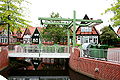
New Hagen

new town hall

Town hall intersection


In 1988 Soltau celebrated the 600th anniversary of being awarded city rights. Festivals, parades and exhibitions took place throughout the year. The major events included a French week in May with 600 guests from the twin town of Laon , a large ceremony on June 8th followed by a city festival lasting several days and a large parade on August 21st with around 40,000 spectators. The general assembly of the Lower Saxony Association of Cities was also held in Soltau on this occasion this year.

From 1945 to 1993 Soltau was a British garrison town . An average of 600 soldiers were stationed in the barracks area on Winsener Strasse during this time, and in some cases the number of British citizens in Soltau was up to 1200. After German reunification and the end of the Cold War , there were restructuring within the British army that led to the withdrawal of the British led from Soltau. The official farewell took place on February 24, 1993 on Schützenplatz. The last soldiers left the city on April 28, 1993. The withdrawal had a negative effect on the economic situation. In order to counteract this, the barracks site should be the first to be privately used in Germany. For this purpose, the settlement and housing company (AWS) was founded in 1993 as a wholly owned subsidiary of the city, whose task is the development of building areas, the provision of apartments and commercial space, road construction and much more. Directly next to the barracks there was a fallow area on which the headquarters of the Edeka group was located until the move to Minden . Several residential areas were subsequently planned on this site; the former barracks area is now partially used as a service center, and there is also residential development. The so-called Alte Reithalle, a city event center, has also been on this site since 2003.
Development into a tourist center
In 1972 Soltau was recognized as a state-approved resort and in 1987 it was recognized as a "state-approved place with brine operation".
On August 19, 1978 opened Hans-Jürgen Tiemann to Heide-Park , which with about 1.5 million visitors the biggest amusement park is northern Germany and international reputation has gained. The highlights of the park include the Colossos wooden roller coaster, which opened in 2001 and was then the world's largest, and the largest free-fall tower in the world, Scream, which was inaugurated in 2003 . The Heide-Park has always played a pioneering role in the roller coaster sector, Germany’s first Suspended Looping Coaster (Limit, 1999) as well as the first Launched Coaster ( Desert Race , 2007), Dive Coaster ( Krake , 2011) and Wing Coaster ( Flight of the Demons , 2014) established throughout Germany.
After the start of the Heide Park, several other tourist and cultural attractions were opened in the following decades, which have made Soltau one of the tourist centers of the region, such as the toy museum (1984), the local history museum (1989), the Soltau thermal baths (1990), the Designer Outlet Soltau (2012) and the Filzwelt (2015).
In particular, the opening of the designer outlet center was preceded by long-standing disputes. The construction of a Factory Outlet Center (FOC) has been discussed in Soltau since 1996 . The city initially failed several times in court, most recently in 2006 finally before the Federal Administrative Court . From 2006 onwards, a non-target procedure was run that was supposed to enable construction anyway. With the change in the regional spatial planning program in 2008, the establishment of a FOC in the Lüneburg Heath tourist region was made possible. In February 2009 the highest state planning authority, the Ministry of Agriculture, decided that the construction of an FOC in Soltau was permissible. Construction began in 2010, and a lawsuit brought by the competitor Bispingen against the award has meanwhile stopped the construction work. At the end of August 2012, the Designer Outlet Soltau was opened in the Harber district on a total area of 13,500 m². The operators are currently trying to obtain a permit to enlarge the sales area.
In 2006, the German Children's Fund chose Soltau and its city marketing project “spielraum SOLTAU”, which is intended to shape Soltau's image as a child and family-friendly city with numerous campaigns, as the model municipality for the project “Spiel! There's space everywhere ”.


Urban planning since 2007

In March 2007 a concept for redesigning the city center was presented. The " Schaper-Markt ", which was built in the 1970s and has not been used since 2004 , a pedestrian bridge (in the vernacular "Fenner-Kringel"), a parking garage and the permanently installed stage in Hagen were demolished in 2008, leaving a new commercial building in Hagen with a total sales area of 4000 m², which was opened in March 2009.
The Soltau business location has been strengthened with several large commercial establishments such as an Audi logistics center or a Harry-Brot production hall and the expansion of companies that are already based there, such as Hagebau , Deichmann and others.
A concept to strengthen the three retail centers downtown, Almhöhe and Designer Outlet is being considered for the future. In the course of this, an enlargement of the sales areas in Marktstrasse and a reconstruction of the town hall intersection with simultaneous calming of traffic in the old town moat are planned.
literature
-
Wolfgang Bargmann : The Soltau settlement in Lower Saxony history. Cupbearer, Soltau, 3 volumes.
- Volume 1: From the Germanic Settlement to the Thirty Years War. 2003, ISBN 3-933802-09-1 (abstract) .
- Volume 2: From the Thirty Years War to the end of the First World War, 1620 to 1919. 2005, ISBN 3-933802-14-8 .
- Volume 3: From the end of the First World War in 1918 to the beginning of the second phase of urban renewal in early 2009. 2009, ISBN 978-3-933802-19-4 .
- Karl Baurichter: The history of Soltau in the light of old and new sources. Publication in Binnebom , 1966.
- Ulrike Begemann: Soltau in the Weimar Republic, in the Third Reich and in the post-war period. City of Soltau 1987.
- Wilhelm Ehlers: The history of the 96 yards of the rural community of the parish Soltau in Hanover. Soltau 1914.
- Eduard Salfeld: On the church and cultural history of Soltau. Cupbearer, Soltau 1914.
- Wilhelm Schaeffer: History of the city of Soltau. City administration of Soltau, Soltau 1937.
Web links
- This is what life is like in the city of Harm Tyding , knight, pot and lid , website of the city of Soltau
Supporting documents and comments
- ↑ Michael Baales, Ingo Clausen: Life in the cold Dryas period. The last reindeer hunters in the north. In: Archeology in Germany. No. 10, 2016 (special issue), pp. 78–86, here: p. 78.
- ↑ Found site Heber 127, based on: Felix Riede: A possible Brommian shaft-smoother from the site of Mǿllehǿje, north-western Denmark. In: Mesolithic Miscellany. Vol. 22, 2012, No. 1, pp. 10-18 ( online ), here: p. 15 (table). Riede refers to Gernot Tromnau: The sites of the Hamburg culture of Heber and Deimern, district of Soltau. August Lax, Hildesheim 1975, panels 30–32.
- ↑ Wilcken Dürre: Find places of the Ahrensburg culture in the district of Soltau. August Lax, Hildesheim 1971.
- ↑ Bargmann, Volume 1, chapter The Soltau settlement area , p. 18f.
- ^ Felix Riede: A possible Brommian shaft-smoother from the site of Mǿllehǿje, north-western Denmark. In: Mesolithic Miscellany. Vol. 22, 2012, No. 1, pp. 10-18, here: p. 14 (table).
- ↑ An arrow shaft straightener was needed because the arrows consisted of a 75 to 80 cm long and 8 to 10 mm thick main shaft, which was recycled to save wood and labor, and a 15 to 20 cm long and 5 to 8 mm thick fore shaft , in which the stone tip was - the foreship got stuck in the prey. The two shafts were held together by a dovetail joint , glued with birch pitch and possibly wrapped. To smooth the whole thing, you needed an arrow shaft straightener (Harm Paulsen, Sönke Hartz: Accurate: The oldest evidence for bows and arrows in the north. In: Archeology in Germany. No. 10, 2016 (special issue), p. 46 f.).
- ↑ Martin Schmidt: Late Ice Age hunters and gatherers on the edge of the tundra: Jagdlager Deimern 45, Soltau, district of Soltau Fallingbostel / Lower Saxony. In: Mamoun Fansa, Sabine Wolfram (Ed.): Müll. Facets from the Stone Age to the Yellow Sack. Guide to the exhibition. Oldenburg 2003, p. 36 f.
- ↑ Lateglacial.org ( Memento of the original from August 26, 2016 in the Internet Archive ) Info: The archive link was inserted automatically and has not yet been checked. Please check the original and archive link according to the instructions and then remove this notice. .
- ↑ Ulrich Schoknecht, Jutta Möller, Daniel Nösler, Jens-Peter Schmidt: Northern Germany. In: Association of State Archaeologists (Ed.): Handbuch der Grabungstechnik (2011 update), p. 27.
- ↑ Karl Heinz Brandt: Danube country devices from the southern district of Soltau-Fallingbostel. In: The customer . NF, Vol. 46, 1995, pp. 1-27.
- ^ John Mitchell Kemble: Excavations in the office of Soltau in the summer of 1853. In: Journal of the historical association for Lower Saxony. Vol. 17, 1851, 1st double issue, pp. 183-193 (digitized version ) . According to his report, most of the graves date from the Bronze Age , but occasionally also from the Younger Stone Age.
- ↑ Bargmann, Volume 1, Chapter The Soltau Settlement Area , p. 12.
- ↑ Heide Wrobel: The collar of the Nordic Bronze Age. In: Communications from the Berlin Society for Anthropology, Ethnology and Prehistory. Vol. 30, 2009, pp. 1–20, here: p. 3.
- ^ Heinrich Krüger: The Jastorf culture in the districts of Lüchow-Dannenberg, Lüneburg, Uelzen and Soltau (= Göttingen writings on prehistory and early history. Volume 1). Neumünster 1961, p. 96.
- ↑ Klaus-Peter Johne : The Romans on the Elbe. The Elbe river basin in the geographical view of the world and in the political consciousness of Greco-Roman antiquity. Berlin 2006, p. 139.
- ↑ Bargmann, Volume 1, Chapter The Soltau Settlement Area , p. 23
- ^ Matthias Springer : The Saxons. Kohlhammer, Stuttgart 2004, pp. 57-96.
- ^ Matthias Springer: The Saxons. Kohlhammer, 2004, p. 149.
- ↑ This assessment coincides with the first mention of a pagus Lobingao from the year 850, namely in the vita of the Bremen bishop Willehad , then again in the year 937. In: Wilhelm von Hodenberg : Die Diöcese Bremen and their districts in Saxony and Friesland together with one Diöcesan and a district map. Capaun-Karlowa, Celle 1858, p. 47.
- ↑ The work of the mayor of the city of Walsrode appeared from 1899 in individual sections in the Hanover history sheets ( report on the newer literature on German regional studies , vol. 2, 1904, p. 203 ( digitized )).
- ↑ Friedrich Grütter: The Loin-Gau (= publications on Lower Saxony history. Volume 4). Edited by Otto Jürgens . Schaper, Hanover 1901; Friedrich Grütter: On the history of the city of Soltau. In: Hannoversche Geschichtsblätter . Vol. 4, 1901, pp. 361-370.
- ↑ Bargmann, Volume 1, Chapter Der Siedlungsraum Soltau , p. 24. Quotation: “In particular the grave fields near Soltau with their grave goods (remains of clay vessels, etc.) suggest the 4th and 5th centuries and the type of the by [Keseberg ] The so-called Soltau vessel from another find he reads from the 6th century and finally claims that the Soltau Goraum had maintained its constant size for centuries. "
- ^ A b Alfred Keseberg: Loingo-Nord to Soltau. Discovery of the Gohburg and the curtis Salta. Franconian territorial reform 1200 years ago. In: Der Sachsenspiegel. Sheets for history and homeland maintenance. No. 14, October 21, 1978.
- ↑ Prehistoric trade and traffic routes. Excerpts from the documents by J. Schneider (1890) , section 5. From the Ems near Lathen in an easterly direction to the Elbe (“Folkendung”) . Schneider refers to this passage in the Monumenta Germaniae Historica, vol. 7, Hannover 1846, p. 290 (complete: Georg Heinrich Pertz et al. (Ed.): Scriptores (in Folio) 7: Chronica et gesta aevi Salici. Hannover 1846, Pp. 267-389 ( Monumenta Germaniae Historica , digitized version )).
- ^ Thomas Raimann: Church and secular rulership structures in the Osnabrücker Nordland (9th – 13th centuries). Dissertation, University of Osnabrück 2013, urn : nbn: de: gbv: 700-2015033113148 , p. 230.
- ↑ a b Bargmann, Volume 1, Chapter Die curtis salta , p. 37
- ↑ Bargmann, Volume 1, Chapter Die Parochie Soltau , p. 77.
- ↑ Bargmann, Volume 1, Chapter Die Parochie Soltau , p. 76.
- ↑ Bargmann, Volume 1, Chapter Die Grundherrschaft , p. 33.
- ↑ Theodor Sickel (Ed.): Diplomata 12: The documents Konrad I., Heinrich I. and Otto I. (Conradi I., Heinrici I. et Ottonis I. Diplomata). Hannover 1879, pp. 89–90 ( Monumenta Germaniae Historica , digitized version ), here: p. 90.
- ↑ Bargmann, Volume 1, Chapter Die curtis salta , p. 38.
- ↑ Bargmann, Volume 1, Chapter Die curtis salta , p. 39.
- ↑ Dietrich Wiedemann: The "Curtis Salta": Salt production through compulsory labor. ( Memento of the original from January 22nd, 2016 in the Internet Archive ) Info: The archive link was inserted automatically and has not yet been checked. Please check the original and archive link according to the instructions and then remove this notice. Report. In: Soltau.de , September 2015 (PDF).
- ↑ Bargmann, Volume 1, Chapter Die Vogtei , p. 67.
- ↑ Bargmann, Volume 1, Chapter Die Vogtei , p. 68.
- ↑ a b Bargmann, Volume 1, Chapter Die curtis salta , p. 45
- ↑ Bargmann, Volume 1, Chapter Die Vogtei , P. 68f.
- ↑ Bargmann, Volume 1, Chapter Die Burg , p. 62.
- ↑ Historical wood from the time of Emperor Barbarossa emerged. January 7, 2019, accessed May 25, 2019 .
- ↑ Bargmann, Volume 1, Chapter Die Burg , p. 66.
- ↑ Bargmann, Volume 1, chapter Das neue Weichbild 1388 , p. 108 ff.
- ↑ Bargmann, Volume 1, Chapter The New Soft Image , p. 109.
- ↑ Bargmann, Volume 1, chapter Das neue Weichbild 1388 , p. 110.
- ↑ Bargmann, Volume 1, Chapter Die Burg , p. 66.
- ↑ Bargmann, Volume 1, Chapter The New Soft Image , p. 111.
- ↑ Bargmann, Volume 1, chapter The first stage of urban development 1400 to 1621 , p. 113.
- ↑ Bargmann, Volume 1, Chapter The first stage of urban development 1400 to 1621 , p. 114 f. With reference to Dieter Brosius (article based on the main state archive) and Wilhelm Schaeffer.
- ↑ Bargmann, Volume 1, Chapter The First Stage of Urban Development 1400 to 1621 , p. 115.
- ↑ Bargmann, Volume 1, Chapter The First Stage of Urban Development 1400 to 1621 , p. 116.
- ↑ Bargmann, Volume 1, Chapter The First Stage of Urban Development 1400 to 1621 , p. 118.
- ↑ a b c d Bargmann, Volume 1, Chapter Die Vogtei , p. 72
- ↑ Bargmann, Volume 1, Chapter The first stage of urban development 1400 to 1621 , p. 117 f.
- ↑ Bargmann, Volume 1, Chapter The Battle of Soltau , p. 132.
- ↑ Udo Stanelle: The Battle of Soltau. In: Lower Saxony Yearbook for State History . Vol. 54, 1982, pp. 153-188, here p. 177 f. (PDF) .
- ↑ Udo Stanelle: The Battle of Soltau. In: Lower Saxony Yearbook for State History . Vol. 54, 1982, pp. 153-188, here p. 171 (PDF) .
- ↑ Information about the Battle of Soltau and Harm Tyding. ( Memento of the original from September 24, 2015 in the Internet Archive ) Info: The archive link was inserted automatically and has not yet been checked. Please check the original and archive link according to the instructions and then remove this notice. In: Soltau.de (PDF; 3.7 MB).
- ↑ Bargmann, Volume 1, Chapter Die Parochie Soltau , p. 82.
- ↑ Bargmann, Volume 1, chapter The first stage of urban development 1400 to 1621 , p. 118ff.
- ↑ Bargmann, Volume 1, chapter The first stage of urban development 1400 to 1621 , p. 120.
- ↑ Bargmann, Volume 1, Chapter Around 1600 , p. 138 ff.
- ↑ Bargmann, Volume 2, Chapter The Thirty Years War and its Consequences for Soltau , p. 23 f.
- ↑ About the life and work of Jacobus Koch see Matthias Blazek: Murder case 300 years ago in Celle. In: The Lower Saxony , Sunday supplement of the Böhme newspaper . Vol. 152, Soltau 2016, No. 28.
- ↑ Bargmann, Volume 2, Chapter The Thirty Years War and its Consequences for Soltau , p. 25 ff.
- ↑ Bargmann, Volume 2, Chapter The Thirty Years' War and its Consequences for Soltau , p. 27.
- ↑ Bargmann, Volume 2, Chapter The Thirty Years War and its Consequences for Soltau , p. 26.
- ↑ Bargmann, Volume 2, Chapter The Bourgeois Food in the 17th and 18th Centuries , p. 31 f.
- ↑ Bargmann, Volume 2, Chapter The Bourgeois Food in the 17th and 18th Centuries , p. 33 ff.
- ↑ Bargmann, Volume 2, Chapter State Administration in Modern Times , p. 64.
- ↑ Bargmann, Volume 2, Chapter State Administration in Modern Times , p. 67.
- ↑ a b Bargmann, Volume 2, Chapter State Administration in Modern Times , p. 68.
- ↑ Bargmann, Volume 2, Chapter State Administration in Modern Times , p. 69 f.
- ↑ Bargmann, Volume 2, The Bourgeois Food in the 17th and 18th Centuries , p. 43.
- ↑ Bargmann, Volume 2, Chapter Soltau in the history of the country in the 17th and 18th centuries , p. 59.
- ↑ Bargmann, Volume 2, chapter Soltau in the regional history in the 17th and 18th centuries , p. 60ff.
- ↑ Information brochure of the city of Soltau from 2005 ( page no longer available , search in web archives ) Info: The link was automatically marked as defective. Please check the link according to the instructions and then remove this notice. (PDF).
- ^ Wolf-Nikolaus Schmidt-Salzen: Lüneburg, Principality. In: Brage bei der Wieden (Hrsg.): Handbook of the Lower Saxony Landtag and Estates history. Volume 1: 1500–1806, Hannover 2004, ISBN 3-7752-6016-1 , p. 137.
- ↑ Bargmann, Volume 2, Chapter Napoleon and the French Period in Soltau , p. 88.
- ↑ Bargmann, Volume 2, Chapter Napoleon and the French Period in Soltau , p. 91.
- ↑ Bargmann, Volume 2, Chapter Napoleon and the French time in Soltau , p. 91ff.
- ↑ Bargmann, Volume 2, Chapter Napoleon and the French Period in Soltau , p. 94f.
- ↑ a b Bargmann, Volume 2, Chapter Napoleon and the French period in Soltau , p. 96.
- ↑ Bargmann, Volume 2, Chapter The Great Agrarian Reform in the Parish of Soltau , p. 102.
- ↑ Bargmann, Volume 2, Chapter The Great Agrarian Reform in the Parish of Soltau , p. 103.
- ↑ Bargmann, Volume 2, Chapter The Great Agrarian Reform in the Parish of Soltau , p. 103.
- ↑ Bargmann, Volume 2, Chapter The Great Agrarian Reform in the Parish of Soltau , p. 110.
- ↑ Bargmann, Volume 2, Chapter Urban Development in the Late Modern Period, 1815 to 1918 , p. 126ff.
- ↑ Bargmann, Volume 2, Chapter Urban Development in the Late Modern Period, 1815 to 1918 , p. 133.
- ↑ Bargmann, Volume 2, Chapter Urban Development in the Late Modern Period, 1815 to 1918 , p. 139.
- ↑ Bargmann, Volume 2, Chapter Urban Development in the Late Modern Period, 1815 to 1918 , p. 140.
- ↑ Bargmann, Volume 2, Chapter Urban Development in the Late Modern Period 1815 to 1918 , pp. 141f.
- ^ Bargmann, Volume 2, The Kingdom of Hanover Becomes a Prussian Province , p. 146.
- ↑ Bargmann, Volume 2, Chapter The New Infrastructure , p. 160.
- ↑ Bargmann, Volume 2, Chapter Economic Development in the 19th Century , pp. 176ff.
- ↑ Bargmann, Volume 2, Chapter The Economic Development in the 19th Century . P. 173ff. (Bornemann), p. 186ff. (Wiegels) and p. 188ff. (Cupbearer)
- ^ Bargmann, Volume 2, Chapter Die Prussische Kreisstadt Soltau , p. 214.
- ↑ Bargmann, Volume 2, Chapter Die neue Urbanität , p. 236f.
- ↑ Bargmann, Volume 2, Chapter The Church and the Parish of Soltau , p. 244.
- ↑ Bargmann, Volume 2, Chapter The Church and the Parish Soltau , pp. 245f.
- ↑ Bargmann, Volume 2, Chapter The Church and the Parish of Soltau , p. 250.
- ↑ Bargmann, Volume 2, Chapter The 20th Century begins, p. 266ff.
- ↑ Bargmann, Volume 2, Chapter The 20th Century breaks , pp. 270f.
- ↑ Bargmann, Volume 2, Chapter The 20th Century begins , pp. 273f.
- ↑ Michael Grube: Camp Soltau. In: Geschichtsspuren.de .
- ↑ a b Bargmann, Volume 3, Chapter 1918 - The First World War is over , p. 22.
- ↑ Bargmann, Volume 3, Chapter 1918 - The First World War is over , p. 21.
- ↑ Bargmann, Volume 2, Chapter The 20th Century Is Anbreak , p. 274.
- ↑ a b Bargmann, Volume 2, Chapter The 20th Century begins , p. 275.
- ↑ Bargmann, Volume 2, Chapter The 20th Century Is Anbreak , p. 276.
- ↑ a b Bargmann, Volume 3, Chapter 1918 - The First World War is over , p. 16f. With reference to Wilhelm Schaeffer, Die Geschichte der Stadt Soltau , 1937, p. 193ff.
- ↑ Bargmann, Volume 3, Chapter 1918 - The First World War is over , p. 18. With reference to Wilhelm Schaeffer, Die Geschichte der Stadt Soltau , 1937, p. 193ff.
- ↑ Bargmann, Volume 3, Chapter The Riding School and its Conversion , p. 279.
- ↑ Bargmann, Volume 3, Chapter 1918 - The First World War is over , p. 19.
- ↑ a b Bargmann, Volume 3, Chapter 1918 - The First World War is over , p. 20.
- ↑ Bargmann, Volume 3, Chapter 1918 - The First World War is over , p. 25.
- ↑ Bargmann, Volume 3, Chapter 1918 - The First World War is over , p. 27.
- ↑ a b Bargmann, Volume 3, Chapter The political and social changes after 1918 , p. 38f.
- ↑ Bargmann, Volume 3, Chapter 1919 - The post-war period with hardship and worries , p. 37.
- ↑ a b c Bargmann, Volume 3, Chapter The City Administration between the Two World Wars , p. 66.
- ↑ Bargmann, Volume 3, Chapter City Administration between the Two World Wars , p. 64.
- ↑ a b c d Bargmann, Volume 3, chapter The city administration between the world wars , p. 68f.
- ↑ a b National Socialism in Soltau , representation of teachers and students of the Soltaus high school on denktag2002.denktag-archiv.de.
- ↑ Bargmann, Volume 3, Chapter Soltau under the Hakenkreuz , pp. 95f.
- ↑ Bargmann, Volume 3, chapter Soltau under the swastika , p. 97.
- ↑ a b Wolterdingen camp. In: Geschichtsspuren.de .
- ↑ Bargmann, Volume 3, Chapter 1939–1945: Soltau in the Second World War , p. 114.
- ↑ a b Bargmann, Volume 3, Chapter The Greatest Day of Honor in City History , p. 103.
- ↑ Bargmann, Volume 3, Chapter The Greatest Day of Honor in City History , p. 110.
- ^ Michael Rademacher: German administrative history from the unification of the empire in 1871 to reunification in 1990. Historical population structure in the district of Soltau. (Online material for the dissertation, Osnabrück 2006).
- ^ A b Biography of Sally Lennhoff on Stolpersteine-Bremen.de.
- ↑ Bargmann, Volume 3, Chapter Soltau under the Hakenkreuz , p. 100ff.
- ↑ Bargmann, Volume 3, Chapter 1939–1945 Soltau in World War II , p. 111.
- ↑ a b c Bargmann, Volume 3, Chapter 1939–1945 Soltau in the Second World War , p. 116.
- ↑ a b Bargmann, Volume 3, Chapter 1939–1945 Soltau in the Second World War , p. 117.
- ↑ Bargmann, Volume 3, chapter The economic situation between the two world wars , p. 86
- ↑ Bargmann, Volume 3, Chapter 1939–1945 Soltau in World War II , pp. 117f.
- ↑ a b Bargmann, Volume 3, Chapter 1939–1945 Soltau in the Second World War , p. 118.
- ↑ Bargmann, Volume 3, Chapter 1939–1945 Soltau in World War II , p. 119.
- ↑ Bargmann, Volume 3, Chapter April 1945 - The End of the War in Soltau , pp. 120ff.
- ↑ Bargmann, Volume 3, Chapter April 1945 - The end of the war in Soltau , p. 121f.
- ↑ Bargmann, Volume 3, Chapter April 1945 - The End of the War in Soltau , p. 122f.
- ↑ Holger Dambeck: Online vote: Soltau does not want a memorial for Nazi victims. Spiegel Online , February 7, 2005, accessed September 25, 2015 .
- ↑ Stefan Schlag: Soltau memorial commemorates victims of the Nazi terror. Die Welt , April 10, 2007, accessed September 25, 2015 .
- ↑ Maximilian Probst : Guessing riddles in the forest. The daily newspaper , April 12, 2007, accessed on September 25, 2015 .
- ↑ Published in the Soltauer Schriften / Binneboom , annual volume 2009.
- ↑ Bargmann, Volume 3, Chapter April 1945 - The End of the War in Soltau , p. 123.
- ↑ Bargmann, Volume 3, Chapter April 1945 - The end of the war in Soltau , p. 123. Based on written records by Heinrich Holste in Willy Klapproth's war chronicle, p. 5ff.
- ↑ Bargmann, Volume 3, Chapter 1939–1945 Soltau in the Second World War , p. 119. See also: Ulrich Saft: The War in the Home - The bitter end between Weser and Elbe , p. 328.
- ↑ Bruno Nitsche, Hans-Heinrich Wolfes: The end of the Second World War in Jesteburg. In: Jesteburg.de (PDF, 1.0 MB, p. 6).
- ↑ Bargmann, Volume 3, Chapter April 1945 - The End of the War in Soltau , pp. 125f.
- ↑ Bargmann, Volume 3, Chapter April 1945 - The End of the War in Soltau , p. 126.
- ↑ Bargmann, Volume 3, Chapter April 1945 - The End of the War in Soltau , p. 127.
- ↑ Bargmann, Volume 3, Chapter A new era in the history of the city of Soltau begins , p. 131f.
- ↑ Bargmann, Volume 3, Chapter A new era in the history of the city of Soltau begins , p. 132.
- ↑ Bargmann, Volume 3, Chapter A new era in the history of the city of Soltau begins , p. 134.
- ↑ Bargmann, Volume 3, Chapter A new era in the history of the city of Soltau begins , pp. 135ff.
- ↑ Bargmann, Volume 3, Chapter A new era in the history of the city of Soltau begins , p. 139ff.
- ↑ Bargmann, Volume 3, Chapter The Riding School and its Conversion , p. 281.
- ↑ Bargmann, Volume 3, Chapter The structural development from 1945 to 1972 , p. 143f.
- ↑ Bargmann, Volume 3, Chapter The structural development from 1945 to 1972 , p. 144ff.
- ↑ Bargmann, Volume 3, Chapter The structural development from 1945 to 1972 , p. 147f.
- ↑ Bargmann, Volume 3, Chapter The structural development from 1945 to 1972 , p. 150.
- ↑ Bargmann, Volume 3, chapter The school building measures from 1945 to 1971 , p. 154.
- ↑ Bargmann, Volume 3, chapter The school building measures from 1945 to 1971 , p. 159f.
- ↑ Bargmann, Volume 3, chapter The school building measures from 1945 to 1971 , p. 162.
- ↑ Bargmann, Volume 3, chapter The school building measures from 1945 to 1971 , p. 166.
- ↑ Bargmann, Volume 3, Chapter The structural development from 1945 to 1972 , p. 152.
- ^ Federal Statistical Office (ed.): Historical municipality directory for the Federal Republic of Germany. Name, border and key number changes in municipalities, counties and administrative districts from May 27, 1970 to December 31, 1982 . W. Kohlhammer, Stuttgart and Mainz 1983, ISBN 3-17-003263-1 , p. 236 .
- ↑ Bargmann, Volume 3, Chapter The Territorial and Administrative Reform , p. 184.
- ↑ Bargmann, Volume 3, Chapter The Territorial and Administrative Reform , p. 185.
- ^ Zero, comma, zero, zero , In: Der Spiegel, edition of June 20, 1977, 31st year. No. 26.
- ↑ Bargmann, Volume 3, Chapter The Territorial and Administrative Reform , p. 189.
- ↑ Bargmann, Volume 3, Chapter The Territorial and Administrative Reform , p. 190.
- ↑ Bargmann, Volume 3, Chapter Urban Renewal , pp. 209f.
- ↑ Bargmann, Volume 3, Chapter Urban Renewal , p. 218.
- ↑ Bargmann, Volume 3, Chapter Urban Renewal , pp. 216f.
- ↑ Bargmann, Volume 3, Chapter Urban Renewal , p. 214.
- ↑ a b Bargmann, Volume 3, Chapter The Jubilee Year 1988 , p. 274.
- ↑ a b Bargmann, Volume 3, Chapter The Jubilee Year 1988 , p. 275f.
- ↑ Bargmann, Volume 3, Chapter The Jubilee Year 1988 , p. 276.
- ↑ Bargmann, Volume 3, Chapter The Riding School and Its Conversion , p. 283.
- ↑ Bargmann, Volume 3, Chapter The Riding School and its Conversion , p. 284.
- ↑ Bargmann, Volume 3, Chapter The Riding School and its Conversion , p. 286f.
- ↑ Bargmann, Volume 3, Chapter The Riding School and its Conversion , p. 287.
- ↑ Key figures of the city of Soltau 2002 ( Memento of the original from October 12, 2016 in the Internet Archive ) Info: The archive link was inserted automatically and has not yet been checked. Please check the original and archive link according to the instructions and then remove this notice. , Statistical Characteristics, In: www.soltau.de, 2002, p. 16.
- ↑ Bauchronik , In: www.heide-park-world.de
- ↑ Press release of the Lower Saxony Ministry of Agriculture on FOC Soltau from February 3, 2009 (accessed on September 4, 2009).
- ↑ Participation in the development of the Spielraum Soltau model ( memento of the original from August 5, 2016 in the Internet Archive ) Info: The archive link was automatically inserted and not yet checked. Please check the original and archive link according to the instructions and then remove this notice. , In: www.kinderfreund-stadtgestaltung.de
- ↑ Grand opening of the new inner city complex on March 26, 2009. In: Soltau.de .
- ↑ Audi makes you sit up and take notice: 400 jobs in Soltau. In: NDR.de , January 15, 2016.
- ↑ Bargmann, Volume 3, Chapter The Soltau Business Location, p. 299ff.
- ↑ Final presentation of the Soltau 2040 strategy and action plan . In: Soltau.de , October 29, 2014.