Mauzé-sur-le-Mignon
| Mauzé-sur-le-Mignon | ||
|---|---|---|

|
|
|
| region | Nouvelle-Aquitaine | |
| Department | Deux-Sèvres | |
| Arrondissement | Niort | |
| Canton | Mignon-et-Boutonne (main town) | |
| Community association | Niortais | |
| Coordinates | 46 ° 12 ′ N , 0 ° 40 ′ W | |
| height | 6–46 m | |
| surface | 23.62 km 2 | |
| Residents | 2,818 (January 1, 2017) | |
| Population density | 119 inhabitants / km 2 | |
| Post Code | 79210 | |
| INSEE code | 79170 | |
| Website | http://www.ville-mauze-mignon.fr/ | |
Mauzé-sur-le-Mignon is a French commune with 2,818 inhabitants (as of January 1 2017) in the department of Deux-Sèvres in the region Nouvelle-Aquitaine . It belongs to the Arrondissement of Niort and the canton of Mignon-et-Boutonne , of which it is the capital. The inhabitants are called Mauzéens .
geography
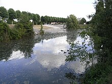
Mauzé-sur-le-Mignon is about 37 kilometers east of La Rochelle and about 130 kilometers southeast of Nantes on the Mignon River . Mauzé-sur-le-Mignon is surrounded by the neighboring communities of Prin-Deyrançon in the north, La Rochénard in the northeast, Val-du-Mignon with Usseau in the southeast, Saint-Saturnin-du-Bois in the south, and Saint-Pierre-d'Amilly in the southwest and Cramchaban in the northwest.
Route nationale 11 ( E 601 ) and route nationale 22 run through the municipality .
history
In 1903 the municipality was detached from Prin-Deyrançon. In 1971 the municipalities of Mauze-sur-le-Mignon and Petit-Breuil-Deyrançon were merged.
Population development
| year | 1975 | 1982 | 1990 | 1999 | 2006 | 2016 |
| Residents | 2,502 | 2.405 | 2,378 | 2,384 | 2,639 | 2,788 |
Personalities
- Daniel Savary (1743–1808), Rear Admiral in the French Navy
- René Caillié (1799–1838), Africa explorer
- Odo Duke of Aquitaine (around 1010-1039 / 1040), killed in battle near Mauzé-sur-le-Mignon

